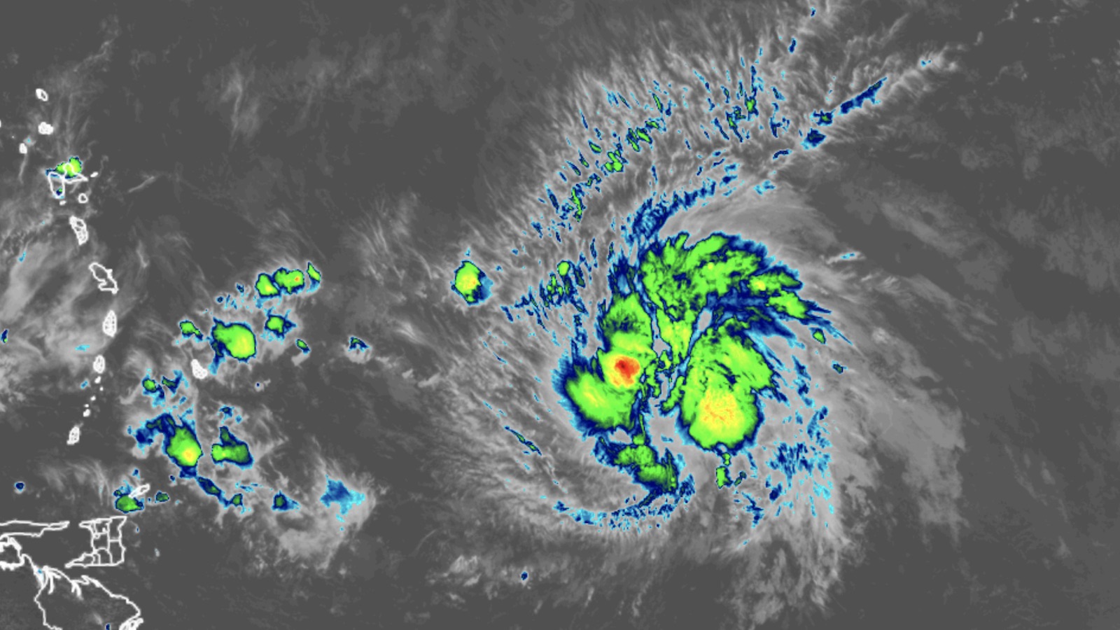
Tropical storm watches and warnings were up on Wednesday afternoon for several of the islands bordering the eastern Caribbean Sea as Tropical Storm Bret continued chugging westward. Bret is expected to remain below hurricane strength as it sweeps through the islands late Thursday. Still, it will bring hazards — and any tropical storm is an unusual entity in June for the Lesser Antilles.
At 11 a.m. EDT Wednesday, Bret was centered about 470 miles east of Barbados, heading just north of due west at 14 mph. Bret is a midrange tropical storm, with top winds holding at 60 mph. Showers and thunderstorms were widespread but only moderately strong around Bret’s center. Working in Bret’s favor are near-record-warm sea surface temperatures for late June, around 28 degrees Celsius (82 degrees Fahrenheit). However, wind shear continued to impede the system, and Bret was beginning to ingest dry air from its northwest.
No major change in strength is expected before Bret reaches the Lesser Antilles, as the storm is beginning to ingest dry air from its northwest. An Air Force hurricane-hunter aircraft was in the process of investigating Bret early Wednesday afternoon.
Tropical storm watches were up for Barbados, Dominica, and Martinique. A tropical storm warning was in effect for St. Lucia, and warnings may be issued for other islands as Bret draws closer. On its current track, Bret is likely to pass near one of these four islands on Thursday night. The strongest winds will be confined to a small area just north of Bret’s center, a zone that could pass over one of the islands or just in between them. Squally weather, including localized rains of up to 10 inches and gale-force winds, will spread more widely across the Windward and Leeward Islands, and flash flooding will be a threat wherever the heaviest squalls arrive.


Forecast for Tropical Storm Bret
The overall forecast for Bret is fairly high-confidence, as forecast models have come into solid consensus. Bret will likely hit the Lesser Antilles on Thursday night at or near its peak strength. Well-established steering currents will keep Bret rolling westward into the Caribbean into Friday and Saturday.
The eastern Caribbean is a notorious “hurricane graveyard” during June and July when trade winds are at their strongest. The low-level east-to-west trade winds usually intensify as they hit the region, which tends to foster divergent flow near the surface and sinking air. Moreover, the strong trade winds and the frequent presence of upper-level lows often lead to stronger vertical wind shear during the early-season window of June and July.
Most models and ensemble members agree that Bret will gradually weaken as it traverses this fraught zone, and the National Hurricane Center predicts that Bret will dissipate over the weekend.

Another tropical cyclone likely to form in the central Atlantic
Hard as it is to fathom on the summer solstice — months before peak hurricane season — it’s possible we will be dealing with a second named storm in the tropical Atlantic by the end of this week.
A well-defined tropical wave designated Invest 93L continued to organize on Wednesday between the Lesser Antilles and West Africa, near latitude 10 degrees north and 36 degrees west. Showers and thunderstorms were limited around 93L, but it was in a moist environment (midlevel relative humidity around 65 percent) and wind shear is expected to remain light to moderate (5 – 15 knots). Most notably, sea surface temperatures are at near-record highs for late June, around 28 degrees Centigrade (82 degrees Fahrenheit).

Forecast models are in general agreement that 93L will continue to organize into a tropical depression and perhaps become Tropical Storm Cindy by Friday or the weekend as it tracks west to west-northwest. An upper-level low is projected to pull 93L northward early next week before it reaches the Lesser Antilles.
If Cindy does develop, it would be the fourth Atlantic storm of the year, after the formation of an unnamed system on Jan. 16 (which was belatedly upgraded to subtropical storm status), Tropical Storm Arlene on June 2, and Bret on June 19. The typical formation date of the season’s fourth storm is August 15. The record-earliest formation date of the season’s fourth named storm is June 20, 2016, when Tropical Storm Danielle formed.

Few analogues for a named storm in the deep Atlantic tropics in June
In more than a century of record-keeping, only a handful of systems have reached tropical storm strength in the Main Development Region between Africa and the Caribbean in the month of June. Ironically, the most recent was Bret (2017), which struck Trinidad as a tropical storm with 50 mph winds on June 20 before dissipating on the coast of South America.
A better analogue for this year’s Bret would be Ana (1979), which peaked with 60 mph winds before striking St. Lucia as a weak tropical storm on June 23 and surviving for a while in the eastern Caribbean as a tropical depression.
As for having two named systems emerge in the Main Development Region during June, that would be a first in the historical record — just as there is no counterpart to the record-warm sea surface temperatures across much of the tropical and eastern North Atlantic that have been fueling this premature burst of activity.
Jeff Masters contributed to this post. Website visitors can comment on “Eye on the Storm” posts (see comments policy below). Sign up to receive notices of new postings here.
Source link


