In brief: Drought conditions have worsened in the Southeast and Southern Plains in recent weeks. A chance of rain this weekend, especially in the Southeast should help matters a little, but much like in the West, more is needed.
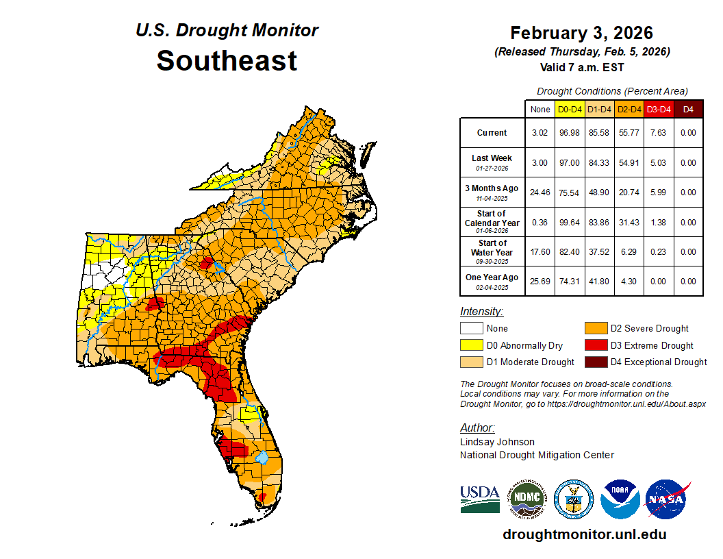
Yesterday we focused on the West with an uptick in moisture incoming. Today, let’s focus on the Southeast. This area has become quite beleaguered by drought in recent weeks. Compare the drought map below for the Southeast from December 30th of last year to last week. Slight the bar to the right to see December 30th and to the left to see last week.
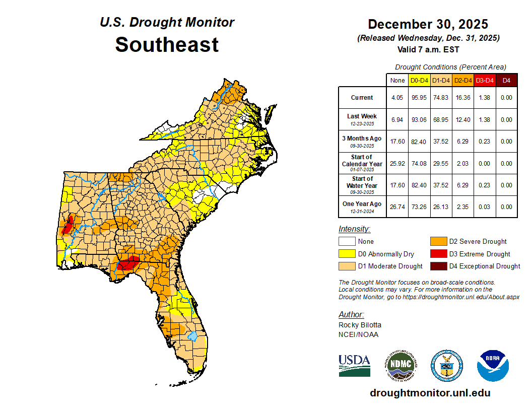

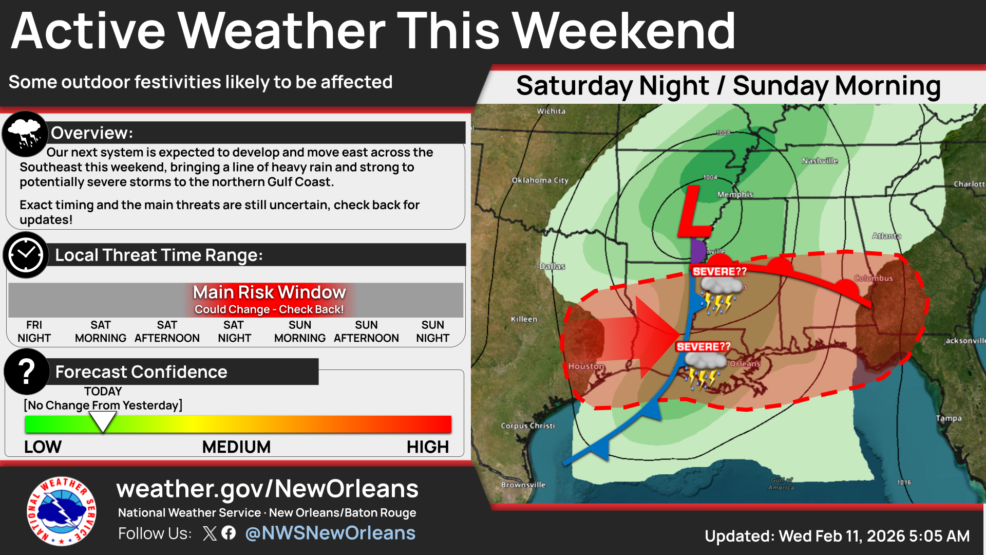
While coverage of drought has not changed a whole lot, the intensity of drought has gotten worse. Much of the Florida Panhandle is in extreme drought, as is the area near and south of Tampa. Portions of Georgia are also in this designation. As in the West, some things will change in the coming days. A storm system and cold front will propagate eastward this weekend, likely resulting in some locally heavy rain and thunderstorms for the region. There is even a chance that we could get some strong to severe storms as well. Of course, we’re coming up to the peak of Mardi Gras season in the South, so it’s a good idea to keep tabs on things this weekend.
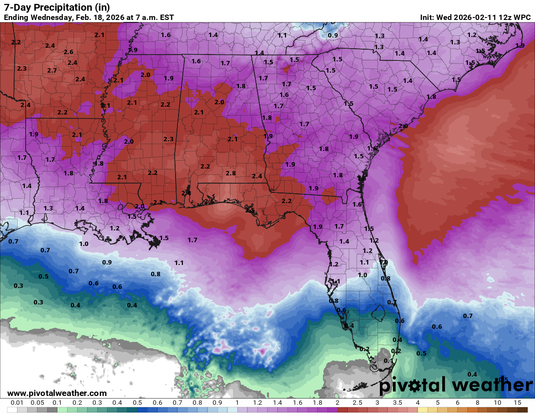
The hope is that we can get a solid 1 to 2 inches of rain out of this system this weekend. I would surmise that the areas most likely to see the most benefit would be in northern Georgia and possibly southeast Alabama. We could also see locally heavy rains in the Florida Panhandle that could help mitigate drought conditions some.
Either way, any rain helps.
Drought conditions are not much better as you travel west, with places like Arkansas even seeing some exceptional drought, the worst of the worst.
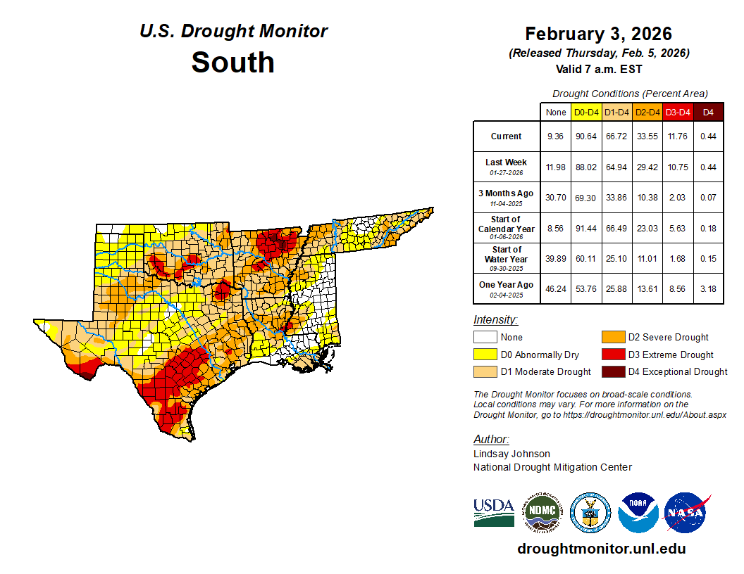
Parts of the Big Bend region in Texas are also in that D4 designation. Much of south-central Texas is in extreme drought. But you can see elsewhere that conditions are somewhat blotchier, with pockets of extreme drought and limited drought in close proximity.
The La Niña situation this year has likely aided in keeping the South rather dry. With expectations of a shift to El Niño coming (more on that soon), we are hopefully going to see drought conditions ease up eventually here. But for now, rain is much appreciated.
Meanwhile, just to update the West, a series of storms continues to look likely from this weekend into much of next week. I count at least 3 individual systems on some of the operational model guidance right now, one just after Valentine’s Day, another on the 17th, and a third on the 19th. Whether all three come to fruition in full or not remains to be seen, but suffice to say, there remains a healthy chance at partially improved snowpack conditions in the West.
We’ll keep tabs on things.
Source link