Headlines
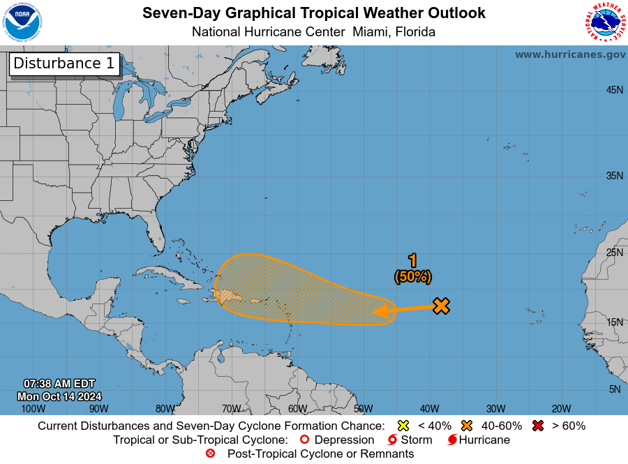
- Invest 94L is in the middle of the central Atlantic, and has about a 50/50 chance to develop as it comes west this week.
- Any development would likely be slow to occur and modest impacts to the Caribbean are possible by the weekend.
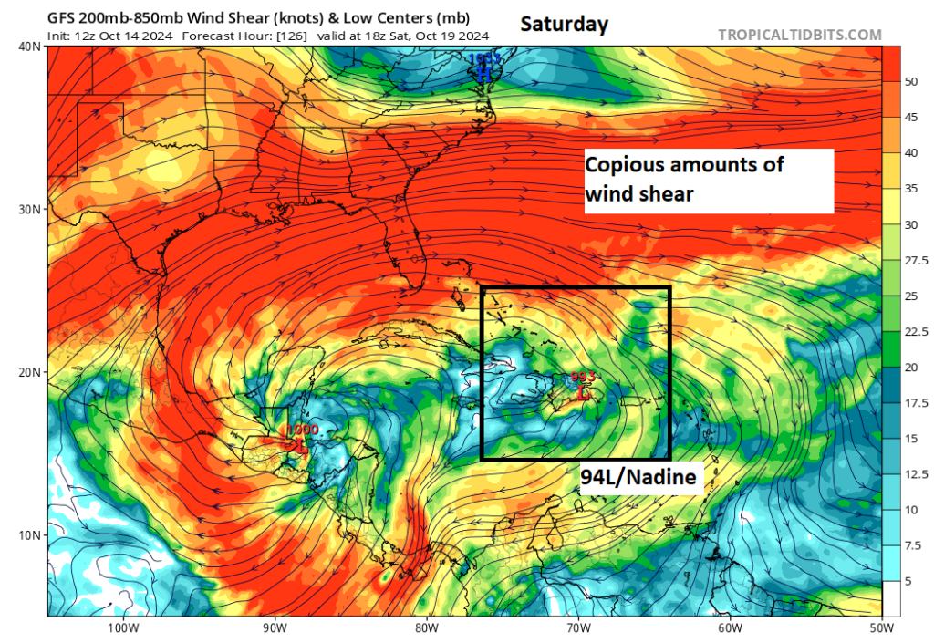
- We anticipate that 94L would fall prey to copious amounts of wind shear in the southwest Atlantic and Gulf before it makes it to the U.S., and it is unlikely to ever be a serious threat to the Southeast.
- No other noteworthy developments are expected.
Invest 94L: Worth watching, but not a very serious concern
The next disturbance we have our eyes on is Invest 94L, a tropical wave moving through the Atlantic right now. The NHC is giving this about a 50/50 shot at development over the next several days.

If you live in Florida, at first glance, your stomach may sink, but in reality it is mid-October, not mid-August. Storms generally do not form here and long track their way to the United States. Also, it’s important to note that the hatched area is not the track of a nascent system but rather the area in which the system may develop. In other words, Invest 94L may develop somewhere in that orange hatched region. If it develops.
So over the next several days, Invest 94L will come westward.

For now at least, 94L is located in a pretty hostile area with lots of dry air surrounding it, and a bit of shear in the vicinity too. Over the next couple days, that may back off some, and that’s when 94L could make an effort to develop slowly. If there is a point where 94L has its best chance of developing, it’s probably in about 3 days as it approaches the northern Leeward Islands and perhaps the Virgin Islands and Puerto Rico. Again, development is probably going to be sluggish here, so we aren’t expecting a Milton or Helene-esque blast of rapid intensification or anything. But if you are in the islands or planning to visit the eastern Caribbean islands this weekend, it’s something you’ll at least want to monitor. Most modeling keeps the ceiling on 94L low as it moves into the islands.
From there, it’s going to be difficult to see Invest 94L making it much farther west while remaining in tact. There is a wall of wind shear forecast to be over the Gulf and Southeast this weekend which would almost certainly shred 94L or whatever it is at that point (provided Hispaniola doesn’t get to shred it first). In other words, by the time we get later into the weekend or early next week, it’s difficult to think that this one remains a major concern.
So bottom line on Invest 94L: Watch it in the Caribbean. Keep tabs on it to the west. But in general, we do not believe this one will be a major issue at this time.
Elsewhere
There’s nothing else we really have our eyes on. We are seeing some periodic signs of Caribbean development from the GFS model in particular. That seems to have very limited ensemble support or support from other models that have performed well this tropical season. At this point, the only organized system they seem to be picking up over the next 7 to 10 days is Invest 94L. So we anticipate that’ll be the only real game in town for a bit.
Source link


