Hurricane Nicole made landfall around 3 a.m. EST November 10 near Vero Beach, Florida, with sustained winds of 75 mph and a central pressure of 981 mb. Nicole was just the fourth hurricane on record to hit the contiguous U.S. after October, and the second-latest landfalling hurricane on record. Only Hurricane Kate in 1985, which hit the Florida Panhandle as a category 2 storm with 100 mph winds on November 21, made landfall later in the season. Nicole set a number of low-pressure records for the month of November, and gave Florida two landfalling hurricanes (along with Ian) in one year for the first time since 2005. According to Steve Bowen of Gallagher Re, the damage from Nicole is likely to be similar to that of Hurricane Eta in 2020, which cost $1.6 billion.
Nicole brought wind gusts of 70 mph or more to three major weather stations: Melbourne Airport (80 mph), Cocoa Beach (78 mph), and Orlando Sanford Airport (70 mph). Wind gusts of at least 40 mph were recorded from Palm Beach to Georgia and on the Gulf coast in the Tampa/St. Petersburg region. A wind gust of 100 mph was recorded on a 600-foot tower at the Kennedy Space Center, where the $4.1 billion Artemis spacecraft was on the pad.
As of 1 p.m. EST Thursday, poweroutage.us reported about 300,000 customers without power in Florida, down from a high of 350,000 earlier in the day.
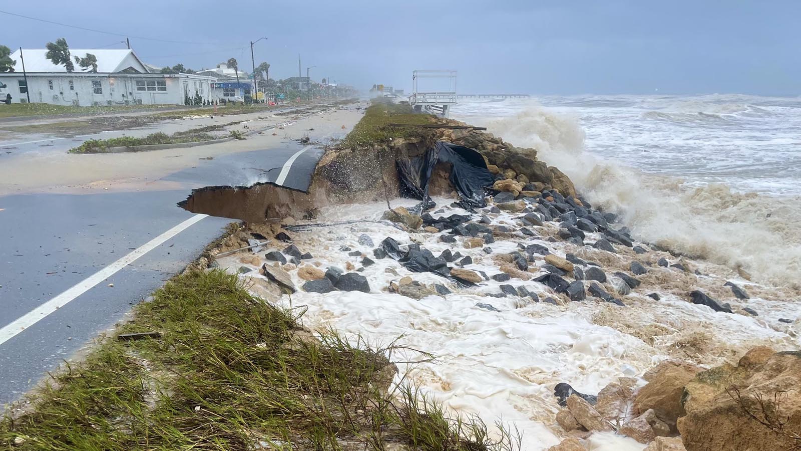
Nicole brought major storm surge flooding
At 1 p.m. EST Thursday, Nicole was centered about 45 miles north of Tampa, headed northwest at 15 mph with 45 mph sustained winds and a central pressure of 988 mb. Satellite images and Tampa Bay radar showed that Nicole was still a large and well-organized storm, and was bringing heavy rains to central and northern Florida and southeastern Georgia. Tropical storm-force winds extended out 345 miles to the northeast of the center, and 12-foot seas extended out 690 miles to the northeast of the center.
Nicole has driven a highly destructive storm surge to the coast of Florida, and major flooding was observed as far north as Charleston, South Carolina, Thursday morning. A water level 3.58 feet above high tide (MHHW) was observed at Jacksonville, Florida (Mayport) during Thursday morning’s high tide. This is the highest water level on record there since 1928, beating the record of 3.21 feet set in Hurricane Matthew in 2016. (The 1898 Georgia hurricane is thought to have brought a higher water level to Jacksonville, though: 6.5 feet.)
Also on Thursday morning, major flooding occurred at Fernandina Beach, Florida, with its fourth-highest level on record; moderate flooding occurred at Fort Pulaski, Georgia (sixth-highest water level on record); and major flooding at Charleston, South Carolina (13th-highest water level on record). Major flooding was observed also at tide gauges at Cape Canaveral, West Palm Beach, and in the Florida Keys at Vaca Key, which had its third-highest water level on record at 11 p.m. EST Wednesday. It’s very fortunate that Nicole made landfall during low tide, or else the flooding damage would have been much greater.


Heavy rains in Florida
According to the 10 a.m. EST Thursday NOAA storm summary for Nicole, more than five inches of rain have fallen at three locations in Florida, with the 5.93 inches at Union Park (seven miles east of Orlando) the highest amount observed. Nicole’s heaviest rains fell over the watershed of the St. Johns River, which surged to major flood stage on Thursday morning, reaching a water level exceeded in only two other years – in 1933, and earlier this year, when the torrential rains from Hurricane Ian drove the river to its highest level on record. The river was still at moderate flood stage from Ian’s rains before Nicole hit, and the river likely will remain at flood stage into December.


Nicole generated waves of more than 32 feet
Nicole brought huge waves to the Florida coast; waves at the buoy 138 miles east of Cape Canaveral, FL, peaked at 32.8 feet on Wednesday night (Figure 4). Waves at the buoy 10 miles offshore from St. Augustine, Florida, peaked at 18.7 feet at 9:30 a.m. EST Thursday. High waves on top of a large storm surge at high tide during the king tides are a recipe for significant coastal damage and beach erosion.


Forecast for Nicole
The track forecast for Nicole is straightforward, with models in close agreement that the storm will turn north and then northeastward, passing through Georgia on Friday morning, then moving through the Mid-Atlantic states and into New England by Saturday morning. Nicole likely will no longer be a tropical cyclone by Friday night, when it will be over the western Carolinas. But the storm will still be a potent rain-maker thereafter, with rainfall amounts of 2-4 inches expected.
Nicole may be the final storm of the 2022 season
With it now being mid-November, and the long-range forecasts from the GFS and European model not showing any new tropical storms forming in the coming week, there is a good chance that Nicole will be the final named storm of 2022. If so, good riddance to this season, which would finish with 14 named storms, 8 hurricanes, 2 major hurricanes, and an accumulated cyclone energy (ACE index) 78% of average. The 1991-2020 averages for a season are 14.4 named storms, 7.2 hurricanes, and 3.2 major hurricanes. Thus, 2022 would be an average season for named storms and hurricanes, and below average for major hurricanes and ACE index. But from an impacts standpoint, 2022 was one of the top-five seasons on record: Ian, Fiona, and Nicole will all be billion-dollar storms, and Ian may challenge Katrina of 2005 as the most expensive weather disaster in world history.
Website visitors can comment on “Eye on the Storm” posts (see comments policy below). Sign up to receive notices of new postings here.
Source link