During a remarkable hurricane hunting career spanning 42 years, over 80 hurricanes, and 659 penetrations into hurricane eyes, NOAA meteorologist Jack Parrish retires this week. Perhaps no other meteorologist alive has seen more exceptional weather and worked with more top weather scientists than Mr. Parrish, and he has some great stories to tell.
After serving as a radar operator and navigator aboard oceangoing Coast Guard cutters for four years, Jack earned a BS degree in Meteorology from Florida State University in 1980. That year, he joined the NOAA Hurricane Research Division (HRD) in Miami, flying as a radar scientist on NOAA’s pair of P-3 Orion hurricane hunter aircraft, NOAA 42 and NOAA 43. In 1983, he joined NOAA’s Aircraft Operations Center as a flight director for the P-3s.
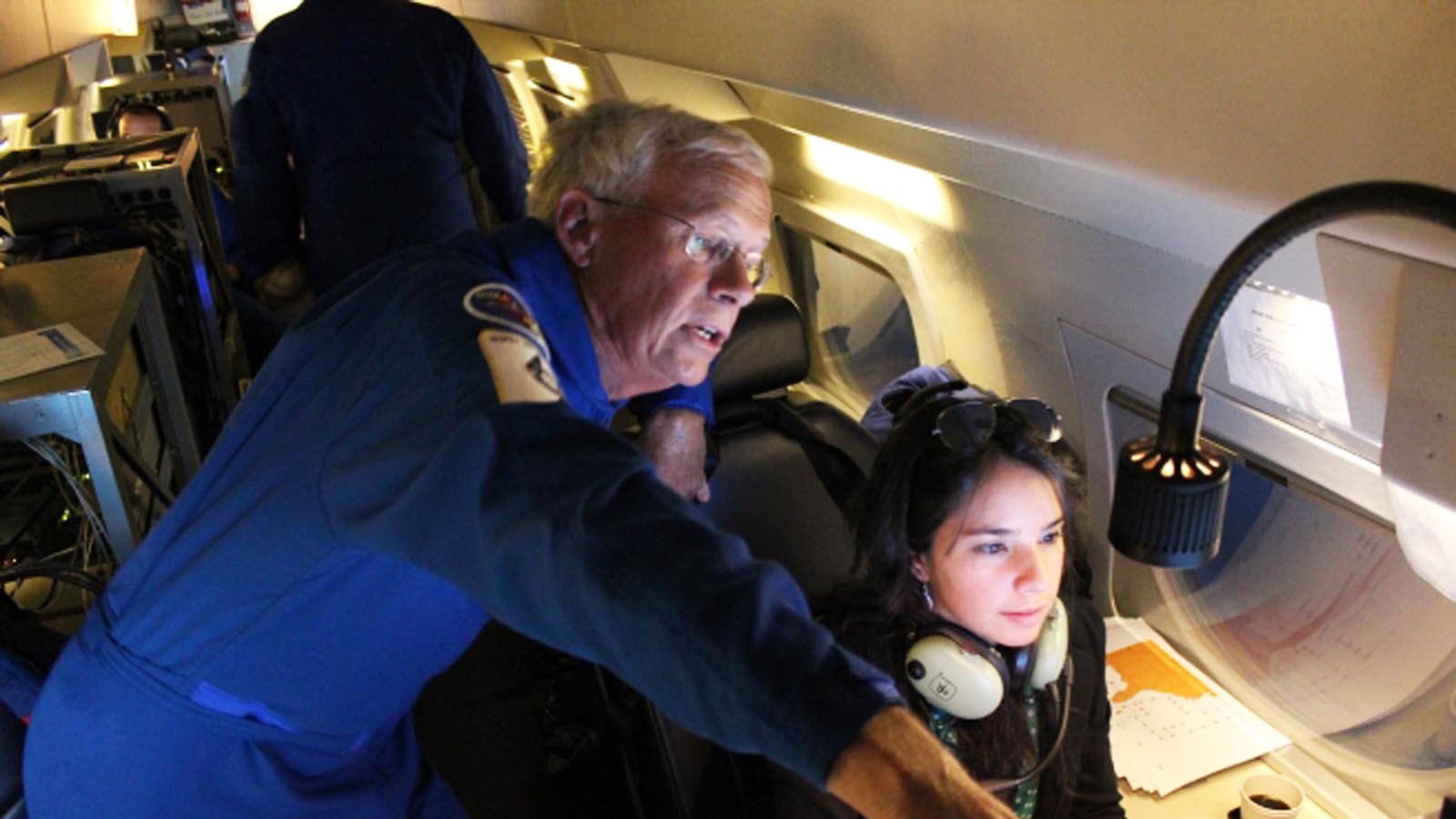
When I joined the NOAA Hurricane Hunters in 1986, Jack was the flight director who trained me on my first project (a severe thunderstorm project led by legendary tornado scientist T. Theodore Fujita), and on my first hurricane hunter flight, into Cat 1 Hurricane Bonnie off the Texas coast. When NOAA added a high-altitude jet (a Gulfstream IV-SP) to its fleet in the 1990s, Jack became a project manager for field studies involving the jet. He took the time recently to relate some of the stories from his remarkable career, and to share his photos.


So to begin, Jack, tell us what were the first and last hurricanes that you flew through?
My first hurricane flight was into Cat 5 Hurricane Allen on 8/5/1980, on NOAA 42. My last was Cat 3 Hurricane Larry on 9/7/2021, on the NOAA jet.
Wow! That’s a pretty auspicious start to a career with the hurricane hunters: flying into Hurricane Allen. Allen still holds the record for the strongest Atlantic hurricane ever measured, with 190 mph sustained winds (two days after your first flight into it). So, what was your roughest flight?
Without a doubt, my second hurricane flight, again into Cat 4 Allen, on 8/6/1980. Those were the days when we flew any intensity hurricane as low as 1,500 feet, again because that’s what the science (NHC, HRD) requested. Typically, we only sought safer, higher altitudes when the experience just was too rough lower. In those days I was working for HRD and training as a radar meteorologist on the P-3s, flying at Station 4 on the left side of the aircraft. That day, we were flying reconnaissance for NHC. The first pass, east to west, between the south Cuban coast and Jamaica, was quite unpleasant in the two eyewalls, but the max turbulence and zero-G events were limited to the eyewall passes (perpendicular to the banding), so they were mercifully brief. So far so good. But the next pass, south to north, was memorable for life. The center of circulation we NOAA flight directors always navigate to when ‘fixing’ the storm was unfortunately tucked up against the northwest eyewall, and we had to turn more to the west to find the center. By now the eye character had become asymmetric, meaning almost no eyewall on the south side, and not much turbulence there. But on the north side, at least on radar, it was Dante’s Inferno ahead.
I think it would have been really bad, but short-lived, if we had continued turning to the west and just exited to the west, and then realigned the pattern. But instead, we marked the center and in the last calm moments, turned north again, sliding into the northwestern eyewall. For the next about 20-25 minutes, complete bedlam! In crawling north in the western eyewall, we had about 120 knots of headwind, so our relative (ground) speed exiting that environment was probably only about 90-100 knots. And then, even with C-band radars in the nose and lower fuselage, we learned a lot about extreme attenuation in rainfall so heavy, as new convective bands were repeatedly appearing on radar once we had made it almost clear of the current one. It was simply a rapid-succession roller-coaster of ups, downs, and sideways. No drawers stayed closed, things we thought were tied down securely were not, documents flew about and ended up in the passageways; it was difficult to see the displays due to eyeball jitter, and impossible to hit any buttons to optimize displays. My trainer Pete Wirfel, flying outboard at Station 4, was horrified at the oscillation he saw between the number 1 and 2 engines on the left wing, and he closed the window flap so he wouldn’t have to see it anymore.
It seemed to go on forever. When we finally made it to the north side of the pattern and turned to the southwest, it took something like an hour to clean up the aircraft so we could continue the mission. We finished the reconnaissance pattern at 10,000 feet (a much calmer penetration in that case), before returning to Miami. Inspection of the aircraft indicated no excessive strains or bent metal – a real testament to Lockheed engineers for sure.


Yikes! Was that also the most memorable hurricane flight that you were on?
As awful as the 8/6/1980 mission was on NOAA 42, the most memorable was on 9/25/1987, when Cat 3 Hurricane Emily was about to make landfall on the south coast of Hispaniola. It was a multi-aircraft eye penetration-fest, flying through a red-hot eyewall as many times as was safely possible. We were flying at 12,000 feet; NOAA 43 was at 10,000 feet or lower. The flying was all in the eyewall that day, with very intense updrafts and downdrafts. We made 10 passes flying ‘pie-wedges’, generally in the northern quadrants, then sampled the high cirrus clouds with our microphysics instruments before returning to the eyewall intensive for another nine eye penetrations. I recall the NOAA 43 pilots becoming alarmed at the vibrations while flying through the eyewall at 10,000 feet, so we quickly ascended to about 17,000 feet so they could come up to 15,000 feet. Talk about a fast repositioning! Pilot Dave Turner gave them a cushion in a hurry, since he heard their concern over the radio, and we were instantly on the way up.
The ice must have been very abusive; we abraded numerous holes in the radomes and leading edges, and Flight Engineer Butch Moore had to replace two oil coolers (like engine radiators) before NOAA 42 could bring us home from San Juan. It was the most memorable because I’ve never seen a flying crew so focused and responsive to the changing terrible stuff on radar; I also learned that day something about what we could do, versus perhaps what we should do, for science.
I was the flight director on NOAA 43 that day, and I remember communicating with you via radio when you nonchalantly mentioned NOAA 42 had just completed an 18th penetration, and circling around to do one more! That flight set an all-time record for most eye penetrations on a single flight, and your plane took an unbelievable pounding that day. My plane got pounded badly as well; the event that made us scamper higher from 10,000 feet was an eyewall penetration where we hit 3 Gs of acceleration from an updraft of +23.9 m/s (53 mph), immediately followed by a downdraft of -9.6 m/s (21 mph). After climbing to 15,000 feet and doing our next penetration, pilot Jim Gunnoe was forced to roll the plane in order to stop a dangerous aerodynamic flutter that developed in the wings. He came back to my station after that penetration and advised me that we might want to consider aborting the mission. It was only my third hurricane I’d flown, and my first major, so I didn’t realize that the turbulence was particularly bad. When chief mission scientist Pete Black instantly and enthusiastically supported going home, I knew that we’d better skedaddle! Was one of those two flights your most dangerous flight?
I think the Hurricane Allen flight I described was my most dangerous flight. But there were numerous cases flying the inflow/collar cloud around supercell thunderstorms for the National Severe Storms Laboratory that came darn close. In many of those cases, the air was relatively smooth most of the time, but we would record 80-90 knots of inflow while observing what I’d estimate as about 60 knots of outflow (a gust front) at the surface below the aircraft. Since their favorite collar-cloud altitude was 3,000 feet, there had to be a terrific shear in that shallow column, and I sure cringed at the prospect of accidentally flying through it. Thankfully, it never happened on my watch.


Who were your favorite crew members to work with?
So many, so many … From the early days, definitely computer tech and flight director Dick Darby and electronics tech Al Jarvi. Dick was my Flight Director trainer. Both Dick and Al had about two years of formal education beyond their high school diplomas (though plenty of military training), yet were as smart as anyone I’ve ever joined in the air. Dick was such a relaxed mentor; nothing that happened in the hurricane’s dynamic environment ever visibly perturbed Dick (I won’t say the same for certain aspects of government BS). From observing Dick Darby in the Flight Director seat, I learned what has never been forgotten, that our happy place was about 20-40 miles in front of the aircraft, farther whenever possible, so the crew always knew what was coming and how we planned to handle it. If we needed to discuss safety with the aircraft commander, there was sufficient time. I handled the second fix in an intensifying Hurricane Alicia in 1983 with Dick on board to critique; the next day, when we ran out of flight directors, Dick’s training enabled me to perform my solo mission as Flight Director as the storm approached Galveston. Thanks, Dick, those instructions stuck with me to this day.
Al Jarvi was my first introduction to what we called a “super-tech.” These folks were in charge of everything electronic in the P-3’s cabin, meaning everything scientifically important. In those days, so many things broke almost every time we launched (or else we just focused on the ‘oh-no’ items). Our engineers and techs, often led by a super-tech, went instantly to work making things right as we approached the severe weather. We flew ahead on faith, and it was just amazing how the required systems were back up in time to get the critical findings back to the NHC. Talk about people ‘watching your six’, there they were, giving me as the science leader incredible confidence heading for the eye.
Yes, Dick and Al were two of my favorite co-workers as well, in addition to pilot Dave Turner. Who were your favorite scientists to work with?
Again, so many but three come immediately to mind.
The first, Noel LaSeur, an early storm-flying meteorologist and one of my favorite undergraduate professors at FSU, thanks to a one-on-one convective meteorology reading course where we got to discuss a new groundbreaking paper each week. Noel happened to join us on my fourth hurricane flight, sitting inboard at the radar station on my third flight into Cat 5 Hurricane Allen (1980) – this time, right in the center of the Gulf of Mexico. We had pounded through the eye quite a few times, vertically stacked with NOAA 43 and NOAA 41 (a WC-130B Hercules … yes, we had one of those back then). There was a sudden arrhythmic thumping under the floor as we passed out through the eyewall; I was new enough that I asked LaSeur if it was anything to be concerned about. He responded with a deadpan, “No, Jack. If it was there would be general excitement among the techs and flight engineers.” Well, you know what happened within the next 10 seconds, all kinds of crew members’ ears pressed to the floor, stethoscopes out and listening, talk of emergency vectors out of the storm, general hubbub. So, I figured this is it (for the second or third time in Allen, quite an intro to hurricane flying). In the end, it turned out to be the sealing strip between the lower fuselage radome (it dropped down when in flight) and the concave part of the fuselage in which it rested when not extended – not a big deal, and we were repaired and flying the next day. But my sense, if LaSeur was cool, so was I.
Then there was flying tail Doppler radar patterns around severe thunderstorms over northern Alabama with Ted Fujita. That scientist knew his thunderstorms! I felt perfectly comfortable with Ted over the back of the pilot’s seats giving them heading information while I was able to just listen to his running commentary over the headset. After a while I essentially abandoned the Flight Director station to go up onto the flight deck and follow his hot-mike commentary while watching what he saw and knew about the evolving thunderstorm structure and hazards with each pass. Now that’s Mother Nature’s classroom at its best! My favorite Ted quote: “Jack, when I’m out here flying, I’m 20 years younger!” Then, in a lower slower voice, “Back in the office … 10 years older.” What a fine gentleman!
And the unforgettable Mel Shapiro. I think Mel’s mostly out of the business now, so we’ll never get to observe one of Mel’s hand-drawn cross-section analyses in the making, being constantly extended as we launched successive dropsondes across such atmospheric phenomena as polar lows, bomb intensifying oceanic vortexes and atmospheric rivers. Mel’s mind moved much too fast to wait until after landing to begin the analyses; I swore he had the paper written in his mind before we were on final approach. But the coolest memory, Mel’s energy with each model update was irrepressible. Soon to come was the knock on my Anchorage or Honolulu hotel door, 4 a.m. or so, “Jack … Jack …” There’s Mel with two cups of coffee and a hard copy of the latest 500 mb product, sketching out today’s research flight plan.


What was your favorite location for a field project?
Very hard to knock Oahu, although work could be work wherever it took us. When we finished TOGA-COARE, I had a both challenging but satisfying project with Bob Grossman, CEPEX, that took us P-3 flying, at times as low as 75 feet off the ocean, between Hawaii – Christmas Island (Kiribati) – Majuro – Kwajalein, then back in reverse. I was both project manager and flight director, so I worked for a month with little sleep, but what cool exotic places. One amazing memory was there was a screw-up about paying for fuel at Kiribati, so I spent the second half of each inbound flight signing a huge stack of Australian $50 travelers checks to pay for a fill-up. Exhausted-wrist syndrome!
I also learned to truly love Anchorage projects in the dead of winter. The people there are as warm as the air is cold. All that’s amazing about Alaska, but no tourists. The first time we dropped below the cloud deck to see the Kenai Peninsula mountain range was literally breathtaking; I had no idea there was a place on earth so beautiful from the air.
What is the most spectacular non-hurricane weather phenomenon you’ve seen?
That’s a tough question, between a nighttime Mesoscale Convective System (MCS) out over Australian’s Gulf of Carpentaria (with enough lightning to make it seem like daytime), to the complete convective washing machine of the center of a developing bomb cyclonic low, to almost linear straight-line MCS wind events that are so solid and strong you have to fly across multiple states just to get around them. But the two that come most vividly to mind were: (1) being struck by lightning over north Texas, and looking right down the lightning channel as it connected to a silo below the aircraft (that’s a wow moment), and (2) the ridiculously warped low-level flow pattern where the drainage wind flowing northward down the Brenner Pass collides with the east-west Alps just west of the Innsbruck Airport in Austria. It’s one of those local effects where the winds can blow strong in opposite directions at each end of the single east-west runway. Now that’s taking off using the faith system, as it will turn into a headwind in time for the aircraft to lift off. Honorable mentions include Kelvin wave clouds inside of well-formed hurricane eyewalls, St. Elmo’s fire lightning bolts painting the cockpit windows and extending well forward of the nose boom, and not knowing what a haboob was, thus walking and coughing through the zero-visibility dust storm in downtown Phoenix.
Due to climate change, is there an example of a flight where you saw something that you wouldn’t have seen 42 years ago when you first started flying?
Here’s the simple one, Jeff, having to fly farther north, at times north of Barrow, Alaska, to work the polar ice edge. There are larger leads in the ice, and it is not as hard to launch an Aircraft eXpendable BathyThermograph (AXBT) and not bounce it across the sea ice to land it in the water. There are fewer iced-in Alaskan ports, with earlier break-up dates for the rivers. Back home here on the Florida west coast, I’m seeing more King Tide flooding. The King Tides have been here forever, but didn’t have as much flooding. The gradual warming is certainly evident.

What is left on your weather bucket list left to see, or have you seen it all?
Until 2019, I had seen only two tornadoes. Thanks to the TORUS project that year, I’ve now seen more than I can count, so that item has been crossed off my weather bucket list! There’s a funny story to relate about that. One of our recent great additions to the Hurricane Hunters is Major Ashley Lundry, who shines as one of our storm-qualified P-3 flight directors while also serving as a WC-130 Aerial Reconnaissance Weather Officer for the Air Force Hurricane Hunters in her reserve time. Ashley was working with me over the Midwest, flying around some of the more spectacular mesocyclone and hook echo radar signatures we’ve seen – and we’ve seen a lot of them. Ashley commented, “with that structure we ought to be seeing a lot of tornadoes.” My response was, “Don’t get your hopes up, I’ve seen very few with my own eyes; they’re usually tucked under the collar and wall clouds and obscured by dust, rain shafts and often failing light. We live vicariously through the eyes of the ground chasers!” So, something like two days later, on 5/28/2019, flying over eastern Kansas, we saw multiple supercells, and of course a visible tornado or funnel cloud (or two … or three) out of each one of them – all types and life cycles. It was a visual extravaganza with every pass. So, no matter how many years you do this, nature has surprises lurking out there, that’s for sure.
I still want to see the waterfall at Yosemite that appears as a firefall with just the right sun angle, time of day and atmospheric optics. And I’ve heard there are only two places on earth to see a waterfall-induced moonbow, one somewhere in Kentucky … so challenges lie ahead. It has been quite a ride.
Website visitors can comment on “Eye on the Storm” posts. Comments are generally open for 30 days from date posted. Sign up to receive email announcements of new postings here. Twitter: @DrJeffMasters and @bhensonweather
Source link