Headlines
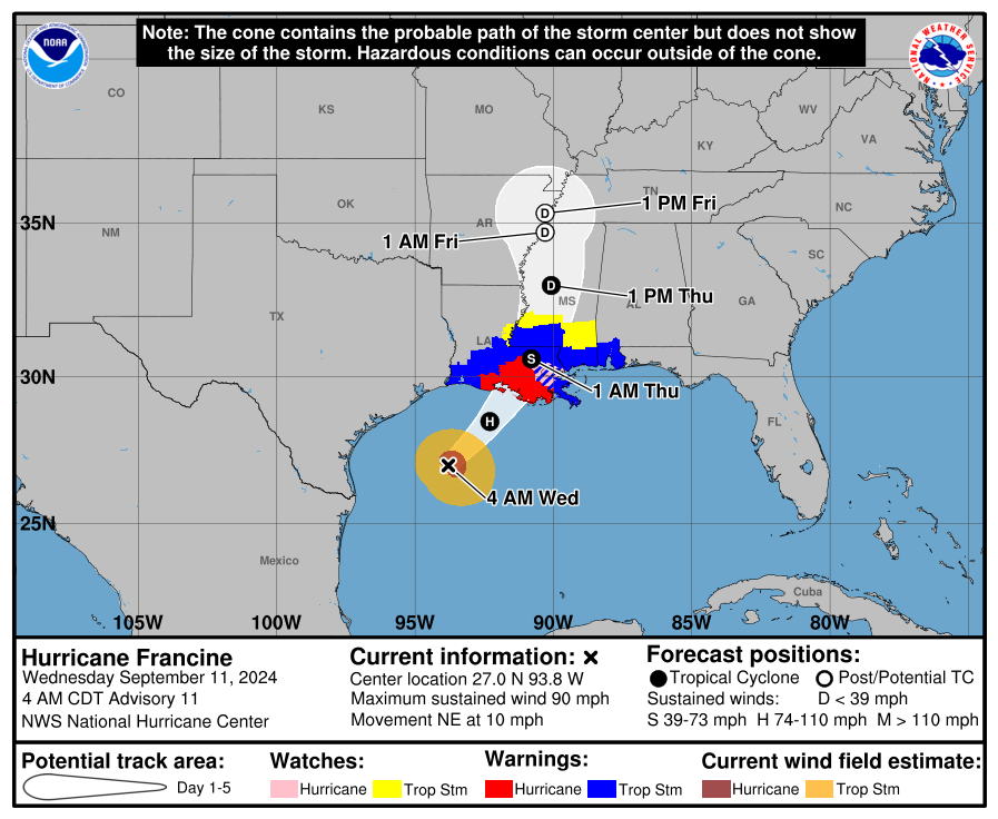
- Francine make its initial approach to the Louisiana coast as a high-end category 1 hurricane.
- Francine will make landfall late this afternoon or evening, likely between the Atchafalaya Delta and Port Fourchon.
- Significant wind and surge issues are likely at the coast with lesser impacts inland but tropical storm force winds and power outages a good bet between Lafayette and coastal Mississippi.
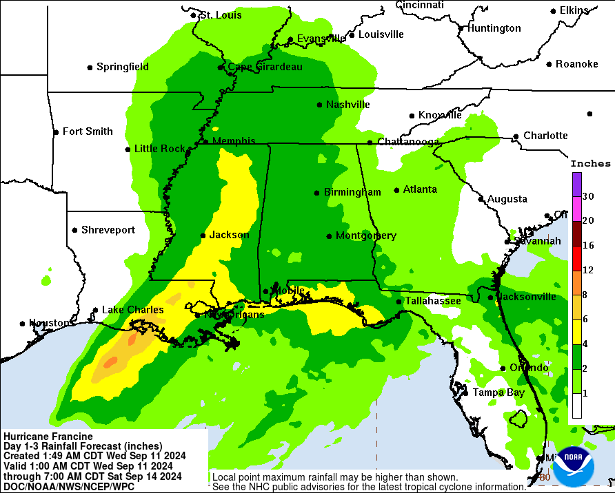
- 4 to 8 inches of rain expected in Louisiana and southern Mississippi with flash flooding likely in spots.
- Francine will slam on the brakes near Memphis but should basically just die off in place with scattered rains the rest of this week across the Southeast.
Francine now
Hurricane Francine has 90 mph maximum sustained winds this morning, as it did some work overnight to get more organized. It has a few hours left to gain some more intensity before it runs into dry air and wind shear that will likely take its toll on the storm.
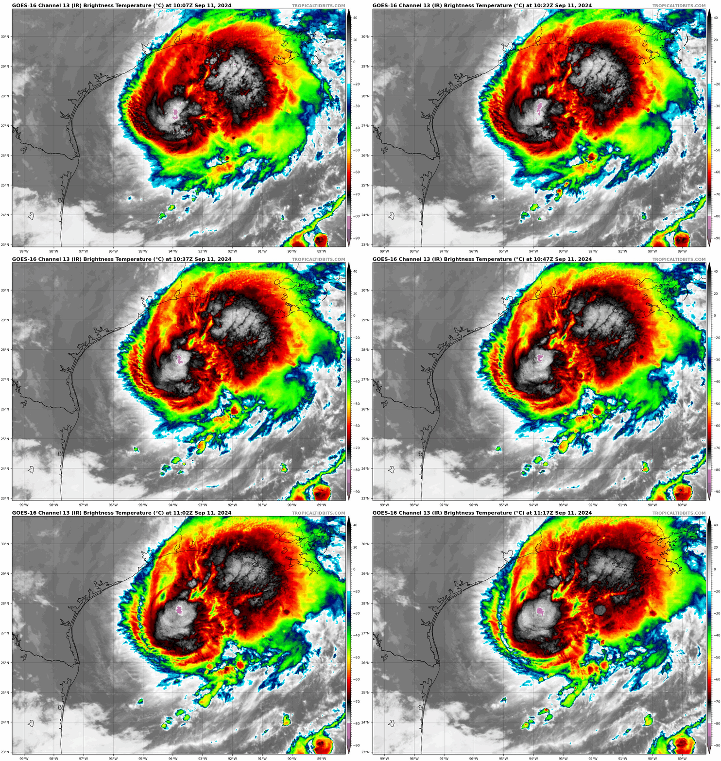
Francine’s outer rain shield has pushed ashore, mainly south of I-10 in Louisiana so far. Rain will continue to spread inland today.
Francine’s forecast and impacts
As of the 4 AM CT advisory, Francine was moving northeast at 10 mph. This speed should pick up some through the day. On its current track, a landfall between the Atchafalaya Delta and Port Fourchon seems most likely. That should occur late this afternoon or evening. As noted, rain has begun to overspread Louisiana, mainly east of Cameron and Lake Charles, and that will continue today. Rain totals of 4 to 8 inches in the Atchafalaya Basin and into parts of Mississippi. Rainfall will be 4 to 6 inches in New Orleans east to the Florida Panhandle.
Flash flooding is likely in spots, and the Weather Prediction Center has a moderate risk (level 3 of 4) for flash flooding risk in much of southeastern Louisiana and portions of southern Mississippi.
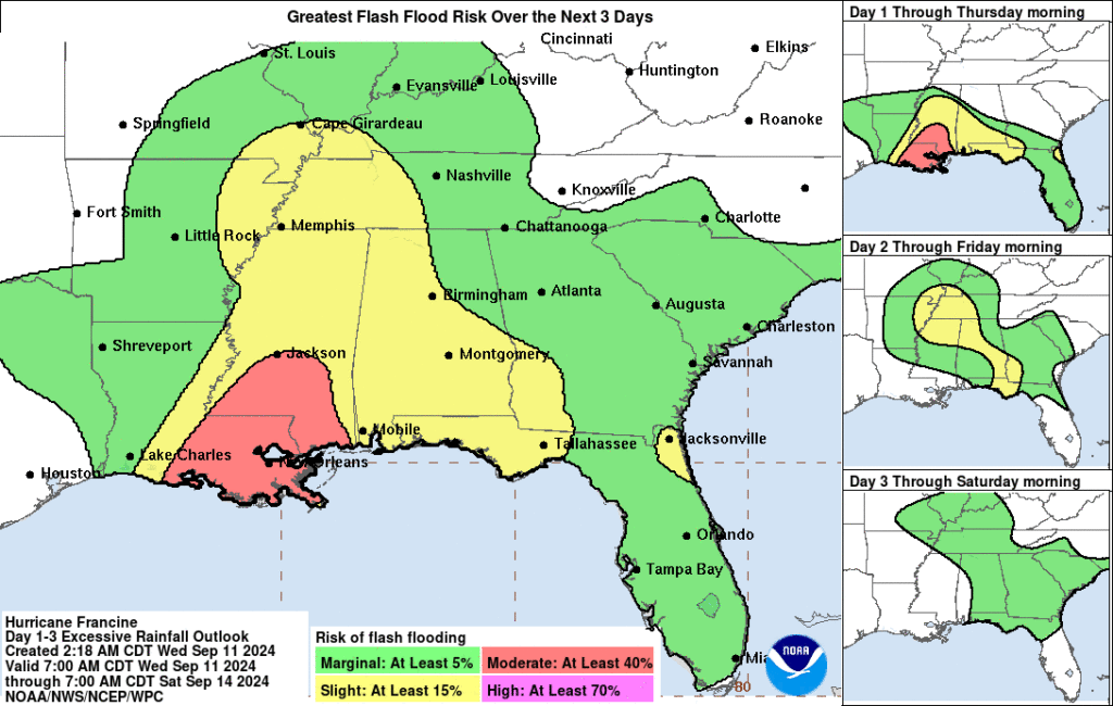
In addition to excessive rainfall, we expect to see isolated tornadoes today, and a slight risk (level 2/5) for severe storms exists in eastern Louisiana, extending east to the Florida Panhandle.
In terms of wind, the highest risk will be right at the coast, obviously. As you push inland, we’ll see hurricane-force wind risk extend into Morgan City, Houma, and perhaps extreme southwest portions of the New Orleans metro. New Orleans proper should see moderate to high-end tropical storm force winds, as will Baton Rouge, perhaps Lafayette, and up into portions of southern Mississippi.
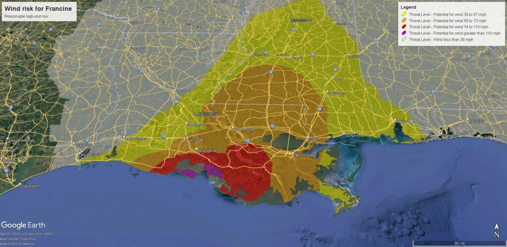
As we did yesterday, here are the current forecast maximum wind gusts as of 6:45 CT based on official National Weather Service forecasts.
Lake Charles: 36 mph
Lafayette: 49 mph
Baton Rouge: 51 mph
Port Fourchon: 67 mph
New Orleans: 57 mph
Morgan City: 87 mph
Houma: 67 mph
Gulfport: 62 mph
Natchez: 38 mph
Vicksburg: 38 mph
Jackson, MS: 40 mph
Mobile, AL: 37 mph
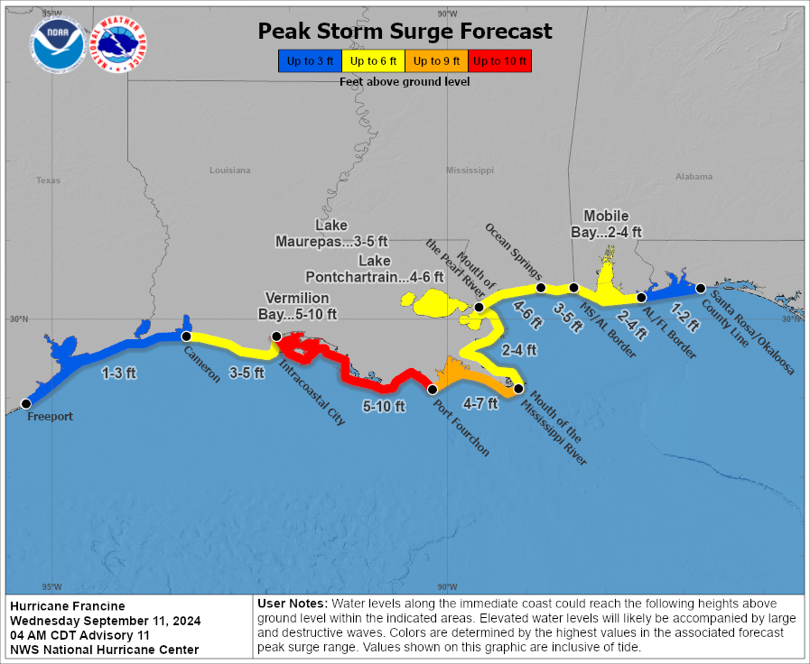
Storm surge will continue to be an issue as well with 5 to 10 foot surge expected on the Louisiana coast between Vermilion Bay and Port Fourchon. While the surge drops off east of there, it remains fairly substantial all the way to the Florida border, including a 2 to 4 foot surge in Mobile and 4 to 6 foot surge in Mississippi and in Lake Pontchartrain.

Beyond the coast, Francine will accelerate north into Mississippi, but it will slam on the brakes (as a non-tropical storm) just south or west of Memphis. As it just sort of sits, spins, and dies off, periods of scattered showers and storms will impact parts of the Southeast through the rest of the week off and on. No serious flooding is expected at this time, but it’ll be a good idea to keep tabs on things in Georgia, Tennessee, and Alabama perhaps heading into the weekend.
No other land concerns in the tropics right now. We’ll have another update before evening today.
Source link


