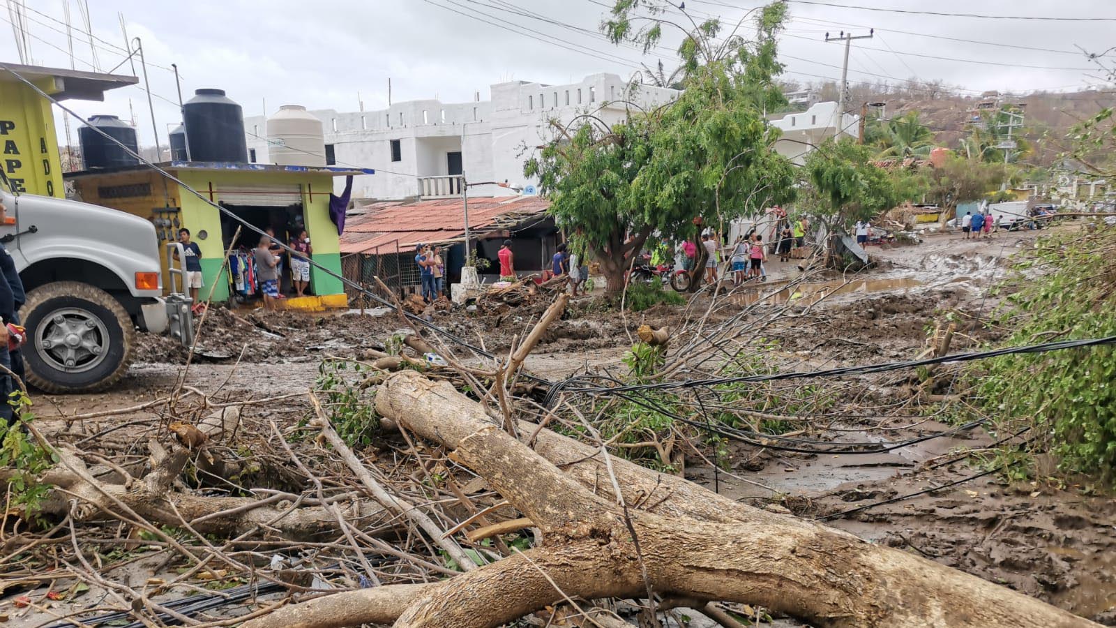
The first victims of the 2022 eastern Pacific hurricane season were claimed by Hurricane Agatha, whose flooding rains have killed at least 11 and left 32 missing in Mexico’s Oaxaca state. Agatha made landfall about 10 miles west of Puerto Angel, Mexico, at about 5 p.m. EDT Monday, May 30, as a category 2 storm with 105 mph winds. Agatha was the strongest landfalling eastern Pacific hurricane on record so early in the year.
Agatha dumped up to 9.45 inches (240 mm) of rain in a 24-hour period near the Mexican coast, triggering destructive flooding and landslides. According to floodlist.com, the hurricane left 200,000 customers without power and severely damaged two bridges. Agatha was a deadlier storm than any of the five eastern Pacific hurricanes that struck Mexico in 2021, and is the deadliest eastern Pacific storm since late May 2020, when Tropical Storm Amanda killed 40 people in Central America.


Agatha’s remnants may bring year’s first Atlantic named storm
Agatha’s remnants have merged with a large low-pressure system over Central America and the western Caribbean. This disturbance was designated Invest 91L by the National Hurricane Center (NHC) on Wednesday morning. A hurricane hunter aircraft is scheduled to investigate 91L on Thursday afternoon.
The disturbance has marginal conditions for development, because of high wind shear of 20-30 knots. However, warm ocean waters of 28 degrees Celsius (82°F) and a moist atmosphere with a mid-level relative humidity of 80% likely will allow for some slow development of 91L. Satellite images on Wednesday afternoon showed that 91L had developed a modest area of heavy thunderstorms and a respectable amount of spin at mid levels, but no surface circulation was apparent. Development will be aided by the current position of the Madden-Julian Oscillation (MJO), which is bringing a large-scale area of rising air to the western Atlantic.


Though 91L has strong model support for development, wind shear is predicted to remain high this week, and any storm that does form in the Gulf would likely be incapable of rapid intensification. The odds of development appear to be greater after the system crosses over the Florida Peninsula and enters the waters off the Southeast U.S. coast on Saturday or Sunday (Figure 3).
Since Agatha’s well-defined circulation did not survive crossing Mexico’s rugged terrain, 91L would be named Alex. In its 8 a.m. EDT Wednesday Tropical Weather Outlook, NHC gave two-day and five-day odds of Atlantic tropical cyclone formation of 70% and 80%, respectively, to 91L.
Heavy rains from 91L will be its main threat, and will likely begin affecting Cuba on Thursday, and South Florida and western Bahamas on Friday. Seven-day rainfall amounts of five-plus inches are expected over portions of Mexico, Cuba, South Florida, and the western Bahamas by Wednesday, June 7 (Figure 3). Because of dry air to the northwest of the system, a sharp cutoff point for the heavy rains is expected over central Florida.
South Florida received between 2 to 4 inches of rainfall with isolated amounts of 4 to 6 inches during the Memorial Day weekend, leaving the ground saturated in many regions. Heavy rains from 91L could lead to a flood watch for portions of South Florida on Thursday.


First day of hurricane season
Today, June 1, marks the official start of the Atlantic hurricane season, and for the first time since 2014, the first named Atlantic storm did not occur before the official start of the season. June is typically a quiet month: Only about 6% of a season’s named storms, 3.5% of its hurricanes, and 0.6% of its major hurricanes form in June.
The most recent hurricane to make a U.S. landfall in June was category 1 Hurricane Bonnie on June 26, 1986. Only one major hurricane has made landfall in the U.S. during June: category 3 Hurricane Audrey on June 27, 1957, near the Louisiana/Texas border.
Bob Henson contributed to this post.
Website visitors can comment on “Eye on the Storm” posts (see below). Please read our Comments Policy prior to posting. (See all EOTS posts here. Sign up to receive notices of new postings here.)
Source link