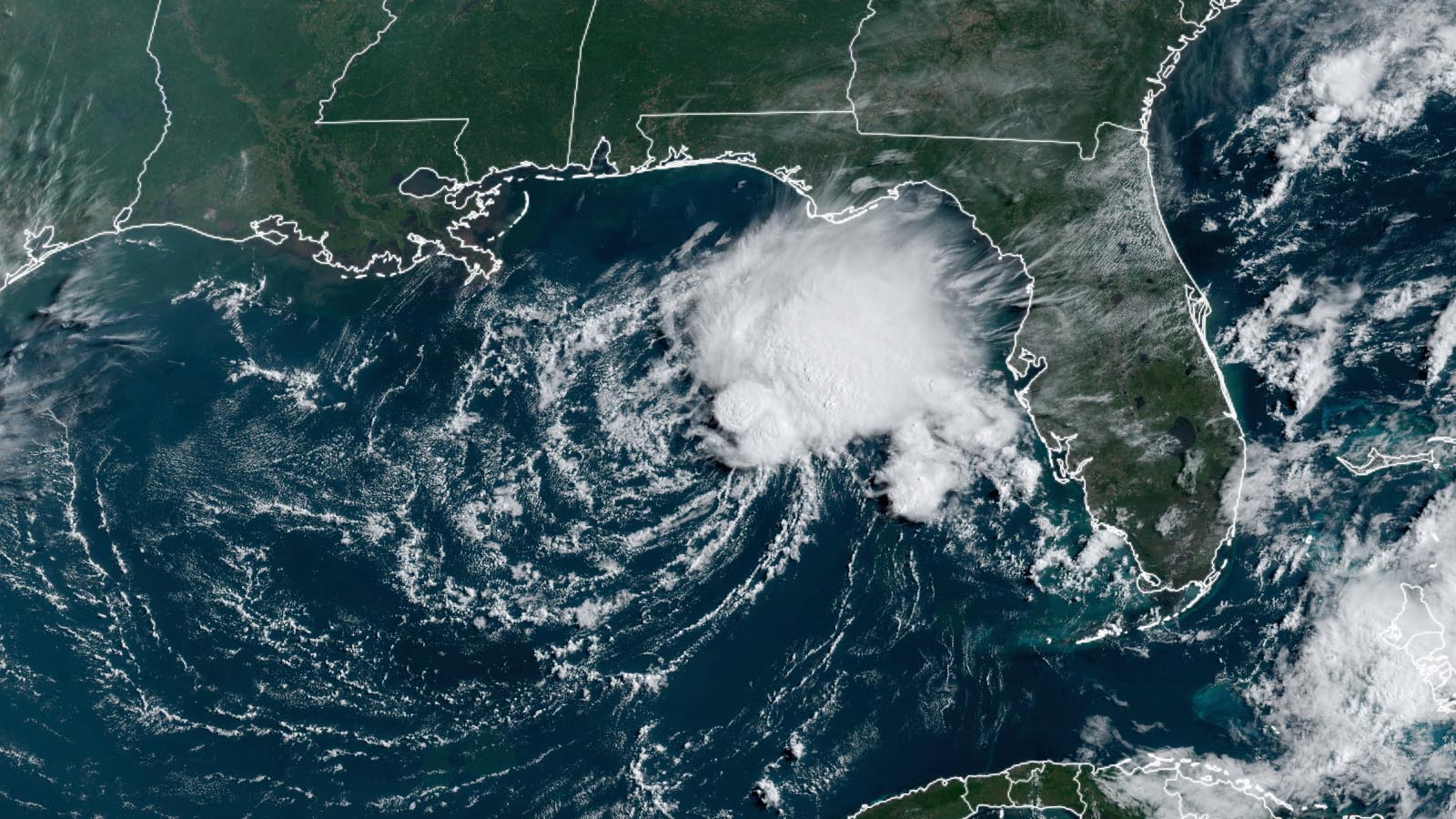
Tropical Depression Two (TD 2) formed over the marginally warm waters of the Gulf of Mexico on Thursday afternoon but poses little threat to any land areas and will be short-lived. TD 2 is a typical early-season system — one that forms close to the U.S. coast from a trough of low pressure, is weak and highly sheared, and brings little in the way of dangerous impacts.
Satellite loops on Friday morning showed that TD 2 had the classic appearance of a weak system experiencing high wind shear — a low-level surface circulation exposed to view, with all of the heavy thunderstorms displaced to one side. Strong upper-level winds out of the west were creating a very high 40-45 knots of wind shear, which was keeping TD 2’s heavy thunderstorms confined to the east side of the circulation.
The 5 a.m. EDT Friday advisory from the National Hurricane Center had TD 2 moving south at 5 mph, with top sustained winds of 35 mph and a central pressure of 1007 mb.
Forecast for TD 2
Conditions are marginal for development, with sea surface temperatures close to the threshold for tropical cyclone development, about 26.5 degrees Celsius (80°F). Along with high wind shear, TD 2 is suffering from a dry atmosphere (a midlevel relative humidity of 45%).
Wind shear will remain high and the atmosphere dry as steering currents take TD 2 to the south-southeast into this weekend, bringing the system over western Cuba by Saturday night. Though sea surface temperatures will warm as TD 2 heads south, high wind shear and dry air will likely snuff TD 2 out of existence by Saturday night. The main threat from TD 2 will be heavy rains of one to three inches over portions of the Florida Peninsula and western Cuba.
If TD 2 does become a named storm, it will be named Arlene, since a January subtropical storm did not get a name.
The long-range computer models are not highlighting any other threat areas in the Atlantic to watch over the coming seven days.
To learn more about TD 2, we highly recommend the new service started by Houston-based meteorologists Matt Lanza and Eric Burger, theeyewall.com (see Tweet below).
Website visitors can comment on “Eye on the Storm” posts (see comments policy below). Sign up to receive notices of new postings here.
Source link