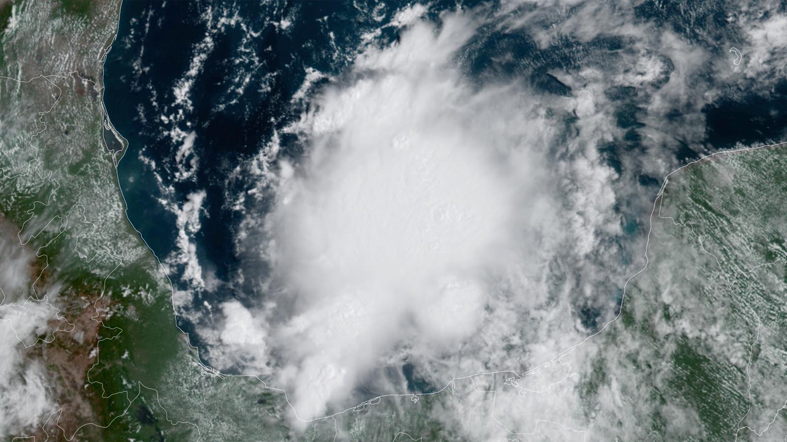
A developing disturbance in the southern Gulf of Mexico’s Bay of Campeche has the potential to organize into a short-lived tropical storm before moving inland just south of the Texas/Mexico border by Saturday night. At 11 a.m. EDT Friday, the disturbance, designated 99L by the National Hurricane Center, was headed northwest at about 12 mph. The system had favorable conditions for development, with sea surface temperatures near 30 degrees Celsius (86°F), moderate wind shear of 10 knots, and a moderately moist atmosphere (a mid-level relative humidity of 65%).
Satellite images on Friday afternoon showed 99L with a modest-sized area of heavy thunderstorms featuring a little bit of spin at mid-levels of the atmosphere and some low-level spiral bands beginning to form. The high topography along the coast of the Bay of Campeche can assist in the spin-up of tropical cyclones by funneling the winds counter-clockwise along the arcing coastline. This effect is likely at work with 99L.
A number of the ensemble members of the European and GFS models develop 99L into a tropical depression or weak tropical storm by Saturday. Steering currents favor a northwesterly track inland over northeastern Mexico by Saturday night, and the main impediment to development of 99L is its short time over water. In a special 10:50 a.m. EDT Friday Tropical Weather Outlook, the National Hurricane Center gave 99L two-day and five-day odds of formation of 60%. The first hurricane hunter mission into 99L is scheduled for Friday afternoon.
The next name on the Atlantic list of storms is Danielle, one of the most recycled names on the rotating list of storms, with seven previous incarnations of Danielle, beginning in 1980.


The main hazard from 99L will be flooding from heavy rains. However, the system’s rains should be more boon than bane, with the heaviest rains falling over northeastern Mexico, which is experiencing moderate to severe drought. Beneficial rains from 99L will also push into southern Texas, whose severe drought conditions were helped early this week by heavy rains from an earlier tropical disturbance, 98L.


The rest of the Atlantic is quiet
Looking out over the rest of the tropical Atlantic, quiet conditions uncharacteristic of the beginning of the peak part of hurricane season during a La Niña year still prevail. As discussed in Michael Lowry’s August 18 newsletter, stable, sinking air in the eastern Atlantic has suppressed development, as has much higher than average wind shear over the Caribbean.
However, tropical Atlantic conditions are increasingly favoring hurricane development. Saharan dust cover is diminishing, and waters are warming considerably, reaching the sixth highest levels on record in the Atlantic’s Main Development Region (MDR) for hurricane formation. Wind shear is predicted to fall next week over much of the tropical Atlantic, so we will keep a watchful eye on tropical waves progressing westward through the tropical Atlantic. So far, though, the long-range predictions from the GFS and European models are not highlighting any specific threat areas for next week.
Bob Henson contributed to this post. Website visitors can comment on “Eye on the Storm” posts (see comments policy below). Sign up to receive notices of new postings here.
Source link