Headlines
- Milton’s eyewall with powerful winds and a dramatic rise in water from storm surge is about to begin coming ashore between Saint Petersburg and North Venice.
- Tampa Bay may empty out as it approaches (as seen in Irma and Ian), and you should not be anywhere near the bay, as water may come rushing back in quickly and without warning.
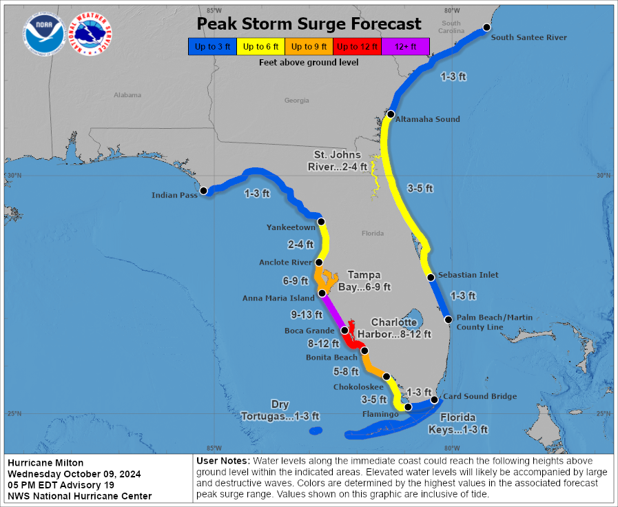
- The worst surge will come dangerously close to moving into portions of Tampa Bay south through Venice.
- Significant surge will continue building south of there to Fort Myers and on the east coast as well.
- A historic tornado outbreak has been ongoing across the eastern half of the Florida Peninsula and will continue a bit longer.
- Flooding from another 10 inches of rain is likely in the northern half of the Peninsula.
- Milton exits tomorrow to the east and out to sea.
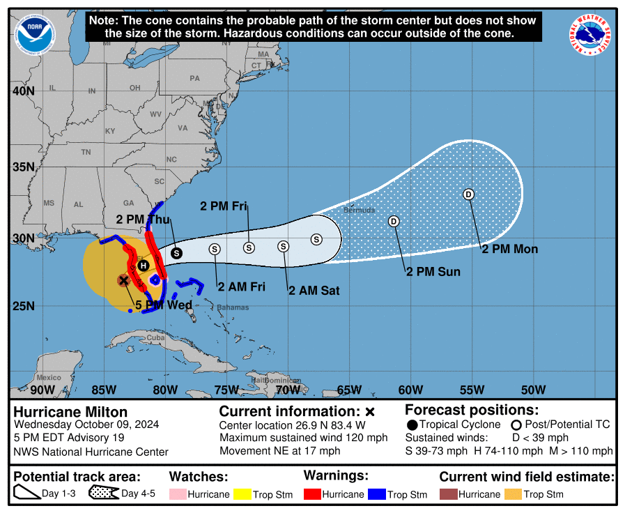
Hurricane Milton is gradually approaching the coast of Florida. It remains an unnervingly close call for Tampa Bay as every wobble makes a difference right now. But it appears the landfall window is between North Venice and Fort De Soto at the entrance to Tampa Bay. The worst of the surge and wind will probably impact the area between Tampa Bay and Venice, with significant surge to the south of there as well. The surge forecast has been adjusted somewhat today.

We still expect significant to borderline catastrophic flooding and inundation in some communities unfortunately. Surge values are currently about 1 to 4 feet on the west coast of Florida. Again, near and south of where this makes landfall will see a dramatic increase in water levels soon as that center approaches.
I can not say this loud enough: If water exits Tampa Bay as we saw with Ian and Irma, do not, I repeat, *do not* go into or near the bay to gawk. This one is coming in much closer to Tampa and it’s possible a wall of water comes rushing back in at some point. You will be trapped.
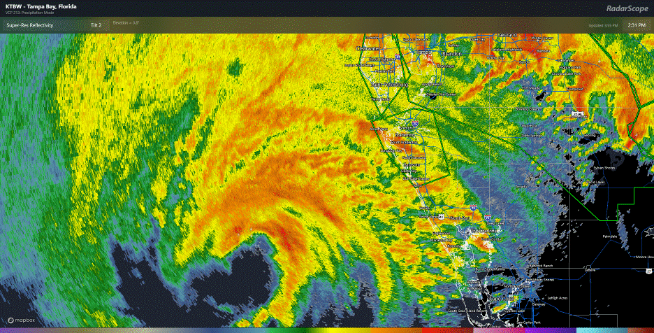
Milton is not as intense in terms of wind (now a cat 3 with 120 mph winds), but it has essentially doubled in size since this morning with tropical storm force winds extending out as much as 250 miles from the center. Hurricane force winds remain confined mostly to that eyewall that is preparing to come onshore near Sarasota and Bradenton. Conditions will get very, very nasty over the next 2 to 4 hours.
This is the time where you shelter in place and hope for the best. We certainly hope for the best for folks in Florida too.
Milton has been a prolific tornado producer in Florida today.
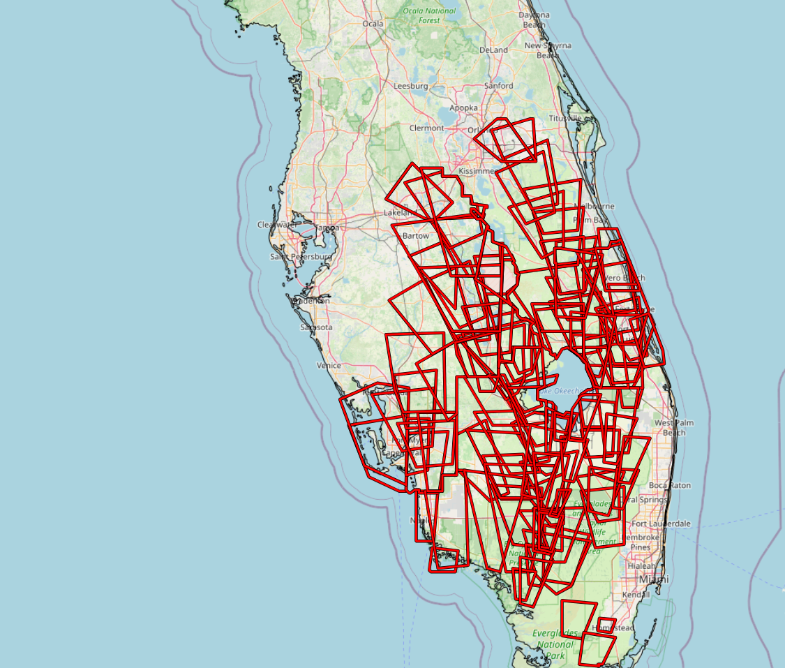
It will take time to weed through the warnings, reports, and damage, but I am certain we will have one of Florida’s most significant tornado outbreaks when all is said and done. Additional tornadoes are possible as the center moves across the state.
Flooding rains continue also, with as much as 2 to 5 inches so far across Florida and a lot more to come.
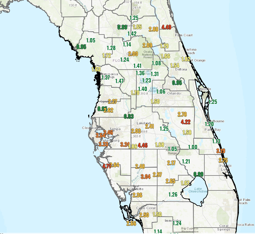
Those rains continue tonight, and we’ll see flooding expand and worsen across the northern half of the Florida Peninsula. As much as another 10 inches or so is possible.
Milton will exit and turn into an extratropical storm (basically akin to a nor’easter or generic “coastal” storm) tomorrow as it rushes out to sea. We can then begin to assess the damage. All the best to our Florida friends, and we’ll have another brief update either mid-evening or in the morning.
Source link