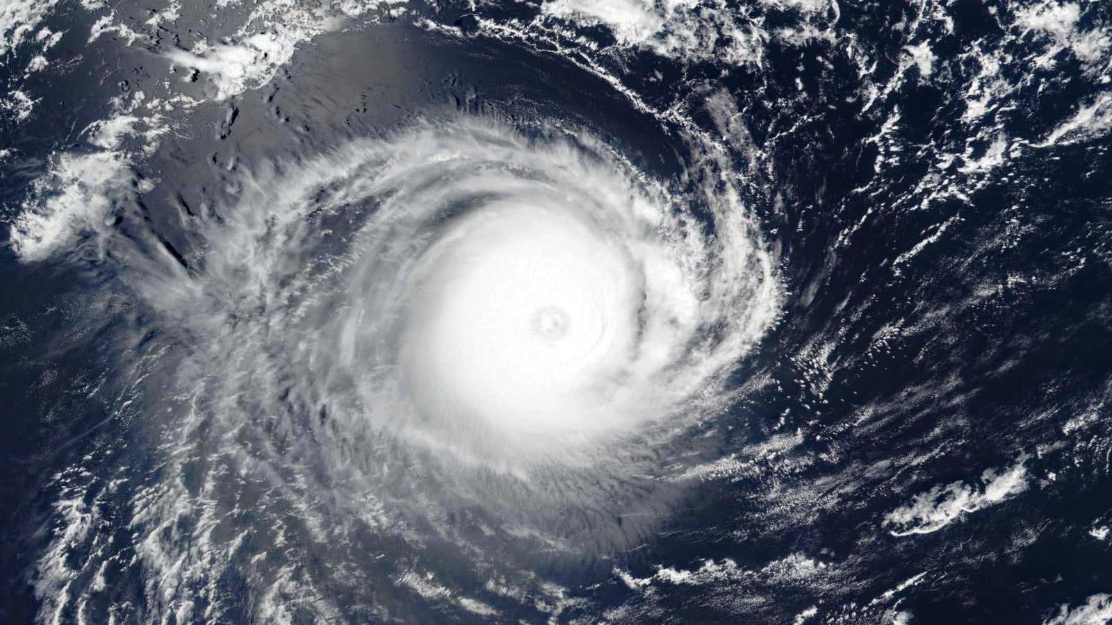
Earth’s first category 5 tropical cyclone of 2023 is Cyclone Freddy in the southern Indian Ocean. Born off the coast of northwest Australia, Freddy could make it all the way to Africa by next week — perhaps setting records for Southern Hemisphere cyclone power and duration and threatening Madagascar as a still-potent storm.
According to the Joint Typhoon Warning Center, Freddy peaked with 165 mph winds at 0Z Feb. 16 (7 p.m. EST February 15). According to NOAA’s historical hurricane tracks website, this makes Freddy one of only five category 5 storms ever recorded in February on Earth. The only February storm stronger than Freddy (by wind speed) was Tropical Cyclone Winston of 2016, which peaked with 180 mph winds near Fiji on Feb. 20, 2016.
Freddy was initially assigned a peak intensity of 155 mph by the Joint Typhoon Warning Center but was retroactively upgraded to a Cat 5 with 165 mph winds, presumably when high-resolution satellite data (synthetic aperture radar and SMAP) became available.
Freddy will be an unusually long-lived tropical cyclone for the Indian Ocean. Freddy was named Feb. 7 off the coast of northwestern Australia and has already generated about 35 units of accumulated cyclone energy, or ACE, a measure of cyclone strength over time. According to Dr. Phil Klotzabach of Colorado State, Freddy looks likely to eclipse the Southern Hemisphere single-storm record for ACE of about 53 currently held by Cyclone Fantala of 2016. According to Colorado State, the southern Indian Ocean is already 45% above average for ACE for the 2022-23 season, mostly because of Cyclone Darian of December (42.5 ACE units) and now Freddy.
Freddy a threat to Madagascar
At 7 a.m. EST Thursday, Freddy was headed west at 17 mph and had weakened to a category 4 storm with 145 mph winds. Conditions were favorable for development, with moderate wind shear of 10-15 knots, sea surface temperatures of 28-29 degrees Celsius (82-84°F), but an atmosphere that was somewhat dry. Dry air will continue to be an issue for Freddy, and the combination of dry air and moderate wind shear is predicted to cause a slow weakening trend over the next five days. However, both the Joint Typhoon Warning Center and La Rèunion Tropical Cyclone Center predict that Freddy will remain a major category 3 or 4 storm during the next five days.
The ridge of high pressure steering Freddy to the west will get eroded by a trough of low pressure passing to the south on Friday, resulting in Freddy heading more to the west-southwest. On this track, the storm will likely pass just north of La Rèunion on Monday, and make landfall in Madagascar on Tuesday. Five-day track forecasts often have large errors; however, Freddy’s track forecast may be higher-confidence than usual given the storm’s fairly direct path and straightforward steering pattern. As of Thursday morning, the European and GFS model ensembles both showed a high probability of landfall in Madagascar, as noted by the Joint Typhoon Warning Center.
Freddy represents a significant flood threat for Madagascar. Soils are saturated in central parts of the island from the impact of Cyclone Cheneso, which stalled off the west coast of the island and brought torrential rains Jan. 19-21 that killed 33 people, left 20 missing, and made 34,000 people homeless.
2022: a below-average year for Cat 5 storms
Two category 5 tropical cyclones were observed globally in 2022: Super Typhoon Hinnamnor (160 mph winds on Sept. 1) and Super Typhoon Noru (160 mph winds on Sept. 25), according to ratings by the National Hurricane Center and the Joint Typhoon Warning Center. Typhoon Hinnamnor made landfall in South Korea on Sept. 5 as a category 2 storm with 100 mph winds, killing 11 and causing over $1.2 billion in damage. Typhoon Noru made landfall in the Philippines as a Cat 4, and in Vietnam as a Cat 2, killing 22 and causing at least $60 million in damage.
The 1990-2022 average for an entire calendar year is 5.3 Cat 5 storms, according to ratings by the National Hurricane Center and Joint Typhoon Warning Center. Three other 2022 storms fell just 5 mph short of attaining category 5 strength, topping out with 155 mph winds: Hurricane Ian near Florida on Sept. 28, Super Typhoon Nanmadol south of Japan on Sept. 17, and Cyclone Darian west of Australia on Dec. 23.
Bob Henson and Jasper Deng contributed to this post.
Website visitors can comment on “Eye on the Storm” posts (see comments policy below). Sign up to receive notices of new postings here.
Source link


