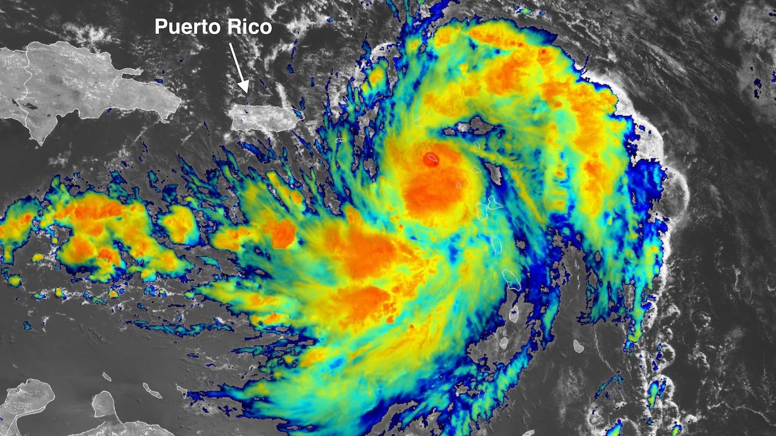
Tropical Storm Ernesto was organizing at an increasingly rapid clip over the northeast Caribbean on Tuesday, and it’s expected to become a large, powerful, and prolonged hurricane as it barrels northward from the Caribbean starting on Wednesday. A Hurricane Watch was issued Tuesday morning for the U.S. and British Virgin Islands, Vieques, and Culebra, as Ernesto could become a Category 1 storm while passing over or near those islands early Wednesday. Nearby Puerto Rico is predicted to experience somewhat weaker winds on the left-hand (west) side of Ernesto, but widespread gales, torrential rains, and flash flooding will hammer the island.
At 11 a.m. EDT Tuesday, Ernesto was centered about 155 miles east-southeast of St. Croix and 250 miles east-southeast of San Juan, Puerto Rico, moving west-northwest at 18 mph. Top sustained winds had increased to 50 mph. Tropical Storm Warnings covered the northeast Caribbean from Guadeloupe to Puerto Rico.
Satellite imagery at midday Tuesday showed a rapidly organizing tropical storm. Ernesto’s field of showers and thunderstorms (convection) was large and growing, with upper-level outflow steadily improving. Tropical-storm-force winds already extended out up to 105 miles northeast of Ernesto’s center, and by Wednesday the envelope of gales will extend out roughly twice as far. Ernesto’s convection will dump torrential rains from Tuesday into Wednesday across much of the northeast Caribbean, potentially topping 8 inches locally in parts of Puerto Rico (see Fig. 1).


Forecast for Ernesto
Conditions are aligning strongly in Ernesto’s favor over the next several days, lending high confidence to the forecast now that the storm has begun to consolidate. Ernesto will continue tracking over near-record-warm sea surface temperatures averaging close to 29 degrees Celsius (84 degrees Fahrenheit), which is roughly 1°C or 2°F above average for mid-August. Ernesto has successfully dodged the influence of extensive dry air to its north and east, and its large envelope of moisture (mid-level relative humidity around 60-65 percent) will help protect it for some time. Wind shear is predicted to remain light to moderate (mostly 5 to 10 knots) over the next couple of days. Ernesto will also benefit from one or more upper-level outflow channels predicted to help ventilate the storm, especially as it moves into the Atlantic subtropics.
Ernesto is predicted by the National Hurricane Center to become a Category 1 hurricane on Wednesday and to approach Category 3 strength by Friday. Rapid intensification could push Ernesto to these levels more quickly than predicted, as acknowledged by NHC. Output from the SHIPS statistical model on Tuesday morning showed that the odds of rapid intensification will be 5 to 7 times climatology, with a one-in-three chance that sustained winds will hit 110 mph (the top end of Category 2) as soon as Thursday morning. It would not be a shock to see Ernesto reach Cat 3 strength and become the Atlantic’s second major hurricane of 2024, following Cat 5 Beryl.


The track forecast for Ernesto is fairly straightforward. Ernesto is starting to bend northwest as it rounds the southwest corner of the large Bermuda-Azores high now covering much of the North Atlantic. This bend is predicted to keep the center of Ernesto just east of Puerto Rico on Wednesday, with a direct hit more likely on the British and U.S. Virgin Islands as Ernesto is approaching or at Category 1 hurricane strength.
After Ernesto clears the Caribbean, there will be no threat to land until this weekend, when Ernesto will likely pass near Bermuda. Whether or not Bermuda gets a damaging hit will depend on subtle deviations in the northward track, which will be shaped by upper-level features yet to be solidified in forecast models. In their early Tuesday runs (6Z), the HMON and HWRF intensity models brought Ernesto to Category 3 strength by Saturday, as Ernesto reaches the latitude of Bermuda; the HAFS-A and HAFS-B models were weaker, showing a Category 1 or 2 approach.
The powerful circulation of Ernesto will send large swells and dangerous rip currents toward the U.S. East Coast by this weekend. Some National Weather Service local offices are already highlighting the threat in hazardous weather outlooks, given the large number of beachgoers expected on a summer weekend.


Ernesto will help reduce extreme coral heat stress
The Caribbean Sea has experienced multiple consecutive months where ocean temperatures have been the highest on record, including during July of 2024. This record heat has brought unprecedented heat stress to the coral reefs, which are suffering from the highest level of bleaching risk, according to the latest analysis from NOAA’s Coral Reef Watch (Fig. 3 above). However, the powerful winds of Ernesto will do some good, helping mix the waters surrounding the coral reefs, bringing cooling, thereby reducing the heat stress on the corals in the northeastern Caribbean.
We help millions of people understand climate change and what to do about it. Help us reach even more people like you.
Source link


