
Headlines
- Ernesto will exit out to sea tonight and tomorrow, brushing southern Newfoundland with some impacts on the way out.
- The Atlantic looks quiet through early next week.
- If we want to scope out trouble that isn’t showing up on models, we’ll watch a Gulf disturbance this weekend and early next week; unlikely to develop but will bring some welcome rain chances back to Texas.
Ernesto finds the exit ramp
After impacting Bermuda and sending a bunch of rough surf toward the Atlantic coast of the U.S. and Canada, Hurricane Ernesto is on the way out the door today.
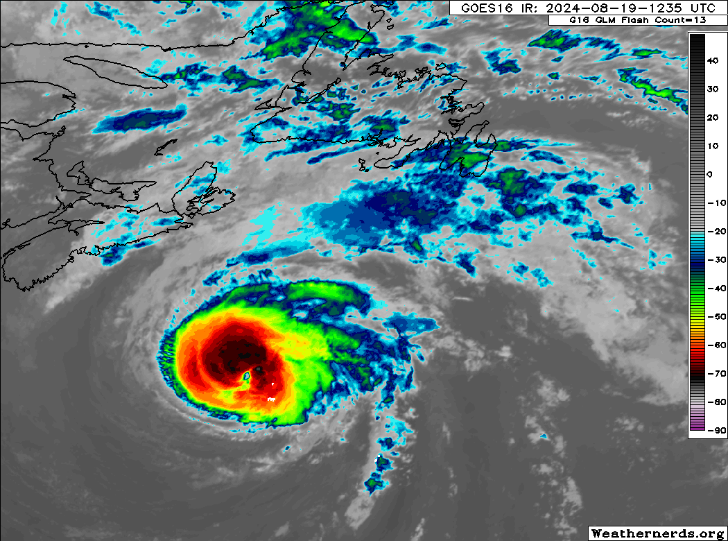
Ernesto is now moving northeast at 28 mph and taking on that “look” of a storm in transition from tropical system to post-tropical low pressure. Winds are 90 mph with Ernesto, and the wind field remains large, with tropical storm force winds expanding out 220 miles from the center. As Ernesto makes its closest pass to Newfoundland tonight, wind, rain, and rough seas will likely impact the Avalon Peninsula.
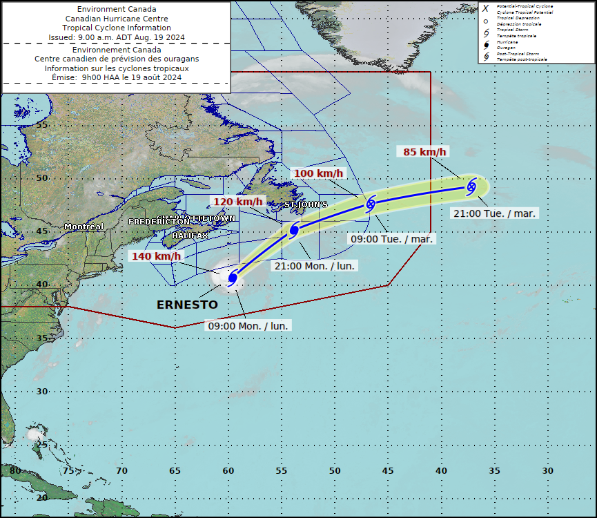
With Ernesto moving along quickly, conditions should deteriorate there quickly tonight, then improve quickly tomorrow. By tomorrow night, Ernesto should be full extratropical/post-tropical and racing east-northeast across the Atlantic. And that closes the book on the fifth storm of 2024.
A lull for a moment
The Atlantic basin will shut down post-Ernesto for a moment or two. Or three. Who knows. Tropical activity over the next 7 days is expected to be basically non-existent.
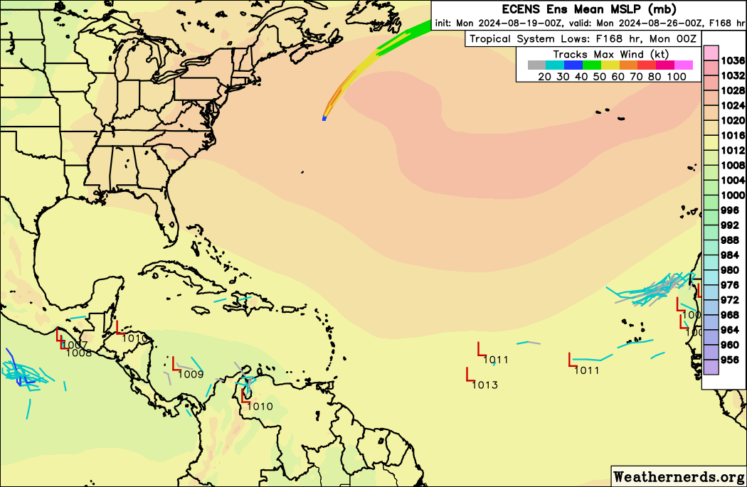
How long this lull lasts is tough to say. We’ll dive more into the context of all this and how this season stacks up vs past seasons a little later this week (and key reasons to not write it off as a “bust” in mid-August). For now, I don’t see anything really of note out there over the next 7 to 10 days. I do believe conditions will shift more favorable for activity as the calendar flips to September. But that’s an average confidence feeling right now.
If we want to dig for trouble that could surprise us, we could maybe look in the Gulf this weekend or next week. It appears that a disturbance is going to swing in either off the Atlantic or from inland thunderstorms across the Southeast and into the northeast Gulf of Mexico by this weekend. From there it will follow its way around the periphery of a Central Plains ridge of high pressure across the Gulf toward Texas.
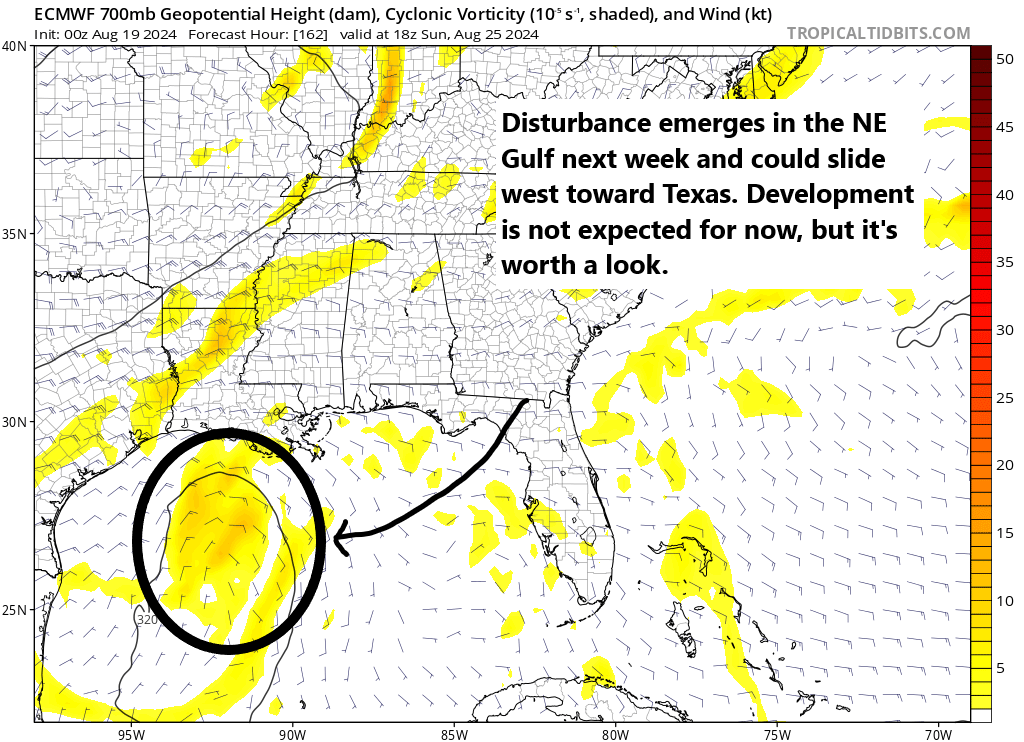
Again, we’re looking for surprise trouble here, which is to say that no model currently develops this at all. And that’s the most likely outcome. But, we’ll keep tabs on it just in case. Regardless, this will probably bring an increase in rain chances to Texas next week, which has gone fairly dry this month. Most rain will be welcome.
But aside from that, I think we’re on a pre-peak break in the Atlantic through early next week. We’ll take it.
Source link