Headlines
- Ernesto now beginning to bear down on Bermuda.
- Heavy rain, strong winds likely well into tomorrow there, as Ernesto slows down and crawls past.
- Ernesto will brush Newfoundland on the way out to sea next week.
- Dangerous rip currents likely up and down the East Coast this weekend with Ernesto’s large size and waves.
Ernesto on approach to Bermuda
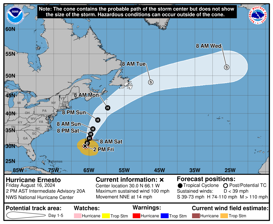
Hurricane Ernesto is now a category 2 storm, with maximum sustained winds of 100 mph — probably. Ernesto is not the healthiest hurricane we’ve ever seen, but it’s a large one.
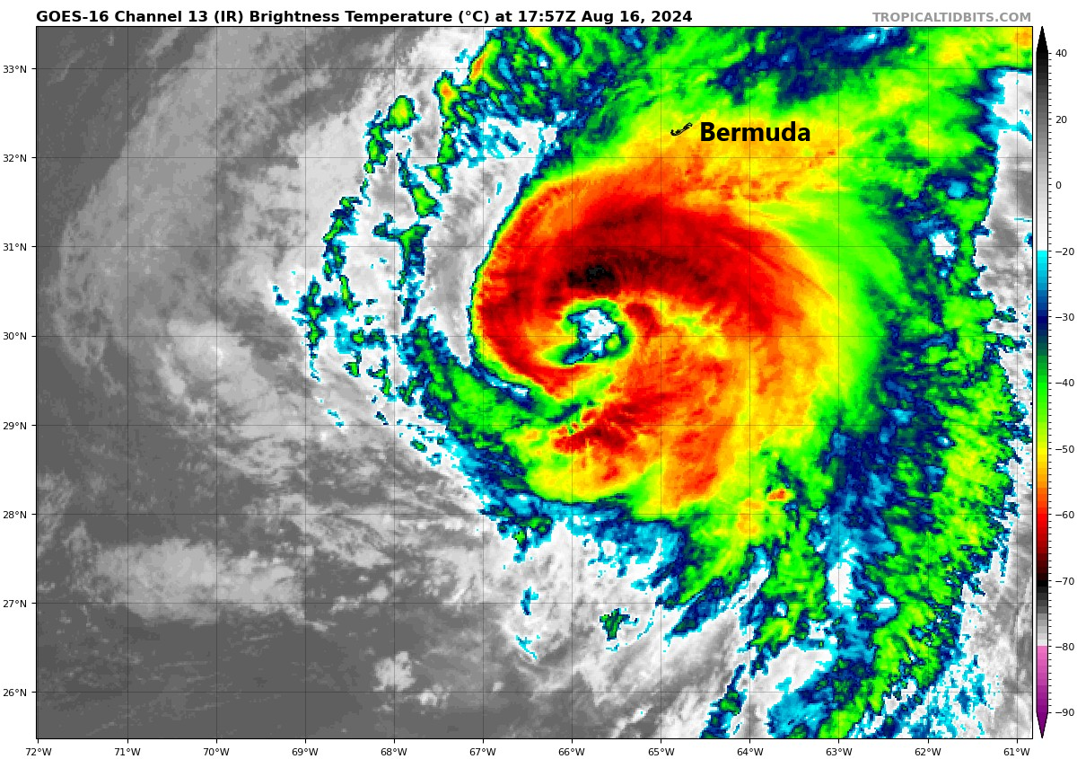
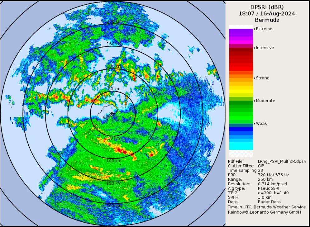
Ernesto is loaded with moisture, and the wind field is enormous. Tropical storm force winds extend out 275 miles from the center. What Ernesto may lack in intensification it more than makes up for in size. Conditions are beginning to go downhill on Bermuda this afternoon, and that will continue into tonight, as evidenced by a lot of rain (and embedded wind) showing up just south of the island.
So even if Ernesto weakens over the next day or so, it will pack plenty of punch on Bermuda, particularly due to the duration of the storm. Ernesto will slow down a good bit through Sunday before picking back up forward speed and accelerating out to sea and weakening once more.

As Ernesto passes Newfoundland, likely just to the south, some impacts are possible there as well, though they would probably hit and exit quickly. Tropical storm force winds and locally heavy rainfall are the main concerns.
In addition to Ernesto as a hurricane, we continue to advertise the extremely rough surf and rip current risk up and down the East Coast that’s expected this weekend. With a wind field of 275 miles, you can bet that Ernesto will be churning out some waves. Dangerous rip current risk will be moderate to high along virtually the entire East Coast by tomorrow and Sunday.
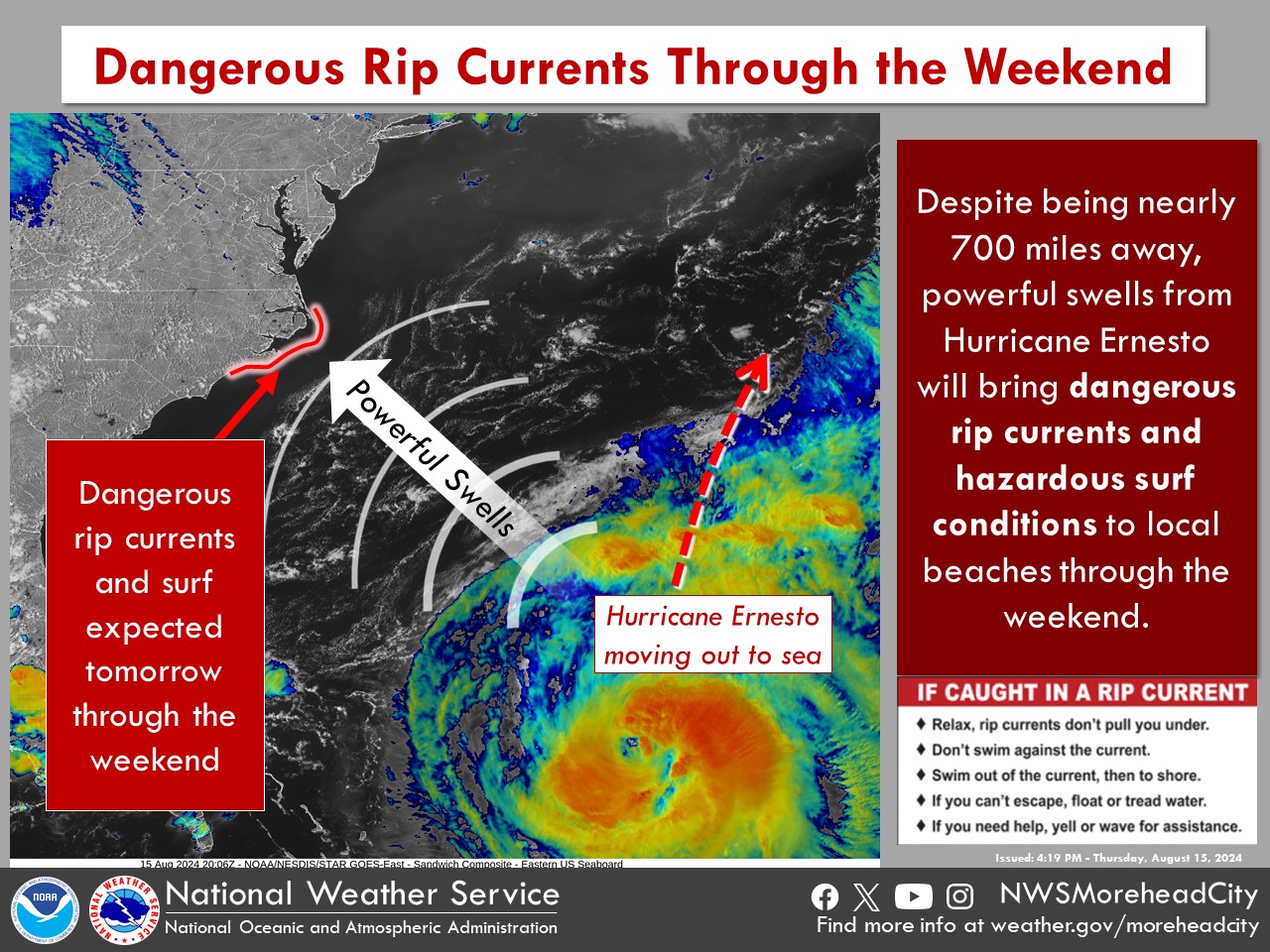
We again urge folks to use caution in the water this weekend.
Behind Ernesto, we continue to advertise calm for next week. We’ll talk more about that next week and assess when it could change.
Source link