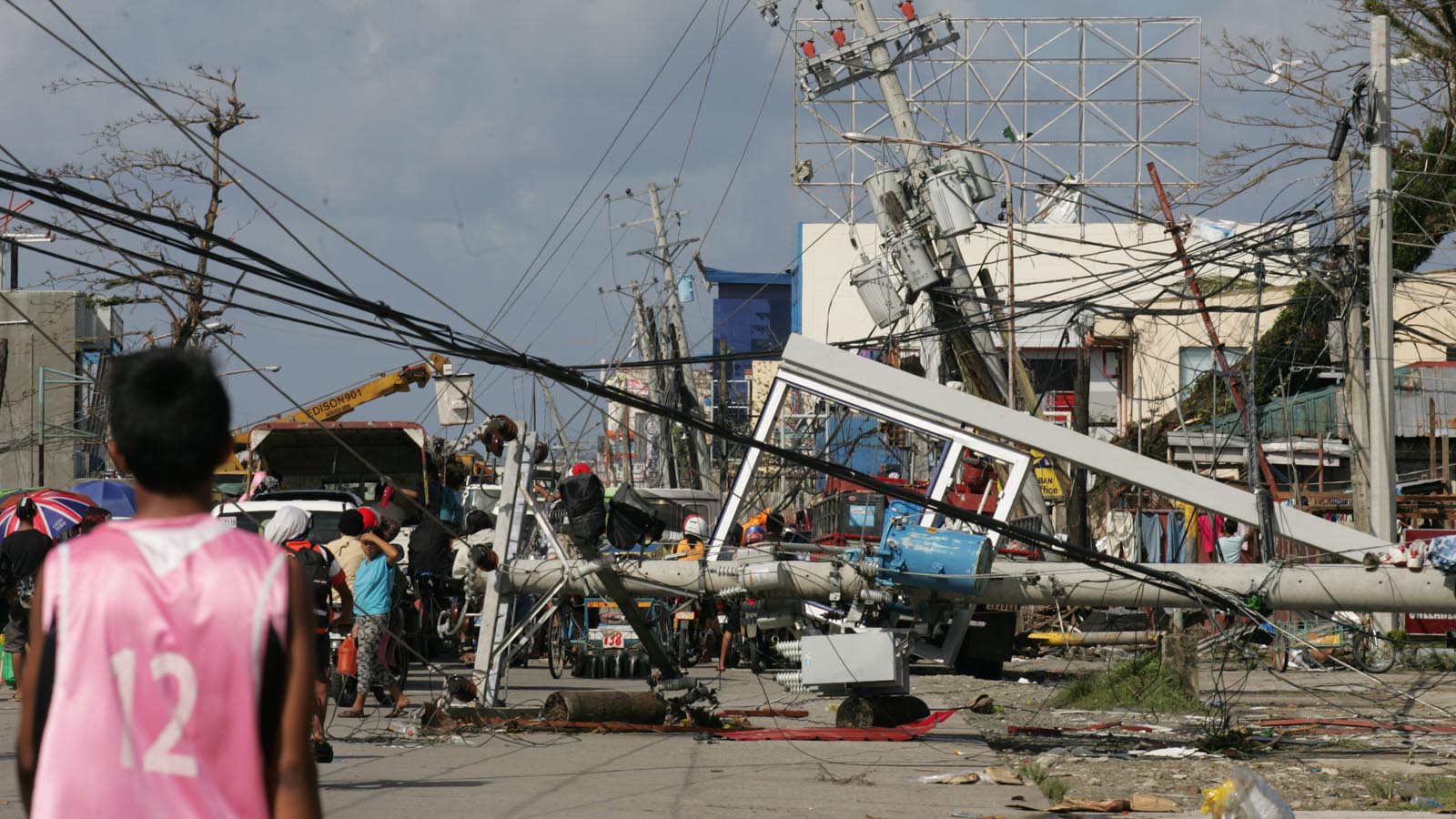
In November 2013, the deep, warm waters east of the Philippines spawned an unprecedented storm: Super Typhoon Haiyan. Haiyan put on a shocking feat of rapid intensification, topping out with sustained winds of 195 mph and a central pressure of 895 mb just before plowing ashore with 190 mph winds on Leyte Island in the Philippines. No tropical cyclone like it had ever been reliably measured anywhere on Earth.
But since Haiyan, four other tropical cyclones have matched or exceeded its intensity. Three were super typhoons in the Western Pacific that also peaked with 195 mph peak winds: Meranti (2016), Goni (2020), and Surigae (2021).
The emergence of this new breed of ultrapowerful storms brings to light an Achilles’ heel in how hurricanes are classified, according to a paper published February 5 by hurricane scientists Michael Wehner and James Kossin: The growing inadequacy of the Saffir-Simpson hurricane wind scale, which classifies hurricanes from Category 1 (minimal) to Category 5 (worst-case scenario).
Wehner and Kossin introduce a hypothetical Category 6 extension to the traditional Saffir-Simpson wind scale. They argue that such a classification may be appropriate to communicate how climate change has significantly boosted the winds of the most intense tropical cyclones. And they found that if the climate warms by 2 degrees Celsius or more — which could happen by midcentury — the risk of a such Category 6 storm in the Gulf of Mexico would double.
A swarm of super-intense hurricanes in the past decade
The satellite presentation of Super Typhoon Haiyan at landfall was a fearsome and awe-inspiring picture of meteorological perfection, with a massive spiral of cold-topped clouds surrounding a stunningly clear eye. The toll wreaked by this unprecedented superstorm was catastrophic: 7,354 killed and damages of $13 billion (2024 USD), making it the deadliest and costliest weather disaster in Philippines history.

Four more tropical cyclones since Haiyan have put on similar fearsome displays.
- Goni hit Catanduanes, Philippines, in 2020 while at peak strength with 195 mph winds, making it the strongest landfalling tropical cyclone in world recorded history, killing 31 and doing over $500 million in damage.
- Meranti (2016) hit the tiny island of Itbayat, Philippines, as a weakening Cat 5, then hit China as a weakening Cat 2, causing damages near $3 billion but no deaths.
- Surigae (2021) did not make landfall.
- And the world’s most intense storm on record came in 2015, when the Eastern Pacific’s Hurricane Patricia peaked with sustained winds of an astonishing 215 mph. Patricia made landfall in Mexico with 150 mph winds, killing 14 and causing $1 billion in damage.
Communication of hurricane risk
The authors of the new paper do not argue that the National Hurricane Center, or NHC, should adopt a new Category 6 rating for their real-time hurricane forecasts since detailed sociological research would be needed to determine if this is an effective messaging strategy to protect lives and property. Any move to expand the Saffir-Simpson scale would have to come from the NHC, and there is little support for such a move from the experts there that I have heard from.

They reason that including a Category 6 would do little good to warn the public about an impending storm, because a Category 5 hurricane is already considered catastrophic — and landfalling Category 5 storms are extremely rare. News that a Category 6 storm was heading toward them would probably not motivate people to take action to protect lives and property any more than if a Category 5 storm were coming.
However, talking about hypothetical Category 6 storms is a valuable communication strategy for policymakers and the public, because it is important to understand how much more damaging these new superstorms can be. Hurricane damage is an exponential function of the winds, and the difference in damage potential between a low-end Cat 5 with 160 mph winds and one with 195 mph winds (the lower end of the hypothetical Cat 6 rating) is more than a factor of four, according to NOAA (Figure 3).
To illustrate, in 2010, the Tampa Bay Regional Planning Council put out the Tampa Bay Catastrophic Plan, a scenario where a Category 5 “Hurricane Phoenix” hits downtown Tampa with 160 mph winds and a 26-foot storm surge. The study projected that the city would see about 2,000 deaths and nearly $250 billion in damage. Using the NOAA damage estimation chart in Figure 1, a low-end Category 6 storm with 195 mph winds might do more than four times as much damage: over $1 trillion. However, as Kelly Hereid of Liberty Mutual pointed out by email, Category 5 storms are already so completely destructive that the damage potential of a Category 6 storm may be less than a factor of four higher than a low-end Cat 5.
Measuring the winds of extreme hurricanes is hard
Determining if Category-6-equivalent hurricanes are indeed beginning to ramp up in frequency because of climate change is hampered by our poor ability to observe intense hurricanes. To illustrate: Satellite measurements indicated that the Eastern Pacific’s Hurricane Patricia of 2015 was a Category 5 storm with about 180 mph winds. However, the Hurricane Hunters found that Patricia had peak winds of 205 mph during the time when their plane was in the storm. (Patricia continued to intensify after the Hurricane Hunters left, and is thought to have peaked with winds of an unimaginable 215 mph.) If the Hurricane Hunters had not collected this data, we may not have known whether Patricia had met the threshold of 195 mph winds needed to classify it as a Category 6.
The Hurricane Hunters regularly fly only in the Atlantic and Eastern Pacific. But the Western Pacific has the world’s largest expanse of warm water that extends to great depths, ideal for generating extreme tropical cyclones. If we’re going to see an increase in Category 6 storms, it will likely primarily occur in the Western Pacific, where about 57% of the planet’s Category 5 storms occur.
The fact that Hurricane Hunter data is not available in that ocean basin makes it harder to detect any potential increase in this new breed of superstorms.

Climate change is expected to make the strongest tropical cyclones stronger
One of the more confident predictions climate models make is that the strongest tropical cyclones will get stronger in a warmer climate. In a 2020 review paper by 11 hurricane scientists, eight of 11 authors gave medium-to-high confidence to the conclusion that “the proportion of tropical cyclones that reach very intense levels will increase,” while the other three authors gave this conclusion high confidence. These confidence levels are defined by the Intergovernmental Panel on Climate Change (IPCC); the highest levels of confidence are given when multiple, consistent independent lines of high-quality evidence are present.
There is less confidence that the total number of intense storms will increase, though, since a common prediction by climate models is that although the strongest storms will get stronger, the total number of tropical cyclones observed globally will decrease. This decrease may already be observable, according to a 2022 paper.

Determining whether we’ve already seen the strongest storms get stronger is hampered by our relatively short length of time with high-quality global data, which begins in the early 1980s. This data shows an increase in Category 5 storms: Of the 207 Cat 5s during the 42-year period 1982 to 2023, 63% occurred in the last half of the period (Figure 4). If we look at the strongest tropical cyclones by ocean basin (Figure 5), the records for nine out of 11 of these ocean basins were set in the last half of this 44-year period ending in 2023.
In a 2019 review paper by 11 hurricane scientists, 10 of the 11 authors concluded that “the balance of evidence suggests that there is a detectable increase in the global average intensity of the strongest (hurricane strength) tropical cyclones” since the early 1980s. Eight of the 11 authors concluded that human-caused climate change had contributed to this increase.
The rarity of Category 6 storms makes them hard to study

One minor issue I have with the paper is the relatively high threshold set for a Category 6 storm: 193+ mph winds. It would have been reasonable to make the cutoff for a Category 6 storm just 3 mph lower, at 190 mph, to allow a few more storms into the club (there are two historic storms that would be added, the Atlantic’s Hurricane Allen of 1980 and the Western Pacific’s Super Typhoon Halong of 2019). Since there are so few of these Category 6 hurricanes, it will be difficult to do a statistical study of how they might be changing with the changing climate for many decades.
A graph of the Saffir-Simpson Hurricane Wind Scale (Figure 6) shows that it is not quite linear, so adjusting the threshold for a Cat 6 would be a reasonable thing to do. Winds for a Category 2 hurricane span a range of just 15 mph, for example, but winds for a Category 4 storm span a range of 27 mph — and the Category 4 range also includes more of the 5-mph increments used to report peak winds (130, 135, 140, 145, 150, and 155 mph) than any other category does.
The regions most at risk: the Gulf of Mexico and the Philippines
The authors of the new paper modeled how climate change might change where and when a Category 6 could exist by looking at past and future changes in the maximum potential intensity of a tropical cyclone — the maximum strength a storm can achieve based on the existing atmospheric and oceanic conditions. For example, it is very difficult to get a hypothetical Category 6 storm when the sea surface temperature is less than 29 degrees Celsius (84°F). This typically limits the days over which such a storm can exist to the late summer and early fall when ocean temperatures are at their highest.

Over the 1979-2015 period, they found that in the regions where intense tropical cyclones often occur, the maximum potential intensity exceeded the Category 6 threshold from a week up to a month per year, but that the number of days when atmospheric and oceanic conditions could support such a storm had more than doubled since 1979. And human-caused climate change was to blame: “we conclude with high confidence that anthropogenic global warming has increased the global risk of Category 6 tropical cyclones since 1979 as reflected by the potential intensity index.”
For climate warming of 2 degrees Celsius above preindustrial levels, their model showed that some regions might see 15 or more days (compared to the period 1979-2014) when conditions would support a Cat 6 (Figure 7): the Pacific waters along the coast of Mexico, the Western Caribbean and Gulf of Mexico, the waters of the South China Sea bordering the Philippines and China, the waters along the north coast of Australia, and portions of the North Indian Ocean near India. The risk near the Philippines would increase by approximately 50% at this level of global warming, and the risk in the Gulf of Mexico would increase even more, by a factor of two.
Bob Henson contributed to this post.
Website visitors can comment on “Eye on the Storm” posts (see comments policy below). Sign up to receive notices of new postings here.
Source link


