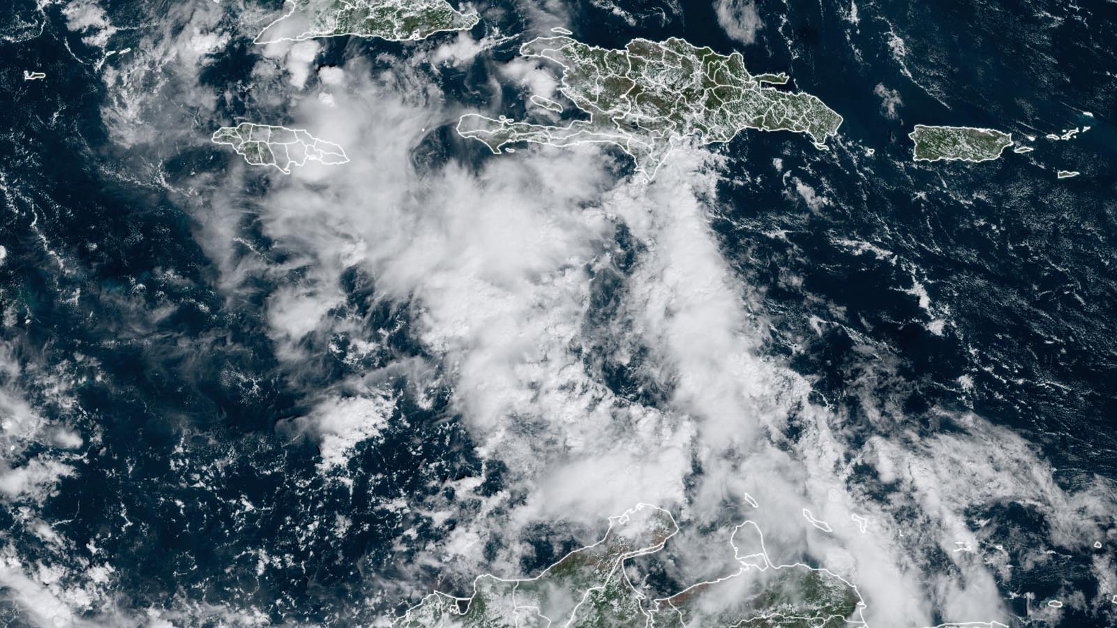
Tropical disturbance 97L in the central Caribbean has the potential to become a tropical depression or tropical storm late this week in the western Caribbean as it tracks westward toward Central America. Regardless of whether 97L develops further, it will bring heavy rains of four to eight inches to eastern portions of Nicaragua and Honduras this weekend.
Satellite images early Wednesday afternoon showed that 97L was disorganized, with only a modest amount of heavy thunderstorms and not much spin. However, conditions in the western Caribbean will be favorable for tropical cyclone development Friday and Saturday, with record-warm waters of about 30 degrees Celsius (86°F), a very moist atmosphere, and moderate wind shear of 10-20 knots.
The most recent set of model runs gave decent support to the development of 97L and predicted that a ridge of high pressure to the north of the Caribbean would keep the system on a mostly westward trajectory, with a landfall on Saturday or Sunday in Nicaragua. In their 8 a.m. EDT Wednesday Tropical Weather Outlook, the National Hurricane Center gave 97L two-day and seven-day odds of development of 20% and 50%, respectively. A hurricane hunter mission scheduled for Wednesday into 97L will likely be canceled because of the system’s lack of organization, but another mission is planned for Thursday. The next name on the Atlantic list of storms is Vince.
Heavy rains from Pilar prove deadly in El Salvador
Tropical Storm Pilar brought heavy rains to portions of Central America on Tuesday and Wednesday, and one flood death in El Salvador was being blamed on the storm. As of 11 a.m. EDT Wednesday, Pilar was located about 120 miles southwest of the coast of El Salvador, with top sustained winds of 60 mph. The storm had embarked on its anticipated motion out to sea, moving west at 7 mph, and could gain speed over the next several days. Pilar has likely peaked in strength and should gradually weaken as it continues into the North Atlantic, though it could remain a named storm for a few more days. Although it will remain over very warm waters with only moderate wind shear, Pilar will be ingesting dry, downsloping air streaming in from its north as winds from the Gulf of Mexico squeeze through the Tehuantepec Gap of southern Mexico. Such Tehuantepecer wind events peak in late autumn and are especially notable during El Niño years.
Storm Ciarán bombing out as it pounds Ireland, the UK, and France
An unusually powerful Atlantic storm was rapidly intensifying on Wednesday afternoon as it passed just south of Ireland. This storm, named Ciarán by the UK Met Office, is predicted to have one of the lowest pressures ever observed in the UK in November. Wind gusts up to 129 km/h (80 mph) are forecast for portions of the UK and France, and heavy rain will fall over much of western Europe.
The winds will be especially fierce over far northern France, where models indicate a “sting jet” associated with the low pressure may plow through. Sting jets, which hit the surface as a channel of air descending and drying on the south flank of an intense extratropical storm, were discovered in post-analyses of the Great Storm of October 1987, which devastated parts of southern England and northern France.
Climate change and European windstorms
Despite some spectacular individual events, no strong trends have emerged over the past several decades across northwest Europe in the behavior of extreme winter-type windstorms known as extratropical cyclones. Unlike tropical cyclones, where strengthening trends linked to climate change have already been identified, extratropical cyclones are not driven as directly by oceanic warming, and natural variability is large. The most recent assessment (2021) from the Intergovernmental Report on Climate Change concluded with medium confidence that “a slightly increased frequency and amplitude of extratropical cyclones, strong winds and extra-tropical storms is projected for Northern, Central, and Western Europe by the middle of the century and beyond and for global warming levels of 2°C or more.” Windstorm damages can be expected to rise across the region this century as such effects are teamed with increased population and wealth, as found in a July study in Nature Communications.
Website visitors can comment on “Eye on the Storm” posts (see comments policy below). Sign up to receive notices of new postings here.
Source link


