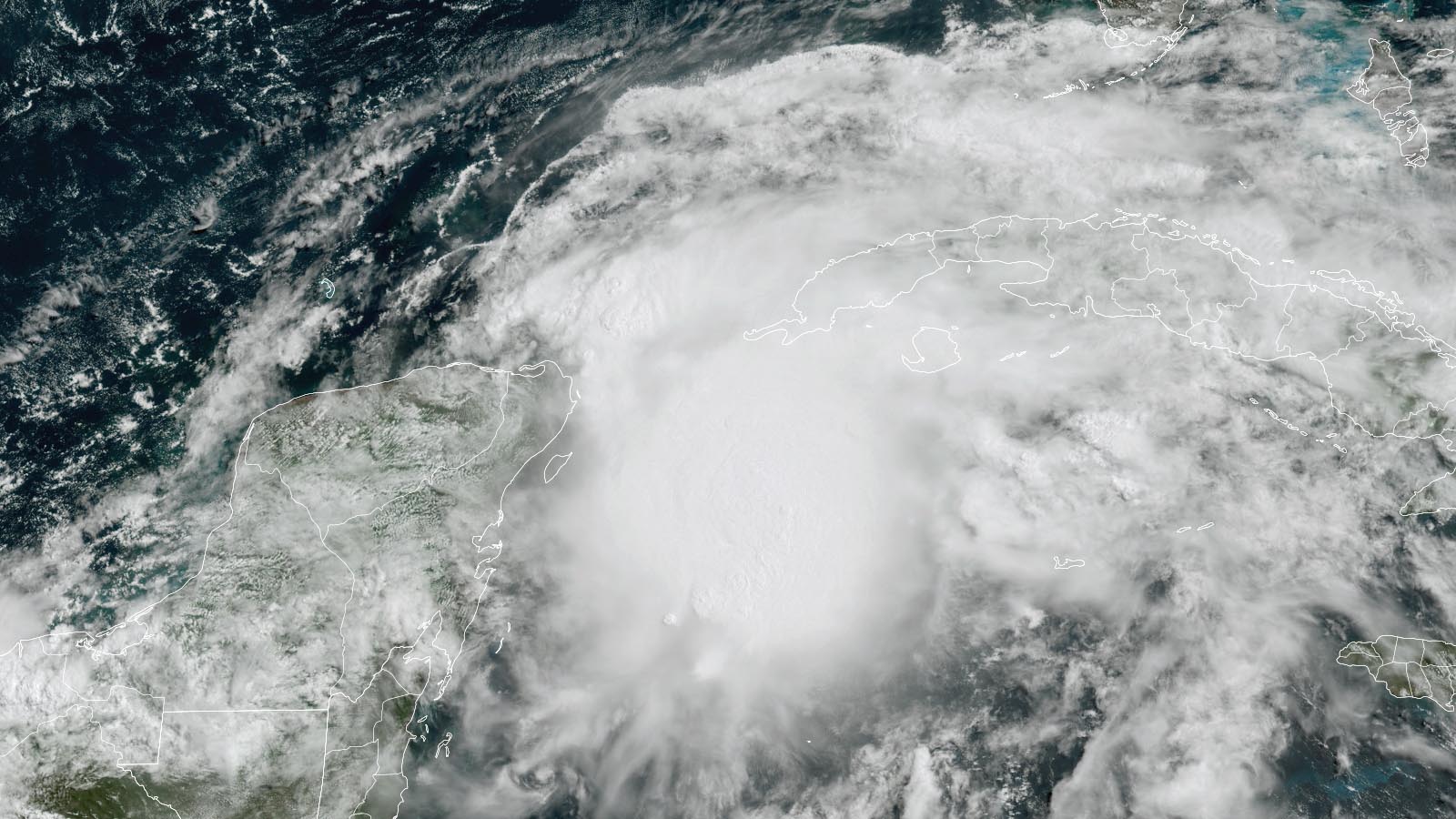
A disturbance designated Invest 91L by the National Hurricane Center (NHC) has grown more organized over the past day, and is likely to become the Atlantic’s first tropical depression or named storm by Saturday. A hurricane hunter aircraft is scheduled to investigate 91L on Thursday afternoon to see if a tropical depression has formed.
The disturbance had marginal conditions for development Thursday afternoon, with high wind shear of 20-30 knots, ocean waters of 28 degrees Celsius (82°F), and atmosphere with a mid-level relative humidity of 65%. Satellite images on Thursday afternoon showed that 91L had developed a modest area of heavy thunderstorms, and a low-level surface circulation was attempting to form near the northeastern tip of Mexico’s Yucatan Peninsula.
Though 91L has strong model support for development, wind shear is predicted to remain high this week, and any storm that does form in the Gulf would likely be incapable of rapid intensification. The odds of development appear to be greater after the system crosses over the Florida Peninsula and enters the waters off the Southeast U.S. coast on Sunday (Figure 1).
The track of 91L will bring it to the coast of southwestern Florida on Saturday; at the time of landfall, 91L is likely to be no stronger than a 60-mph tropical storm, with a weaker storm more likely. Heavy rains from 91L will be its main threat, with seven-day rainfall amounts of five-plus inches expected over portions of Mexico, Cuba, South Florida, and the western Bahamas by Thursday, June 9 (Figure 2). Because of dry air to the northwest of the system, a sharp cutoff point for the heavy rains is expected over central Florida.
South Florida received between 2 to 4 inches of rainfall with isolated amounts of 4 to 6 inches during the Memorial Day weekend, leaving the ground saturated in many regions. Heavy rains from 91L could lead to a flood watch for portions of South Florida on Friday.
In its 8 a.m. EDT Thursday Tropical Weather Outlook, NHC gave 91L two-day and five-day odds of formation of 80%. The first name on the Atlantic list of storms for 2022 is Alex.
Rainy tropical storms are common in Florida during June
According to an excellent Substack post by hurricane expert Michael Lowry with TV station WPLG in South Florida, more than a third of all June tropical storms and hurricane impacts in the U.S. have been in the state of Florida since hurricane record-keeping began in 1851. The most recent June storm to impact Florida was Tropical Storm Colin in 2016, which dumped up to 17 inches of rain in the Tampa Bay area. Before Colin, Florida had Tropical Storm Andrea in June 2013, which produced up to 13 inches of rainfall in parts of North Miami Beach, and Tropical Storm Debby in June 2012, which brought torrential rainfall across the Florida peninsula, with nearly 30 inches falling just south of Tallahassee.
CSU ratchets up their seasonal forecast numbers
The June 2 forecast from the hurricane forecasting team at Colorado State University (CSU) calls for a very active Atlantic hurricane season with 20 named storms, 10 hurricanes, 5 intense hurricanes, and an Accumulated Cyclone Energy (ACE) of 180. Their previous outlook, issued on April 7, had called for 19 named storms, 9 hurricanes, 4 intense hurricanes, and an Accumulated Cyclone Energy (ACE) of 160. The new CSU outlook predicts the odds that a major hurricane will hit the U.S. at about 76% (the long-term average is 52%). The CSU team gives a 51% chance for a major hurricane to hit the East Coast or Florida Peninsula (the long-term average is 31%), and a 50% chance for the Gulf Coast (the long-term average is 30%). The outlook includes a 65% chance that at least one major hurricane will hit in the Caribbean basin (the long-term average is 42%). The forecast numbers were increased from April due to a low chance of El Niño, and warmer than normal tropical Atlantic sea surface temperatures (see Tweet above from the lead author of the forecast). The next CSU forecast is to be issued on August 4.
Bob Henson contributed to this post.
Website visitors can comment on “Eye on the Storm” posts (see below). Please read our Comments Policy prior to posting. (See all EOTS posts here. Sign up to receive notices of new postings here.)
Source link


