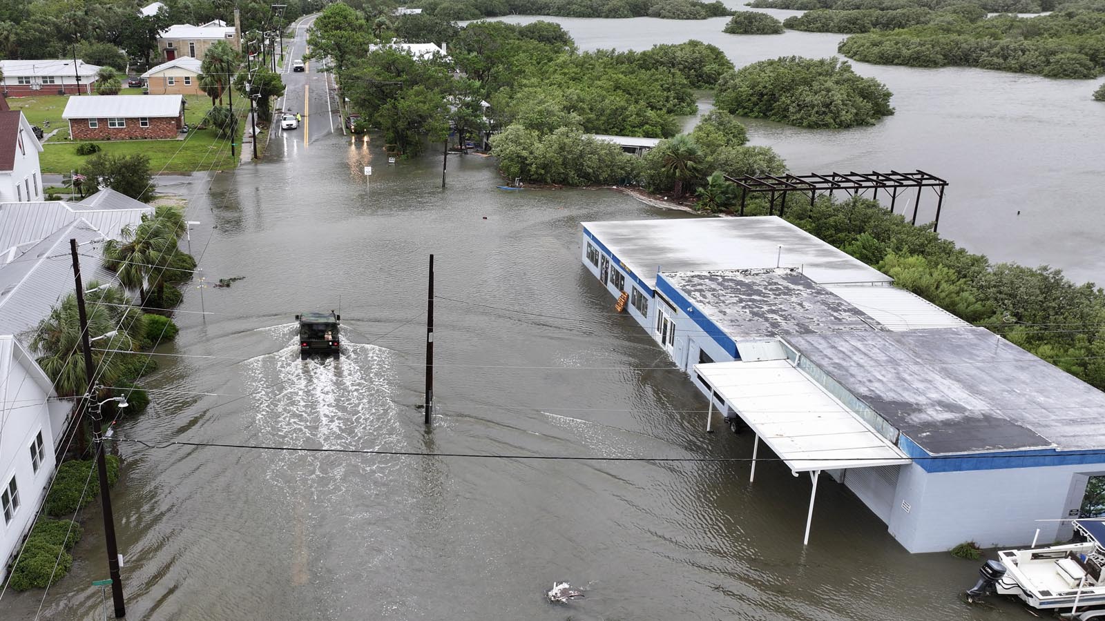
After making landfall in Florida’s Big Bend region on Monday morning as a Category 1 storm with 80 mph winds, Tropical Storm Debby has been moving over land – slowly losing its punch in terms of wind but still producing massive amounts of rain and packing a potentially catastrophic flood threat.
At 11 a.m. EDT Tuesday, Debby was a low-end tropical storm with 40 mph winds, located on the coast of Georgia about 15 miles south of Savannah, moving slowly east-northeast at 6 mph.
Forecast for Debby
The center of Debby is about to move over water, and it is expected to remain off the coast of South Carolina through Thursday morning. Debby will be over waters of 28-29 degrees Celsius (82-84°F), and will have plenty of heat energy to steadily re-intensify. NHC predicts that Debby’s winds will increase to 60 mph by the time of its second landfall on Thursday. During this period, Debby will crawl along, carrying out an offshore loop at a forward speed near 5 mph. This will allow the rejuvenating storm to dump catastrophic heavy rains over a large portion of coastal South Carolina and southern North Carolina.
This historic flood event will finally begin to wind down on Friday and Saturday, when a trough of low pressure will pull Debby to the northeast. However, Debby’s flood threat will then spread to the Mid-Atlantic and Northeast U.S.: widespread rains of 6-8 inches are expected over the next five days (Fig. 1), causing significant flooding. A significant portion of this rainfall total is expected on Tuesday, and is not directly associated with Debby: Moisture pushing well north of Debby will colliding with an east-west frontal system, potentially dumping 3-6 inches of rain in many locations. A Moderate Risk warning of excessive rains and flash flooding is in effect on Tuesday over eastern Pennsylvania, most of New Jersey, and southeast New York, including New York City and Philadelphia. Tuesday’s rains will only exacerbate the risk of additional flooding later in the week when Debby itself finally moves northeast.


NOAA’s Excessive Rainfall Discussion at 4:27 a.m. EDT Tuesday placed portions of coastal Georgia, South Carolina, and North Carolina in a “High Risk” of heavy rainfall for Tuesday, warning of “numerous instances of significant to catastrophic flooding for both rural and urban areas along with rising streams, particularly for the eastern South Carolina.” Their High Risk area projected for Wednesday and Thursday was over most of coastal South Carolina and a portion of southeast North Carolina. Only about 4% of days in the U.S. feature High Risk areas, but they account for about one-third of all flood fatalities and some 80% of flood-related damage. The outlook all three days warned of “widespread and numerous instances of flash flooding with significant and potentially catastrophic flooding likely.”
Major river flooding in Florida
After up to 21 inches of rain fell on Sunday and Monday just south of Tampa Bay (see tweet above), the Manatee River crested on Tuesday morning at 20.12 feet, beating the record of 20.0 feet set on Jul. 21, 1962. Near-record flooding was also observed on the nearby Little Manatee River. NOAA predicts that major river flooding will occur on Wednesday on three rivers in northern Florida: the Suwanee, St. Marys, and Santa Fe.
Already up to a foot of rain in South Carolina
Measurements from the CoCoRaHS rain gauge network in South Carolina for the 24 hours ending between 7-9 a.m. EDT Tuesday showed numerous reports of 10+ inches, with two stations near the coast, southeast of Charleston, reporting 12-13 inches (see Tweet below). Additional rainfall of 8-20 inches is predicted over much of coastal South Carolina, putting the all-time state precipitation record for a tropical cyclone – 23.63 inches from Hurricane Florence in 2018 – in jeopardy.
NOAA currently predicts that major river flooding will occur later this week on three rivers in Georgia, one river in South Carolina, and two rivers in North Carolina.
Tornadoes twist across coastal South Carolina
The NOAA Storm Prediction Center had a Slight Risk (level 2 of 5) across coastal South Carolina and southernmost North Carolina for Tuesday, mainly because of the risk of short-lived tornadoes within supercell storms that could develop in the zone of favorable wind shear north of Debby’s center. Several tornadoes (and/or waterspouts moving onshore) were reported overnight in South Carolina, including one that brought down numerous trees on Edisto Island and another near Moncks Corner.
Next tropical wave to watch is in the Caribbean
A tropical wave scooting across the southern Caribbean on Tuesday will need to be monitored the next few days. Centered just north of the Venezuelan coast, the disturbance was moving west at about 10 mph, with disorganized showers and thunderstorms (convection) well ahead of it. This wave is embedded in a moist atmosphere, and it will be crossing over unusually warm sea surface temperatures through the southern Caribbean of 29 degrees Celsius (84 degrees Fahrenheit), about 1°C (2°F) above average, but strong wind shear should tamp down on any development for the next couple of days.


This wave could angle toward the northwest Caribbean and into the southern Gulf of Mexico by early next week, as suggested by some members of the GFS and European ensemble members (see Fig. 3). However, it appears more likely the wave will continue westward into Central America or southern Mexico before it has a chance to become a robust tropical cyclone.


In its Tropical Weather Discussion issued at 8 a.m. EDT Tuesday, the National Hurricane Center set the 2- and 7-day odds of this disturbance becoming at least a tropical depression at 10 and 30 percent. The next name on the Atlantic list is Ernesto.
Source link


