Headlines
- Debby is moving inland across South Carolina, spreading heavy rain and flash flooding across the Carolinas.
- Significant rain and flooding will continue in North Carolina and expand into Virginia today.
- Debby lifts north and exits tomorrow and Saturday, spreading flooding risks into Pennsylvania, New York, and Quebec.
- The next tropical wave to watch will arrive near the Caribbean islands early next week, and it will be worth watching closely.
Debby brings widespread flooding northward
Tropical Storm Debby has come back ashore today near Bulls Bay, SC, which is just north of Charleston. It continues to slowly migrate inland and will lose wind intensity through the day. One thing it won’t lose is moisture, and virtually all of east-central North Carolina and northeastern South Carolina is under a flood warning this morning. Just a huge spatial area of flash flood warnings.
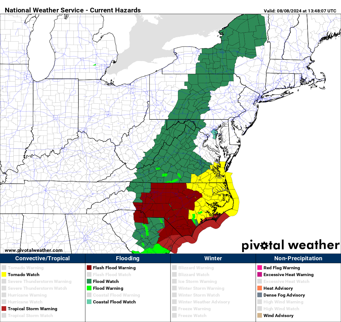
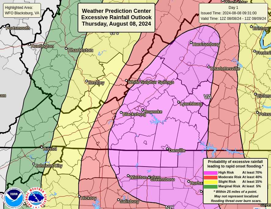
That heavy rain will migrate northward today into Virginia, where a high risk of flooding (level 4/4) extends up through Roanoke, Blacksburg, Lynchburg, and Charlottesville.
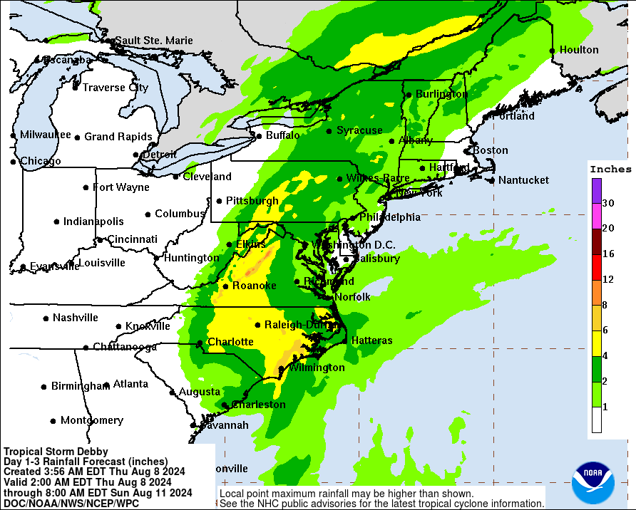
Heavy rain will expand north into Pennsylvania and New York as we go into tonight and tomorrow, as well as into Quebec. Basically, we’re looking at 2 to 5 inches over a wide area, with isolated enhancement in the mountains of Virginia, where the flooding could be the worst. Everything should exit late tomorrow. Some additional heavy rain will be possible east of the this peak axis, but it will be a more manageable rain. Severe weather, including isolated tornadoes are possible too.
And we’ll say goodbye to Debby after this.
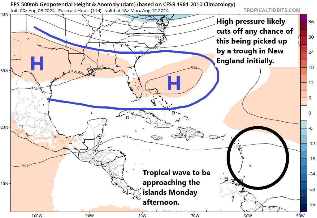
Next wave up is increasingly intriguing
As I noted yesterday, while modeling was mostly leaning toward the next wave not being a big deal, there was reason to watch it. It has indeed been added to the area of interest map today by the National Hurricane Center.
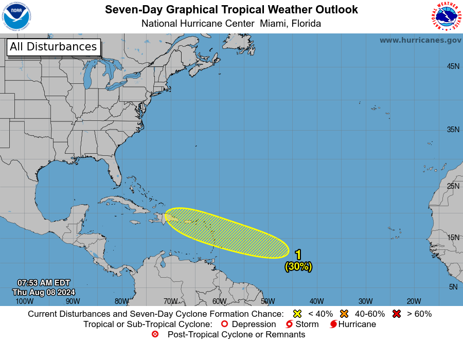
They open the bidding at 30 percent, but I truthfully think we’ll see this increase some in the next day or two. This wave is going to have an interesting future. First off, development with this one will be slow. There is a lot of Saharan dust to contend with in the Atlantic, and there is no reason to think we see much of anything through the weekend. By the time we get to Monday, the wave should be approaching the Antilles. At this point, development may start to unfold slowly. But with high pressure basically in control from the Bahamas into Texas, this system will probably be cut off from “feeling” the tug of a trough in New England initially.

From this point, it becomes a bit of a fight. If this system struggles a bit, it will stay suppressed, likely south of Puerto Rico and Hispaniola. This means it may miss its ride out to sea from the deepening New England trough. However, if development starts moving along more aggressively, we will likely see this system gain latitude toward Puerto Rico and Hispaniola or to the north, making it more likely to ultimately be captured by the New England trough and sent north. Additionally, the specific location and strength of the trough and areas of high pressure will play a big role too. It’s far too early to say how this ballet will play out, but I have to admit, the model data today was a little more sluggish with the pull north, which starts creeping this system a little farther west than we’d care to see.
In terms of timing, impacts will arrive in the islands early to mid next week, and if they come west toward Cuba, the Bahamas, or Florida, it would be late next week. Any risk to the Gulf, if any, is unlikely before at least next weekend. We have a lot of time to watch.
Additional waves may try to get going off Africa around the 20th, but we’ll see.
Source link