Headlines
- Hurricane Debby made landfall near Steinhatchee, FL as an 80 mph category 1 hurricane at 7 AM ET.
- The storm will now meander across Florida and Georgia, with weakening winds and increasing flooding problems.
- Historic, catastrophic flooding is likely from Debby in portions of Georgia and South Carolina with widespread heavy rain causing flooding beyond those areas as well into Florida and North Carolina.
- The next wave behind Debby has low odds to develop but should continue to be watched as it tracks generally due west.
Debby: 75 mph or less, moving NNE 10 mph or slower
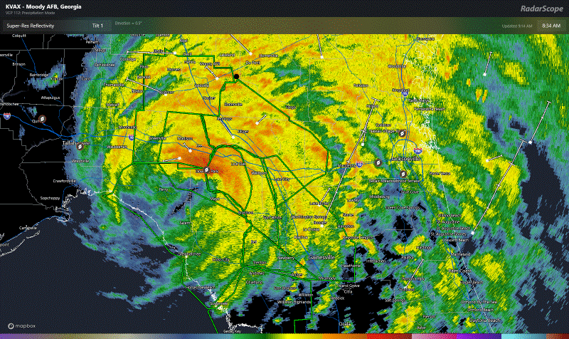
Hurricane Debby made landfall near Steinhatchee, Florida this morning as a category 1 hurricane with maximum sustained winds of 80 mph.
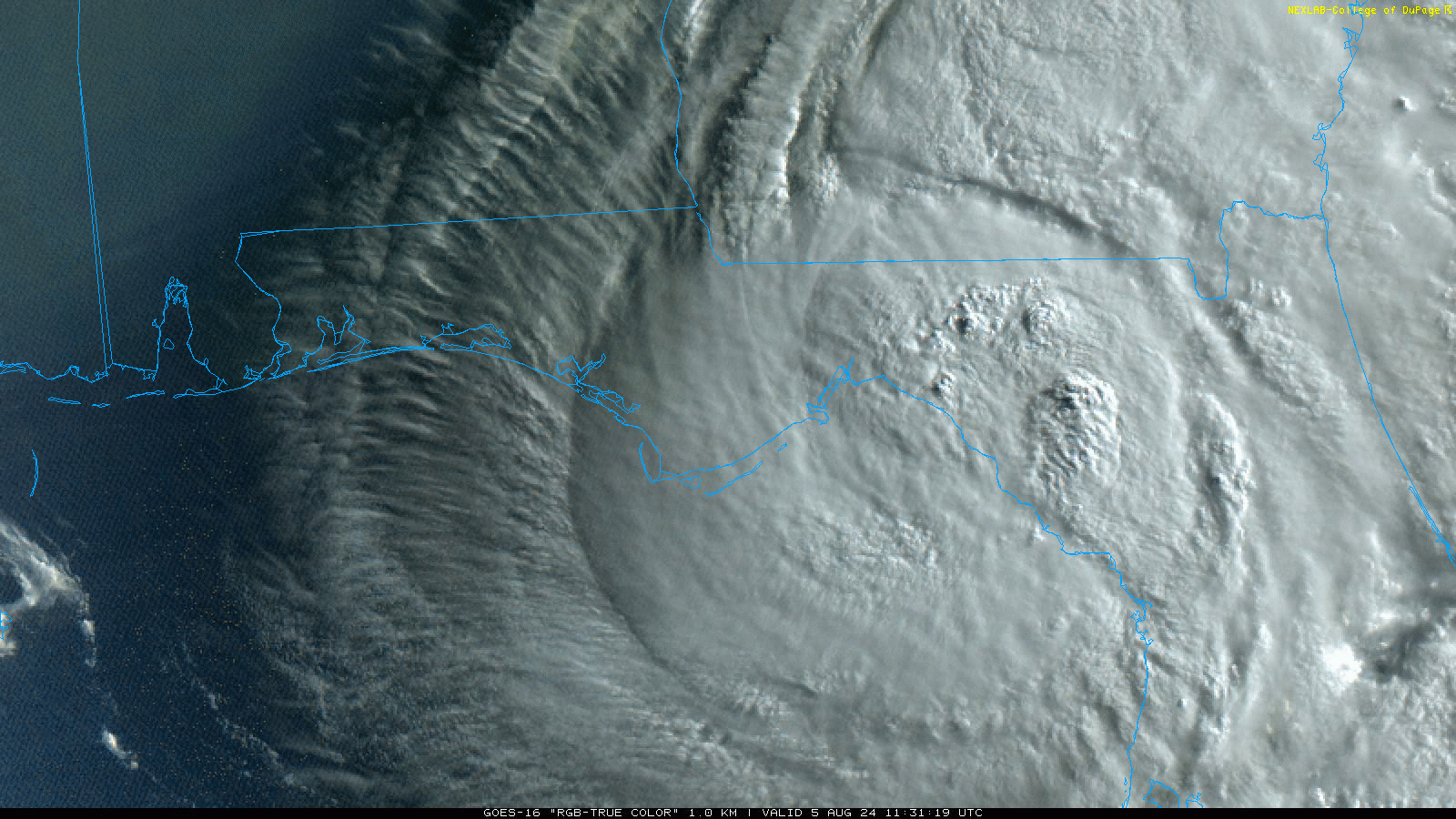
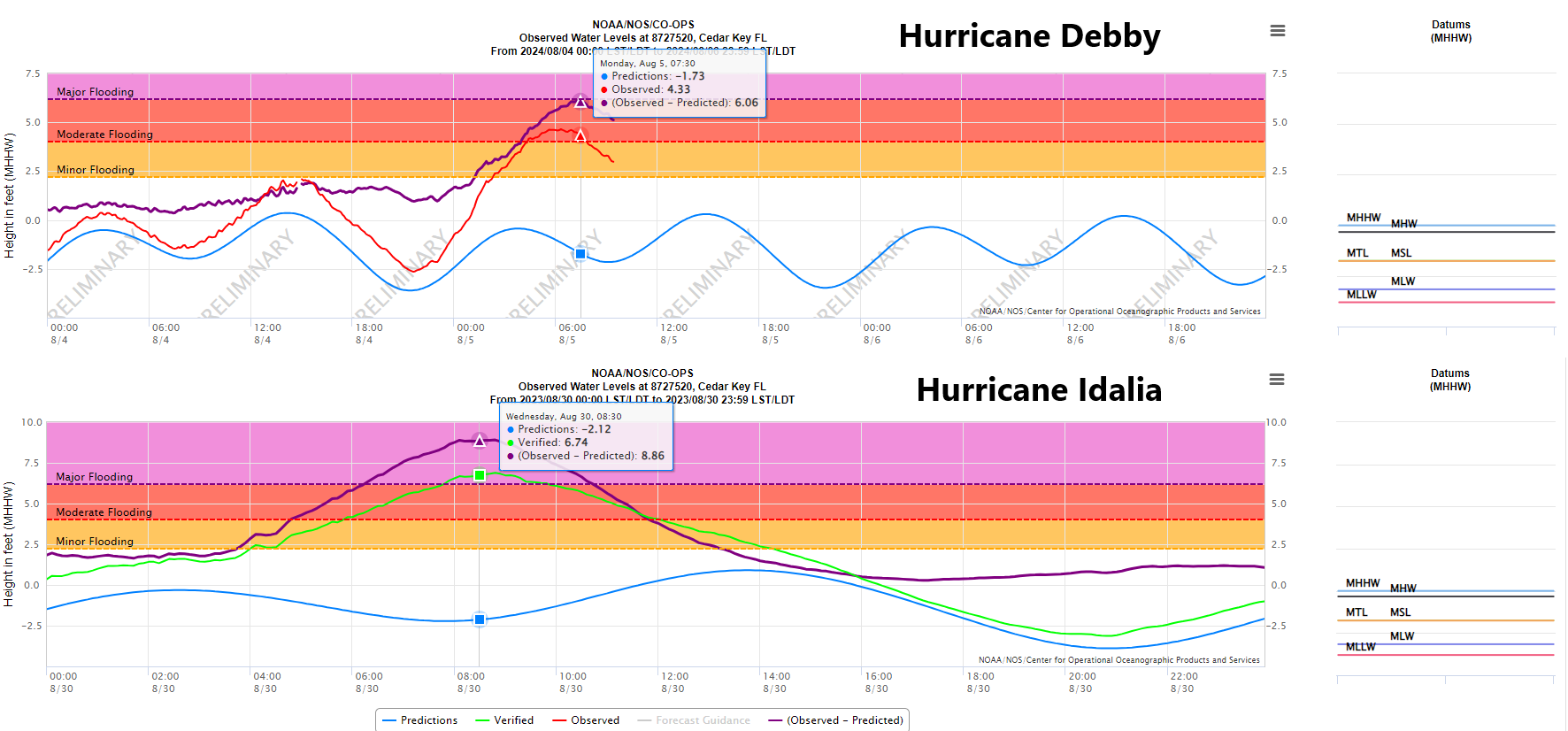
Debby had a pressure of 979 mb, compared to 80 mph and 979 mb with Hurricane Beryl in Texas. Two storms, identical intensities, vastly different impacts. Cedar Key saw about 6 foot surge with Debby, compared to an 8 to 9 foot surge during Idalia last summer.
Overall, surge and wind damage will likely be less than Idalia, but still rather widespread in parts of Florida. There will continue be periodic tornado warnings in Florida and perhaps Georgia or South Carolina as Debby’s bands spread across the area. Additionally, flooding is underway in parts of Florida that have seen the heaviest rain from Debby as it moves northward.

Debby is expected to slowly track northeast and east-northeast into Georgia today, with improving conditions in parts of Central Florida but continued heavy rain and gusty winds in North Florida and Georgia, as well as South Carolina. Debby may make its way back offshore on Tuesday or Wednesday, which could allow for some re-organization to the storm. We’ve seen this a lot in the past, where people see that the storm goes offshore and fear reorganization and another big one. Usually in these cases, the system can gain a hair of strength before it comes back ashore, so we aren’t worried about Debby rejoining the ranks of hurricane or anything. Look for Debby to slide offshore, then back onshore after 24-36 hours or so, remaining a tropical storm.
Debby’s rainfall
The primary threat from Debby will remain the rain. The rainfall forecast continues to call for in excess of 20 inches on the coast of South Carolina, including Charleston, with coastal Georgia, Hilton Head, and Savannah not far off. This is in addition to rain that has already fallen.
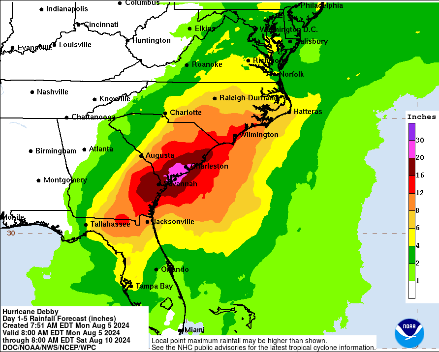
This will all lead to potentially historic, catastrophic flooding for portions of South Carolina, possibly Georgia, and even some bad flooding in portions of North Carolina as well. It’s tough to show river forecasts, as they only include 48 hours of rainfall forecast data, but expect major to record flooding of multiple rivers in southeast Georgia and South Carolina as we head into midweek. Anyone living in a flood zone in those areas should be prepared to take quick and immediate action. This is a fairly high confidence forecast, with fairly minimal risk that it dramatically changes unfortunately.
If you’re curious about South Carolina flooding history as it pertains to tropical systems, Melissa Griffin, an assistant state climatologist put together a pretty outstanding overview at this link.
Our thoughts are with the folks in South Carolina and beyond that will be dealing with some pretty terrible weather this week.
What comes next?
The question in the tropics is always “what’s next?” Well, we continue to watch a tropical wave moving into the Caribbean. This will carry about a 30 percent chance of development right now as it comes west.
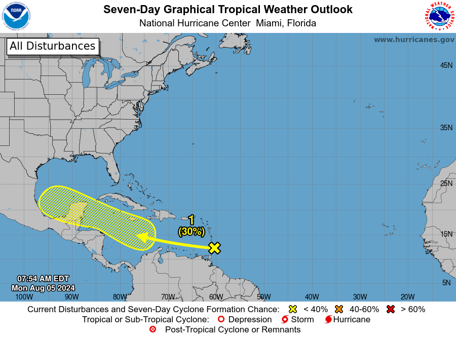
Model support for this one is not terribly strong. Odds of 30 percent seem very reasonable at this point. Yes, the GFS operational crashed a storm into Texas overnight, but it is quite the outlier right now, with little to no support from other models. One reason to expect that this system would continue to go west or west northwest is a large ridge of high pressure that’s expected to establish over Texas this week and perhaps much of next week as well. The five day average for the weekend and next week (when the GFS shows the system making it to Texas) from the European ensemble shows a rather robust pattern of high pressure.
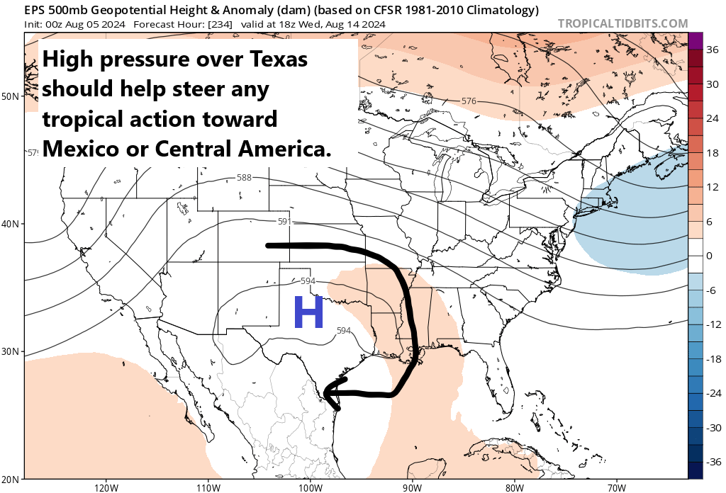
This pattern looks similar to last summer, where Texas was essentially “shielded” from tropical activity by a persistent ridge. We do not expect that this is going to hold up beyond next week right now, but for this particular tropical wave, I would say that a track into the Bay of Campeche or southward is most likely at this time.
There is another wave behind this one that may try to develop in the open Atlantic next week. As of now, we don’t see any significant landfall threats anywhere in the tropics, but we’ll be watching.
Source link