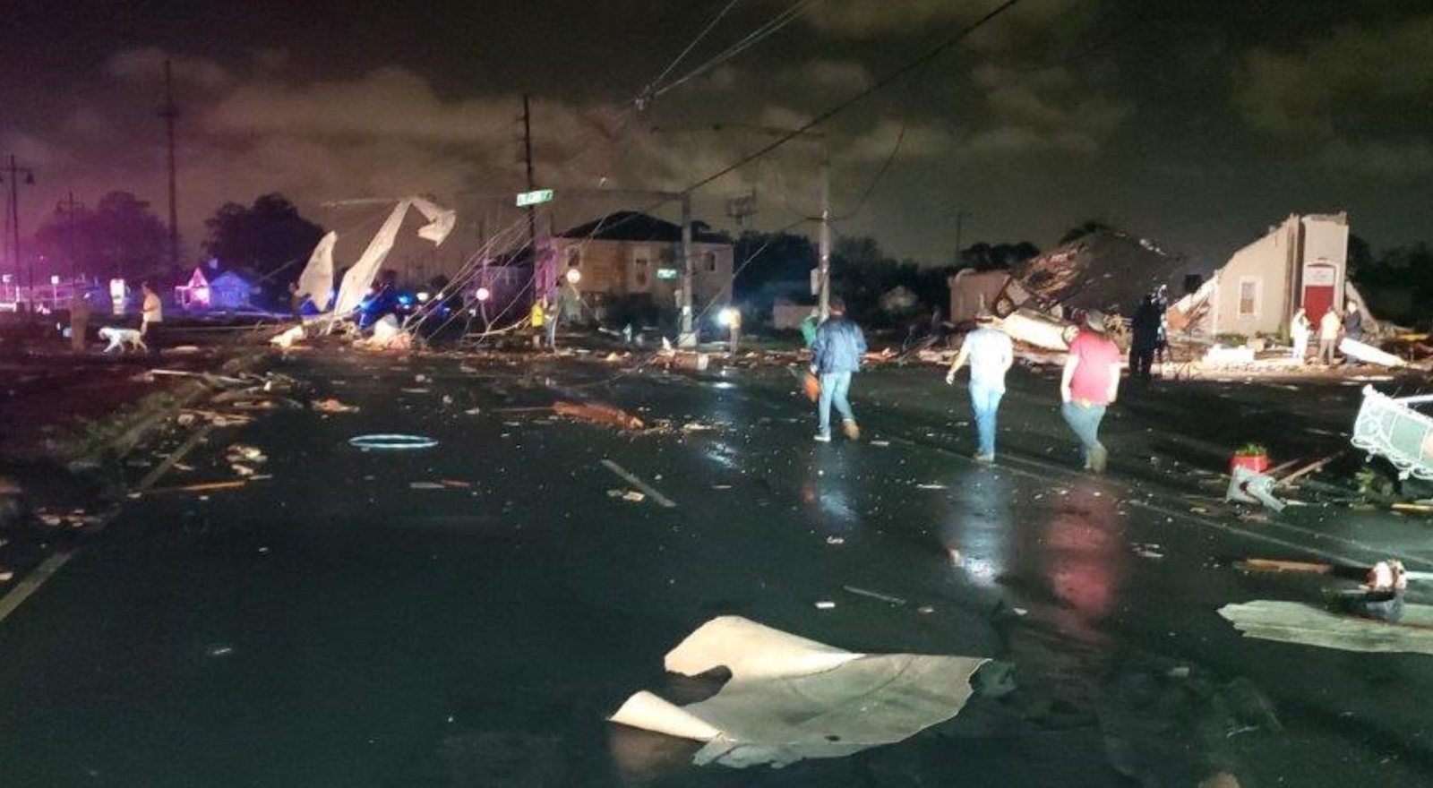
The New Orleans area, which has endured a catastrophic hurricane and a destructive EF3 tornado in the last 20 years, endured another weather hit Tuesday night with a dramatic tornado that passed across southeast parts of the metro area. As of midday Wednesday, one death was reported in the area, along with widespread property damage, including a number of demolished and heavily damaged homes.
The New Orleans office of the National Weather Service (NWS) reported on Wednesday morning that damage of at least EF3 strength on the Enhanced Fujita Scale had already been confirmed in the municipality of Arabi in St. Bernard Parish, immediately east of the Ninth Ward of New Orleans. A full storm survey is to be released in the next day or two.
EF3 tornadoes pack winds of between 136 and 165 mph. Assuming that Orleans Parish is included in the final track of Tuesday night’s tornado, it will be the parish’s second EF3-or-stronger twister in less than six years.
No other tornadoes this strong are on record in New Orleans based on data going back to 1950.
The twister was part of a two-day outbreak that produced at least 37 preliminary tornado reports on Monday and at least 28 on Tuesday, according to the NOAA Storm Prediction Center (SPC). These numbers may change as storm surveyors work to confirm each tornado report.
Despite the many twisters captured on video both Monday and Tuesday, and a large number of towns and cities incurring damage, the overall death and injury toll appeared to be relatively low, at least in part because of advance outlooks and prompt warnings (see below). One tornado-related death was reported on Monday near the Texas-Oklahoma border.
Tuesday night’s tornado produced sporadic damage in the Gretna and Terrytown areas before grinding into Arabi at apparent full strength. Although thousands of people were in the path of the mesocyclone that produced the tornado (see embedded tweet below), only a part of this swath, to be determined by storm surveys, experienced direct tornado damage.
Numerous videos showed a distinct wedge-shaped funnel ripping across town, with video captures revealing a horizontal vortex tube adjoining the funnel – a feature observed in some of the most intense tornadoes of recent years, and successfully simulated within a computer model in a recent study led by Mauricio Oliveira at the University of Oklahoma.
High-quality outlooks and warnings gave region a heads-up
The severe weather and tornado threats in the New Orleans area were exceptionally well predicted at all time frames, which testifies to the ever-increasing skill of SPC together with local NWS forecast offices.
- A full week in advance, on March 15, southeast Louisiana was near the center of an area placed at risk by SPC for severe weather for March 22. Forecasters warned that “…an all-hazards severe event – including potential for tornadoes – seems fairly likely to result.”
- Southeast Louisiana remained in the severe outlook for the entire week leading up to March 22. Early that morning, SPC issued an outlook alerting the public that “a regional severe weather outbreak, including potential for strong tornadoes, is likely today into this evening over the Lower Mississippi Valley and central Gulf Coast states.”
- The New Orleans area was in two consecutive tornado watches, starting at 10:40 a.m. central time Tuesday and extending well past the tornado strike.
- As a tornadic storm organized over the Mississippi Delta well southeast of New Orleans, a tornado warning was issued at 7:00 p.m. A subsequent tornado warning was issued at 7:19 p.m. for Orleans and several adjoining parishes. The tornado struck the Arabi and Lower Ninth Ward areas around 7:30 p.m.
More meteorological tragedy for New Orleans area
Here’s just one sign of the successive blows the New Orleans area has taken from the atmosphere lately: Images of the destruction from the March 22 tornado showed nearby houses with blue tarps on them, from damage not yet repaired after category 4 Hurricane Ida pounded southeastern Louisiana in August 2021.
The city of New Orleans has suffered a terrible beating from weather disasters since 2005, when the storm surge from category 3 Hurricane Katrina breached the city’s levees, drowning between 341 and 643 people in the city (with a much higher total death toll if one includes areas outside the city). Category 1 Hurricane Isaac caused millions in damage to New Orleans in 2012, as did the landfall of category 3 Hurricane Zeta of 2020.
And on February 7, 2017, the city was hit by the strongest tornado observed in Orleans Parish since accurate records began in 1950 – an EF3 that injured 33 and caused approximately $3 million in damage.
Website visitors can comment on “Eye on the Storm” posts. Comments are generally open for 30 days from date posted. Sign up to receive email announcements of new postings here. Twitter: @DrJeffMasters and @bhensonweather
Source link


