Headlines
- No tropical development is expected this week in the Atlantic.
- A tropical wave has a growing chance to develop next week just east of the Caribbean islands and is worth watching.
- The overall background in the Atlantic may become more conducive to tropical development by mid-September.
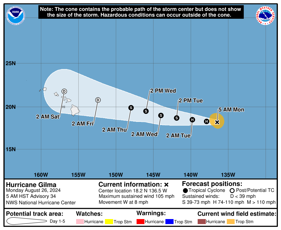
- Hawaii will see modest impacts from the remnants of Hurricane Gilma this weekend.
Another quiet week
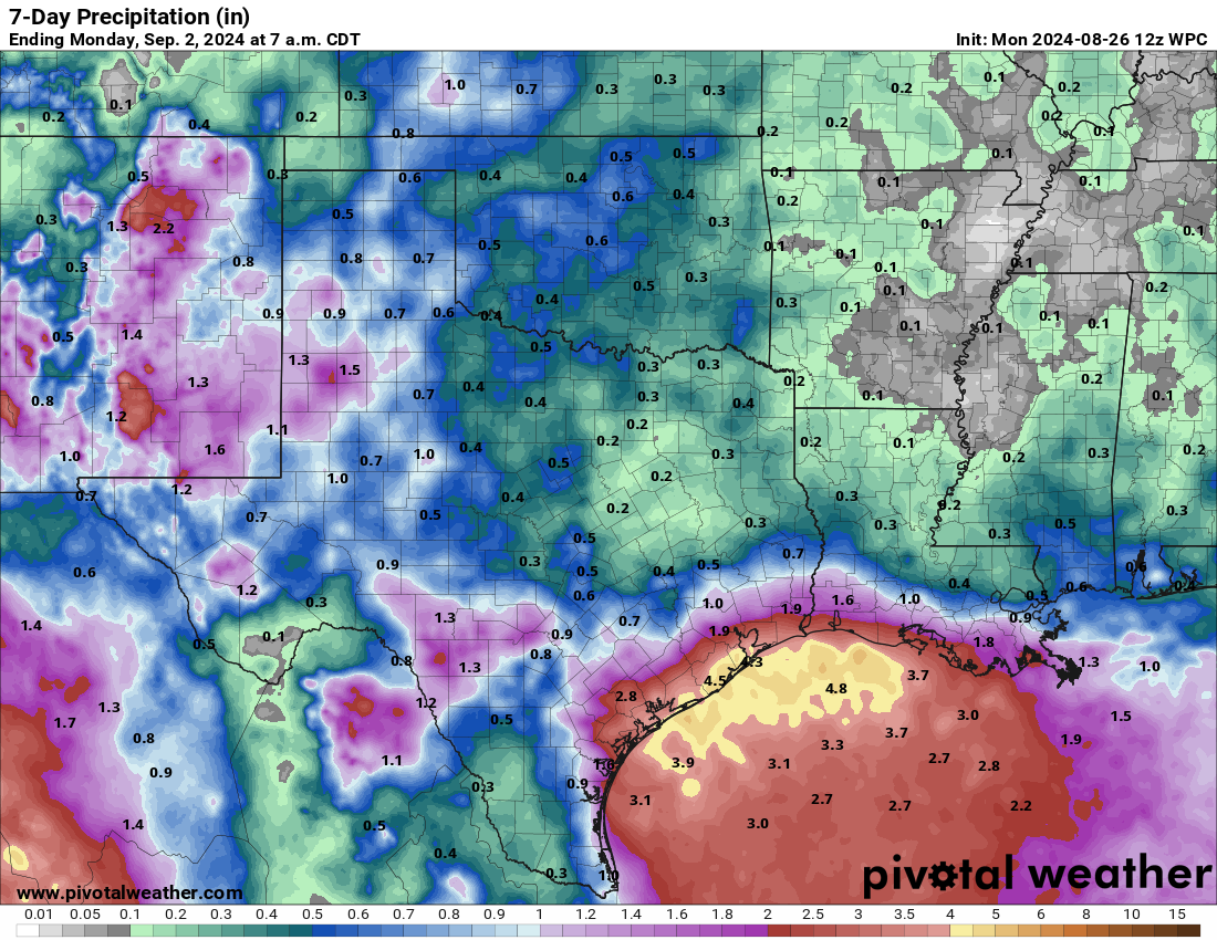
The Atlantic will remain quiet for another week here, as we have no real development chances anywhere in the basin of note. The Gulf Coast will be busy with showers and thunderstorms, but no development is expected from anything.
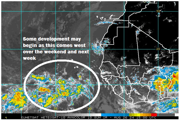
The eastern Atlantic looks quiet for now as well, however there is a tropical wave sitting out there. While it is unlikely to organize this week, it is becoming increasingly plausible that we see this begin to organize a bit as it approaches the islands next week.
Will we get Francine?
The next name on the list is Francine, and there seems to be growing support that we may see this emerge from the morass in the eastern Atlantic in time. The European model is on this with a moderate signal for possible development near the islands next Tuesday.
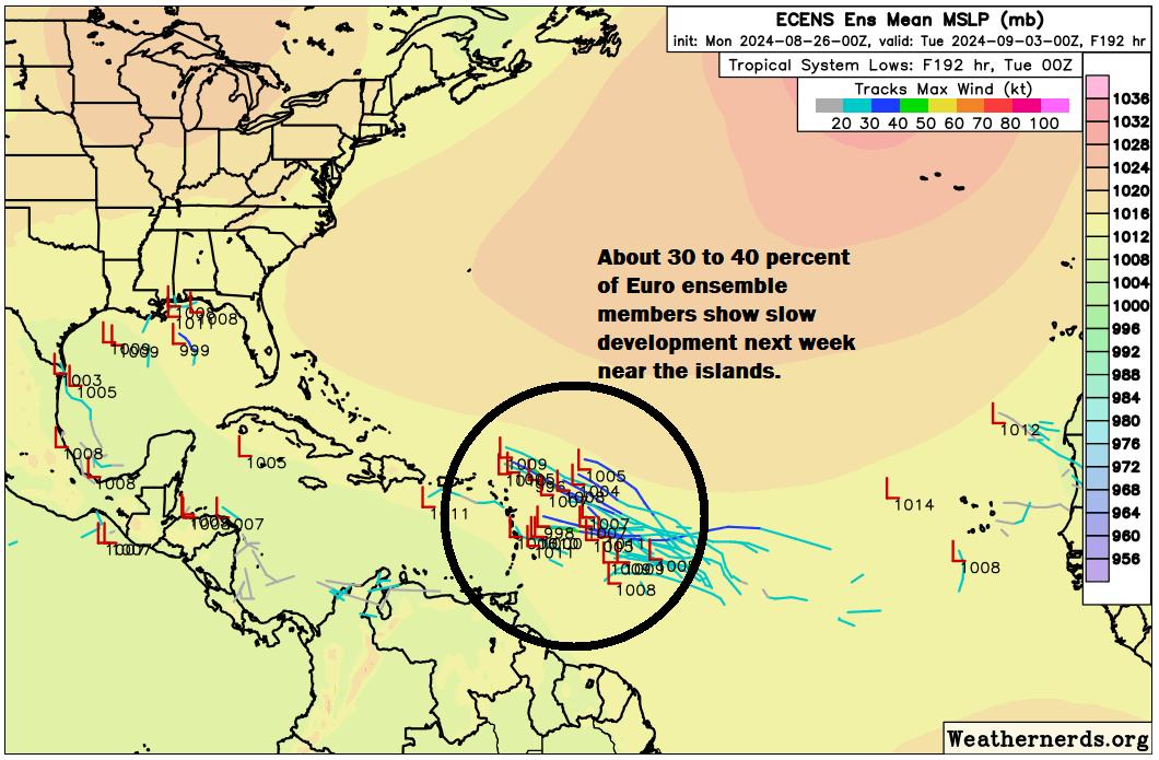
I think things are still a bit tenuous in the Atlantic in terms of dry air, sinking air, and other issues that are disrupting development right now. But the overall background state of the western Atlantic is likely to improve a bit beginning next week for possible development chances. There is also a minor signal in the Gulf for next week, but it remains a minority of model solutions. Still, this would signal that the wet pattern in the Gulf should continue next week as well.
As for the potential of Francine, whatever happens with this system in the Atlantic, it seems most likely to turn northwest at some point. But until we get some additional clarity on how this will shake out, I don’t want to over-speculate. At the least, it would be good for the islands to keep tabs on this possible development next week.
Beyond this one, as I noted above, it does seem as if the overall state of the basin will improve going into the middle of September. This should allow things to pick up. In addition, all this quiet has allowed the Atlantic basin’s sea surface temperatures to persist very warm. We sit at or above records everywhere right now.
So it would make sense to think that as long as the background state of the basin becomes more hospitable for tropical development, it will begin again in earnest. Stay tuned.
Hawaii threats continue
After taking swipe from Hurricane Hone with some considerable flooding on the Big Island and some decent wind gusts. You can see some of the reports here. Next up, the remnants of Hurricane Gilma, which should arrive in the Hawaiian Islands this weekend. On this track, the worst of the rain impacts would likely pass north of the islands. Still, some modest impacts would be possible across the islands this weekend as it approaches and passes.

Behind Gilma, we have Tropical Storm Hector, which is not expected to become a serious threat to Hawaii.
Source link