A potent, fast-developing spring storm will deliver several days of active weather this week from the U.S.’s High Plains to the Mississippi Valley. In particular, an ominous pattern for extreme wildfire behavior is virtually guaranteed over parts of the southern and central Plains.
Less certainty applies to the risk of strong tornadoes, but they will be a distinct possibility, especially late Tuesday and Wednesday.
By early Monday, NOAA’s Storm Prediction Center (SPC) had placed parts of the central United States under severe weather outlooks for each day from Monday through Wednesday. The biggest concern for tornadoes was projected for late Tuesday along a band from eastern Oklahoma and Kansas into Iowa, and for Wednesday across most of the lower and mid-Mississippi Valley.


The impetus for the onslaught of wild weather is a classically broad and strong upper-level low projected to dig into the Rocky Mountains on Tuesday and then pull across the Upper Midwest on Wednesday. Ahead of the upper low and an associated dryline, warm, moist air will sweep quickly northward. As the unstable air encounters a weak boundary left behind by a decaying thunderstorm complex, a few severe storms could erupt Monday evening from north Texas into Arkansas.
A major player in this setup will be a layer of hot, dry air just above the surface, flowing off the parched higher terrain of the Southwest and intensifying on Tuesday. This hot air is expected to serve as a cap on thunderstorm development Tuesday afternoon. The cap may well end up strong enough to inhibit most or all thunderstorm activity into the evening. However, if any storms manage to “break the cap,” the instability and upper-level wind shear will favor the type of supercells that can spawn giant hail and strong tornadoes.
Historical analogs from a database (CIPS) at Saint Louis University show that Tuesday’s setup has some of the fingerprints of major tornado producers from years past – but only if the cap gets broken.
Any storms that develop Tuesday evening may congeal into an intense line during the overnight hours, especially from Iowa to eastern Kansas.
Wednesday is likely to bring more widespread severe weather, with an intense squall line along the front/dryline likely to sweep across a large area from Missouri and Arkansas into Illinois, Indiana, western Kentucky and Tennessee, and Mississippi. The line could bring torrential rain, high winds, and the chance of brief embedded tornadoes.
Any storms managing to stay isolated well in advance of this line will again be capable of spawning higher-end severe weather, including large hail and strong tornadoes.


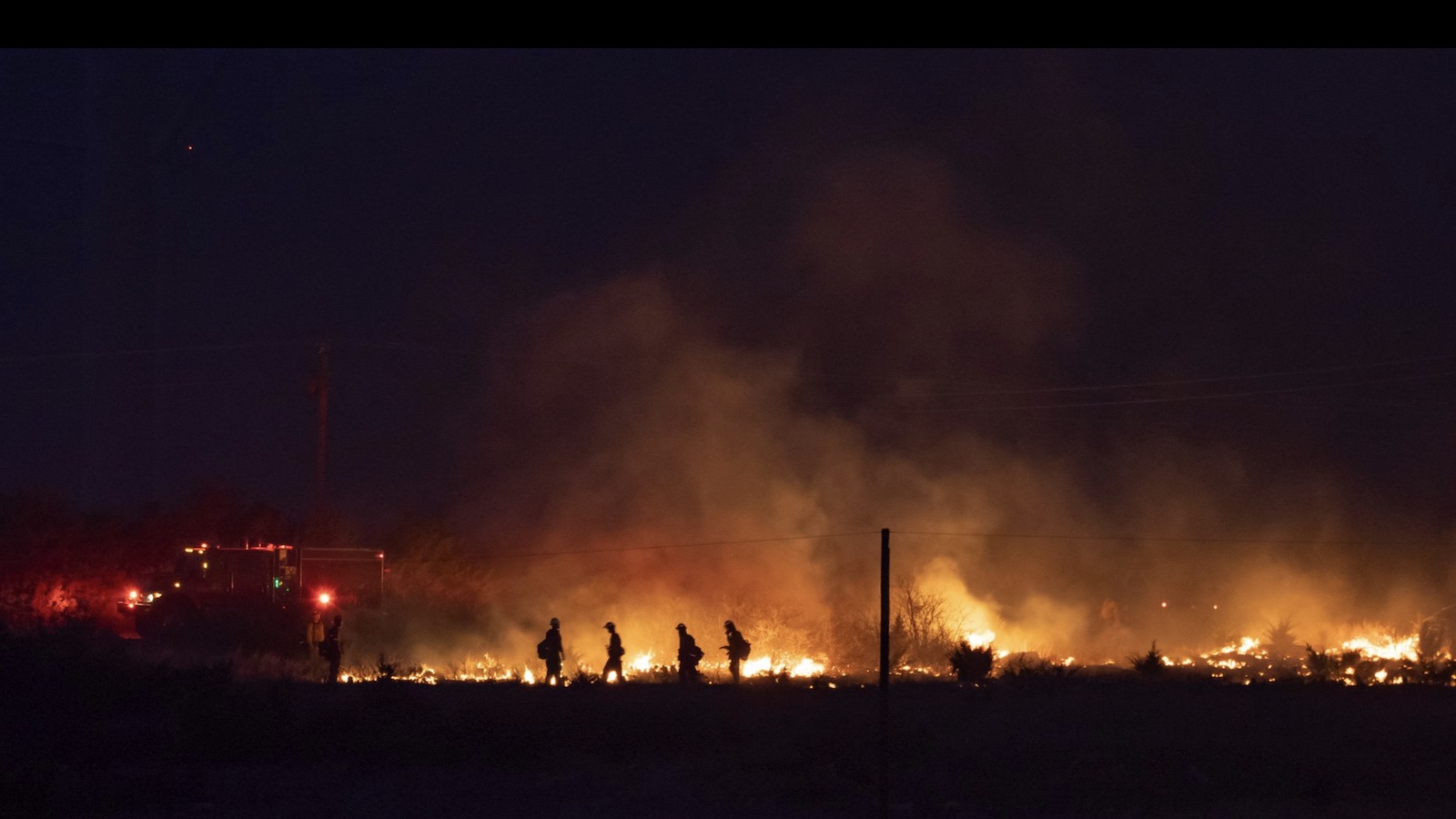
Extreme wildfire conditions likely on Tuesday
Behind the dryline, conditions will be ferociously hot, dry, and windy on Tuesday – all variables that will heighten the risk of fast-moving wildfires across the prairie. Making matters more worrisome is a drought that’s been intensifying in recent weeks, as is common during La Niña events (see below) over the Southern Plains.
As of midday Monday, SPC had placed much of New Mexico and eastern Colorado under a risk of critical fire weather for later in the day. An even bigger danger could materialize on Tuesday (Day 2), when the “critical” area is much larger and encompasses a band of “extremely critical” conditions – the most dire of SPC’s fire weather categories – from the Texas Panhandle into southwest Kansas. More than a million residents are in the “extremely critical” area.
Citing “ongoing extreme drought and exceptionally dry fuels”, SPC warned of wind gusts reaching the 50-60 mph range by Tuesday afternoon, with relative humidity below 10% over large areas. The center added that “exceptionally volatile fire weather conditions” are possible.
Given the multiple fires already seen in the region with other large-scale storm systems earlier this year (such as in the tweeted satellite loop below, from March 21), this situation bears an extremely close watch.
Two recent months bring unprecedented tornado activity
The broad sweep of this multiday storm system is typical of April, as warmer air masses have an easier time pushing further north while the upper-level jet stream is still capable of dipping well to the south.
That said, it’s not as if the past few months have been slouches at generating severe weather. Two startlingly historic tornado outbreaks gave the final month of 2021 more confirmed U.S. tornadoes (193) than in any other December on record. Likewise, several highly active days pushed last month to a record-high tornado total (at least 210) for any March. Both records extend back to 1950, the start of NOAA’s reliable tornado database.
Total tornado reports increased dramatically in the 1950s and 1960s with the adoption of the U.S. warning and spotter networks, and again in the 1980s and 1990s with the advent of national Doppler radar and a profusion of video cameras and storm chasers. This “tornado inflation” appears to have leveled out, however, and there’s little overall trend after filtering out the weakest tornadoes (F0/EF0).
This week’s severe weather will be centered from the Southern and Central Plains into the lower-to-mid Mississippi Valley, a region where early spring can be especially volatile during La Niña. Right now, the second La Niña event in two years continues to hang on in the eastern tropical Pacific. It’s expected to segue into neutral conditions by this summer, though some models keep it in place.
Because of the spring predictability barrier for El Niño and La Niña, it’s too soon to know whether to expect a third consecutive northern winter of La Niña in 2022-23. “Three-peat” La Niña events have occurred once every 20 to 25 years since 1950, most recently in 2000-2001.
Website visitors can comment on “Eye on the Storm” posts. Comments are generally open for 30 days from date posted. Sign up to receive email announcements of new postings here. Twitter: @DrJeffMasters and @bhensonweather
Source link