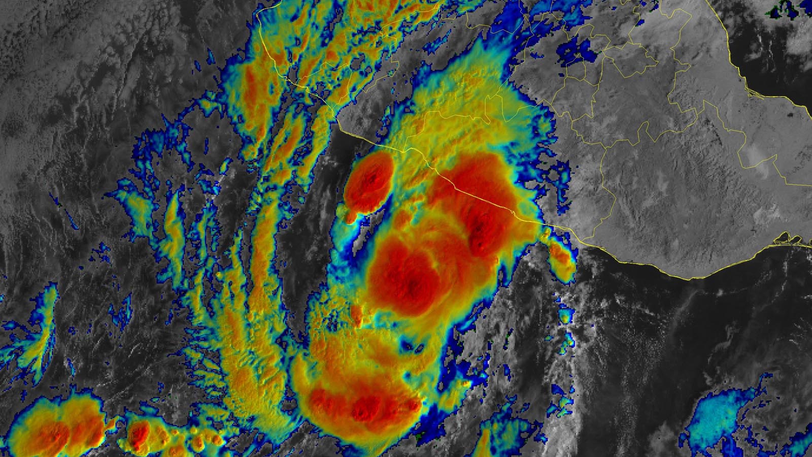
Hurricane Rick, headed for a Monday morning landfall in southwestern Mexico, has not intensified as expected, and will likely not reach major hurricane strength. At 11 a.m. EDT Sunday, Rick was about 135 miles south-southeast of Lázaro Cárdenas, Mexico, headed north at 6 mph. Rick was a category 1 storm with 85 mph winds and a central pressure of 980 mb.
Despite seemingly favorable conditions for intensification, with very warm waters near 30 degrees Celsius (86°F), light wind shear, and a moist atmosphere, Rick had not intensified as much as expected. Nevertheless, the National Hurricane Center is continuing to forecast strengthening, predicting Rick will be a category 2 hurricane with winds of 105 mph when it nears landfall early Monday morning.
Landfall is likely to occur between 3 a.m. and 9 a.m. EDT Monday, October 25, near Lázaro Cárdenas, México (population 180,000). In its 11 a.m. EDT Sunday wind probability forecast, NHC gave Lázaro Cárdenas a 99% chance of experiencing tropical storm-force winds and a 54% chance of hurricane-force winds. The most serious impact of Rick is likely to be its rains of five to 10 inches, with isolated amounts of up to 20 inches.
It is unusual to see an Eastern Pacific hurricane this late in a season when a La Niña event is active.


A near-average Eastern Pacific hurricane season
It’s been a near-average hurricane season in the Eastern Pacific, with 17 named storms, 8 hurricanes, and 2 major hurricanes. The official NHC 1991-2020 seasonal averages for an entire season are 15 named storms, 8 hurricanes, and 4 major hurricanes. However, he accumulated cyclone energy (ACE) is well below average this season: The 2021 ACE is 90, versus the climatological average of 127 for the date.
Two major hurricanes have occurred in the Eastern Pacific in 2021 – Hurricane Felicia, which peaked as a category 4 storm with 145 mph winds in July, and Hurricane Linda, which peaked as a category 4 storm with 130 mph winds in August. Neither hurricane affected land.


Rick is Mexico’s 6th damaging Eastern Pacific named storm of 2021
Rick will be the fifth Pacific named storm to make landfall in Mexico this year, and the sixth to cause damage in the country. The five Eastern Pacific named storm landfalls are the most in the nation since 2018, when six named storms hit. The five other 2021 Pacific named storms to do damage in Mexico:
- Hurricane Pamela made landfall as a category 1 storm with 75 mph winds 40 miles northwest of Mazatlán, Mexico, on October 13, killing two; damage estimates for the storm are not yet available. Pamela’s remnants swept into Texas, causing flooding that killed two people.
- Hurricane Olaf made landfall in Mexico’s Baja California Sur on September 9 as a category 2 storm, killing one and causing tens of millions of dollars in damage. Moisture from Olaf also brought flood damage to the states of Jalisco and Colima.
- Tropical Storm Dolores made landfall near the border of Mexico’s Michoacán and Colima states on June 19 with 70 mph winds, killing three and causing $50 million in damage.
- Category 1 Hurricane Enrique moved parallel to the southwestern coast of Mexico June 25-30, eventually dissipating in the Gulf of California without making landfall. Flooding from Enrique killed two and caused $50 million in damage.
- Hurricane Nora made landfall on August 28 in Mexico’s Jalisco state near Puerto Vallarta as a category 1 storm, killing three and causing $125 million in damage.
Several named storms in the Atlantic also affected Mexico. The most significant by far was Hurricane Grace, which struck the nation twice: on August 19 near Tulum, on the Caribbean coast, at Category 1 strength, and then on August 21 near Tecolutla, on the Bay of Campeche coast, as a Category 3 storm. Grace led to 14 deaths and around $500 million in damage, mainly in its second landfall.
The Atlantic remains quiet
No tropical cyclone threat areas currently are in the Atlantic, but that situation could change later this week. A powerful low-pressure system (a Nor’easter) is predicted to develop off the mid-Atlantic/Northeast U.S. coast on Tuesday, bringing heavy rains and strong winds to the coast (but no snow). The low is predicted to move generally eastward, away from the U.S., Wednesday through Saturday, over marginally warm waters capable of allowing the system to acquire tropical or subtropical characteristics. In its 8 a.m. EDT Sunday Tropical Weather Outlook, NHC gave this future low 2-day and 5-day odds of tropical cyclone development of 0% and 20%, respectively.
U.S. West Coast deluged by early-season storms
Hundreds of miles north of Rick, a sequence of unusually strong winter-like storms has been plowing into the U.S. Pacific coast, bringing much-needed rains along with the risk of flash flooding. The most powerful of this series was taking shape early Sunday off the coast of the Pacific Northwest, where a low-pressure center intensified rapidly over the weekend. By Sunday morning, its central pressure was analyzed at 943 mb – as deep as in many major hurricanes, and as strong as anything on record for this location. As a powerful front and atmospheric river surge eastward into California later on Sunday, high winds and giant waves will lash the coastline, and heavy rains will push well inland across the northern half of the state.
Flash floods are a distinct threat over the burn scars left by massive California fires over the last couple of years, and urban flash floods are a concern as well. If the weekend rains in San Francisco exceed 3.06″, which is quite possible, it will be the city’s biggest October storm in nearly 60 years.
We’ll have more on this multi-pronged storm in a post on Monday.
Website visitors can comment on “Eye on the Storm” posts. Comments are generally open for 30 days from date posted. Sign up to receive email announcements of new postings here. Twitter: @DrJeffMasters and @bhensonweather
Source link