Headlines
- Leslie heading out to sea while Invest 94L may develop just west of the Cabo Verde Islands.
- We are monitoring the western Caribbean next weekend, but there is still nothing of specific significance that we can state about the potential of development, and we urge you to not fall prey to one-off model runs that show scary outcomes.
- Thank you to our Friday featured sponsor: Senior Health Services!
- The close of our post talks a bit about or mission and goal for this site, as well as what we don’t want to be!
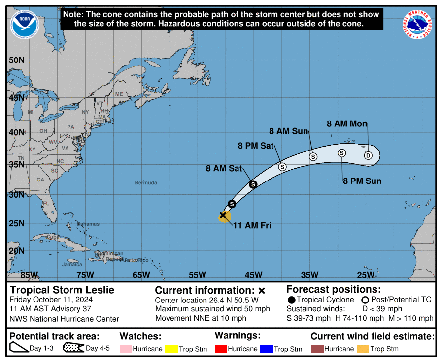
Leslie and 94L way out in the Atlantic
We’re beginning a period of calmer conditions in the tropics. At least as it relates to land-impacts from tropical systems. Milton is now history. Leslie is still churning away in the open Atlantic but it too will soon be history.
Off the coast of Africa, we currently have Invest 94L. This looks ready to pop in the next few days. Model guidance agrees on this, and the overall environment looks decent. Steering winds should bring it west across the Atlantic.
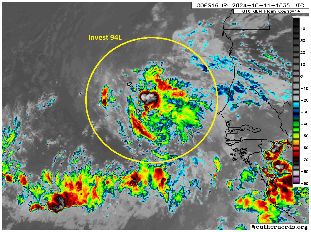
While this is unlikely to threaten the U.S. at any point, this is at least something to monitor if you live in the Caribbean. It’s still a solid week away, but with water temperatures still sitting near all-time records in the Main Development Region (MDR) of the Atlantic, the right environment could easily incubate a strengthening storm.
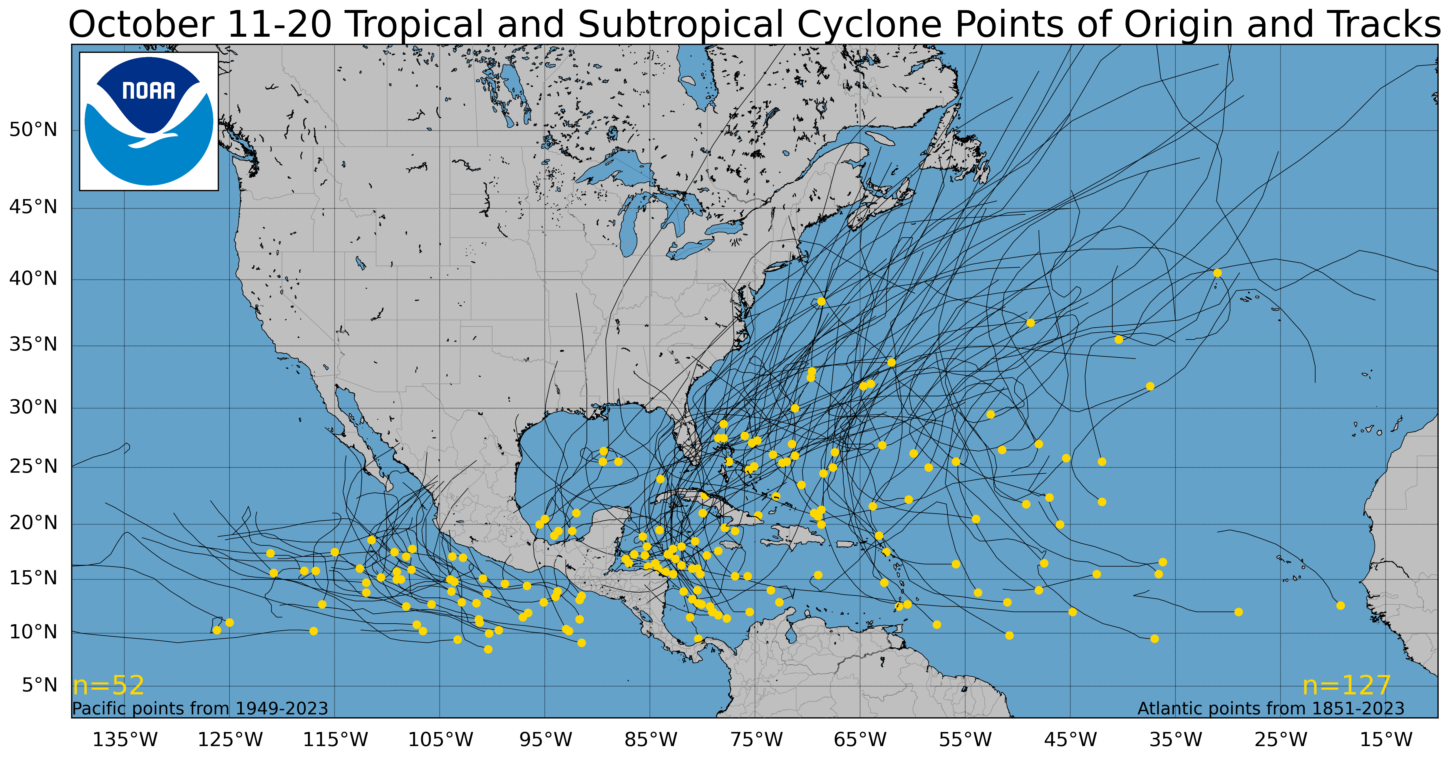
That said, this would be unusually far east for a storm to develop this late in the season. Only one system has formed east of the Cabo Verde Islands since 1851 in mid-October, and only a couple others within 10 degrees of longitude west of there. If 94L forms soon, it would be an oddity. Most storms that form in the central or eastern Atlantic this late in the season tend to curve out to sea before getting to the islands, but obviously some have come close.
We’ll keep an eye on 94L and have more for you Monday.
Eyes on the Caribbean?
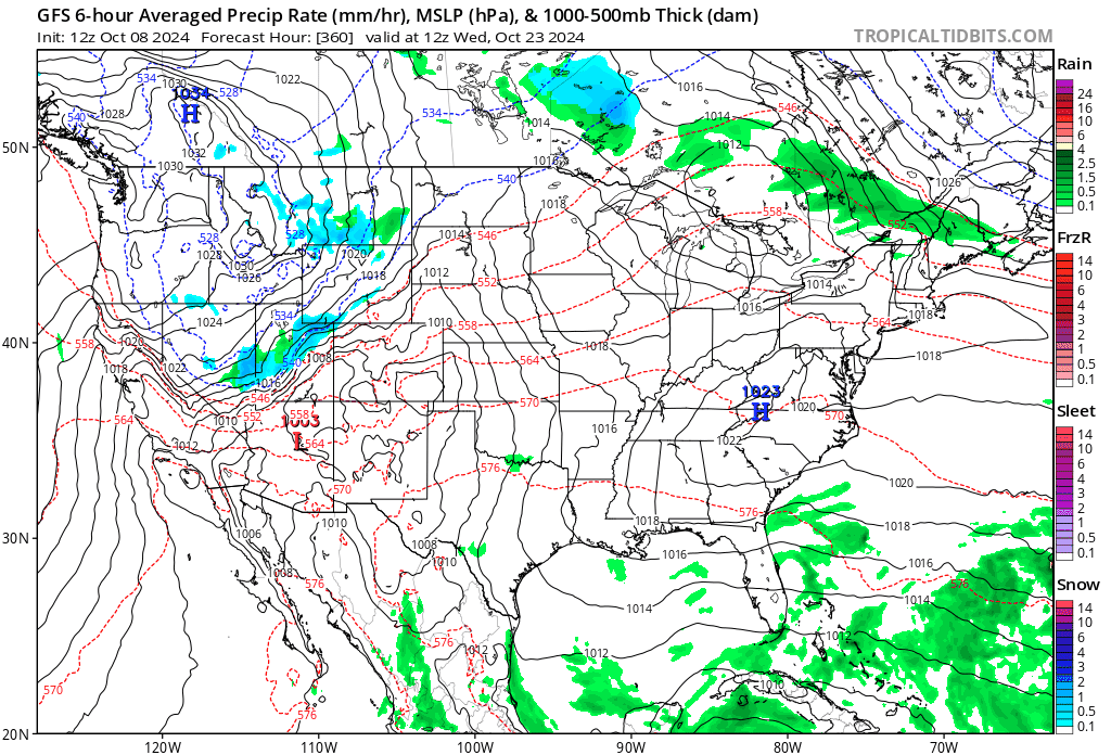
There was one particular GFS operational model run yesterday that sent some folks into a tizzy over the potential for a big hurricane in the Gulf in about 10 to 12 days. I want to remind you all that operational model runs like that specific GFS run are not suited to trust more than 5 to 7 days out. Even within 5 to 7 days there are often issues and miscalculations with the model. So don’t panic when you see that.

No consistency, no trustworthiness.
Most models agree in a tropical disturbance trying to form in the western Caribbean sometime later next week.
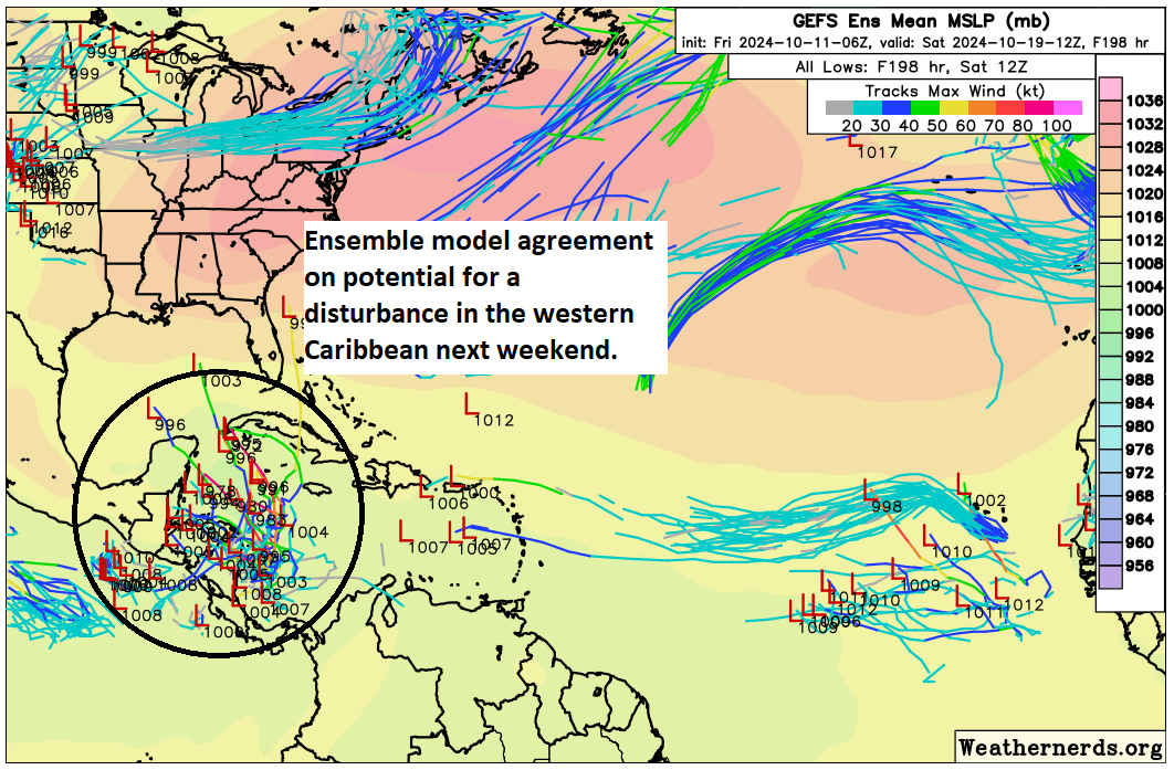
This is a century away in model terms, and there is very little agreement on where things go from here, if anywhere at all. We have a very long time to watch this area, but I would encourage you not to stress over things. A lot of moving parts will impact whether or not this develops, including cold fronts, locations of specific features, etc. Right now, we simply have nothing intelligible to really say about this other than a disturbance is possible there in a week’s time. Anyone selling anything specific at this point should be added to your “do not trust” list immediately. More on this Monday.
Friday featured sponsor: Senior Health Services
Thank you to Senior Health Services and all our sponsors for their support of The Eyewall this season!

Need help with Medicare? Is your plan changing? Senior Health Services is a full service Medicare brokerage providing free Medicare help. Millions of Americans on Medicare are seeing changes to their plans due to the Inflation Reduction Act. If your plan benefits are changing, benefits being cut, costs going higher, or even terminated altogether, we stand ready to assist. We work with Medicare Supplements, Medicare Advantage, Part D plans, and more. If you need help, it’s free! All you have to do is visit us at seniorhealthservices.com or call us at 281-894-7540. We serve most states. Did we mention it’s free? Don’t do it alone. Call us if you need help.
A final word
We have had some very spirited comments in recent posts, which have been useful and interesting conversationally! We encourage that. We just ask to keep it respectful. I don’t want to have to moderate or shut things down at any point. We trust y’all to treat each other with courtesy.
Secondly, I just want to clarify a couple misconceptions I read. We did not build this site for Houston. While we hope Houstonians will use it as a companion to the robust information we offer at Space City Weather, we built this site for everyone else, truthfully. There are a handful of good blogs out there talking about the weather, and we want to join them. I hope any of you in Florida, Georgia, Louisiana, or the Carolinas will share this site with your friends and family. We try not to advertise and prefer our growth to be by word of mouth in most cases. Let our work speak for itself.
There are two primary reasons we don’t post 5 or 6 updates a day when a storm threatens someone. First, honestly, not a whole lot changes from morning to evening. Yes, a storm can rapidly intensify or change intensity but in general, that doesn’t have a massive impact on the forecast, and if it does, in most cases a second post later in the day will cover it. We live in a world with frequent, *URGENT* push alerts. We aren’t that. We don’t want to oversaturate you with repetitive stuff just so we can show we’re still on top of things and generate traffic for the sake of traffic. We want our posts to carry value and information, not regurgitation. Second, we are not local experts on Tampa or Jacksonville or Cape Hatteras or Charleston. We could never be. We know a bit, in some cases a lot about geography. But the local nuance can only be covered by local experts. That’s why at a point, we want you to find trusted local sources of information to turn to, such as your local NWS office or a particular broadcaster or online source in your region. Simply, we cannot do at scale what they do for you locally. So yes, please use us! But make sure you’ve got someone not from Houston that you’re following to give you that local insight or nuance that you need.
As always, thanks for your support, follow us on social media, and share us with your friends and family!
Facebook
Instagram
TikTok (we will occasionally cross post from Instagram there)
Twitter/X
Threads
Bluesky
Mastodon
Source link