Headlines
- Development odds are increasing in the Caribbean.
- Slow development is possible in about 3 to 5 days with a slow west or northwest movement.
- Interests in Central America, Mexico, Cuba, Jamaica, and the Caymans should continue to monitor development closely.
- U.S. impact risks remain quite low due to cooler water in the Gulf and wind shear.
Caribbean development odds inching up
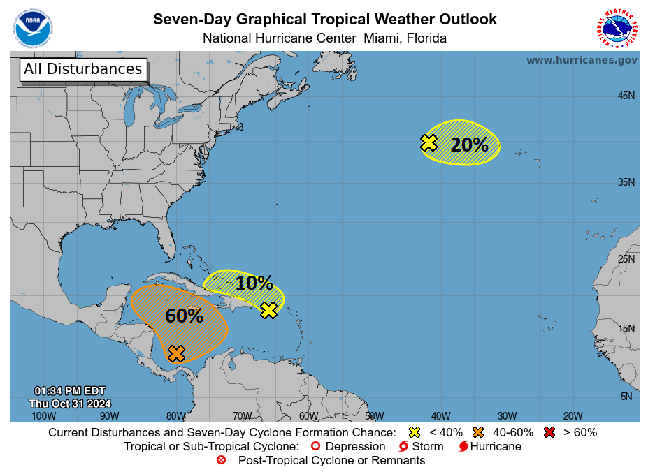
The system that could develop in the Caribbean over the next several days is up to 60 percent today, as the forecast continues to look a touch more bullish on development.
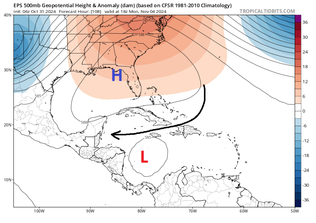
Back on Tuesday, we noted that it would probably move north or west from where it gets going, and today the NHC basically says the same thing. The upper pattern is favoring something a little anomalous for November, as most often, systems will move north or northeast from the Caribbean this time of year.
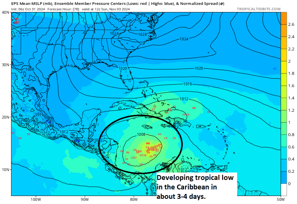
Anyway, we have at least loose model agreement almost across the board today that something should get going in the western or west-central Caribbean in about 3 to 5 days. In fact, looking at the Euro ensemble, we can see a clear development signal in the Caribbean by Sunday.

There will be a number of factors in play that will impact the strength and track of this system. First off, notice that there is also a low pressure signal on the north side of Cuba or Hispaniola. That low-probability system could have an impact on how shear impacts the Caribbean disturbance. Initially, high pressure over Florida and the eastern Gulf will likely help steer this system slightly to the west. Over time, that high pressure system may shift east a bit to focus more over Florida or the Bahamas. This could open the door to more of a northwest or northerly motion into the Gulf from this system.

You may look at that outcome and say, “Oh no, here we go again.” But the situation in November is generally much different than that of October. While the Gulf is generally warmer than normal, it has cooled a good deal in the last month.
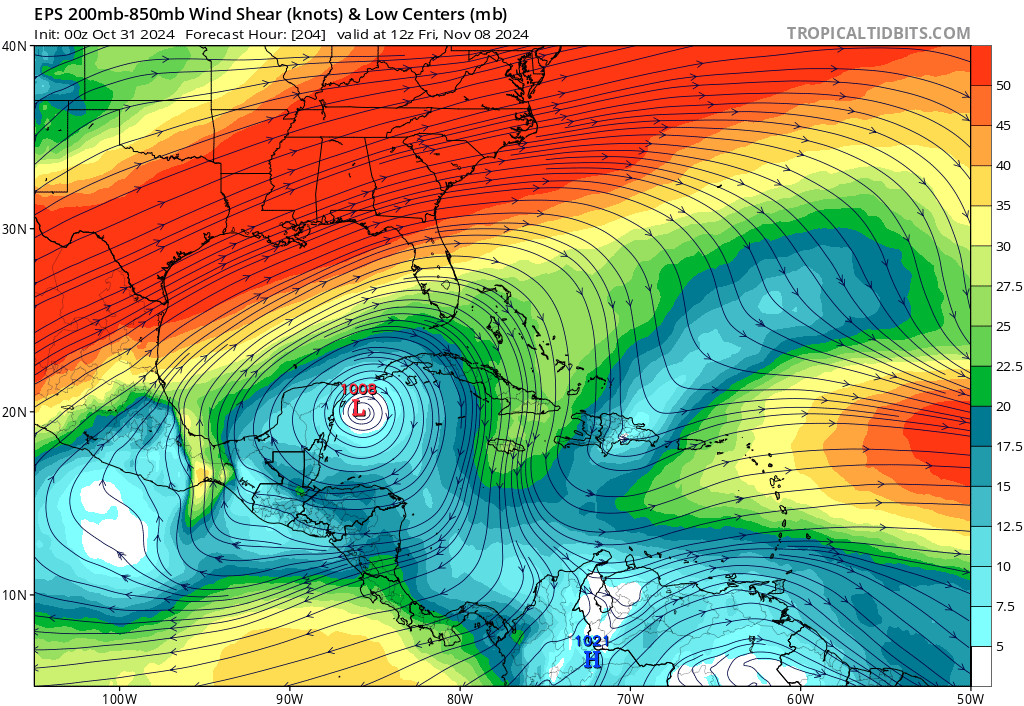
So we aren’t dealing with the precursor setup that we were with Helene or Milton. Secondly, wind shear tends to be quite aggressive in November. The forecast of wind shear in the northern and western Gulf is quite significant next week, with high shear in those locations.

That said, any kind of development is worth noting, particularly for folks in Mexico (the Yucatan), Cuba, Jamaica, or the Cayman Islands. And I would encourage those areas to watch this system closely, especially given that the Caribbean remains very warm and has barely cooled off in the last 30 days. For folks in the U.S., this is unlikely to cause major heartburn, but it probably remains worth watching at least until we have a better sense of how things will unfold. For now, it remains nothing of serious concern for the Gulf Coast.
More this weekend.
Source link


