Headlines
- The Atlantic is expected to remain generally quiet through the end of the month before activity likely picks back up in early to mid-August.
- Sea-surface temperatures in the basin have resumed warming after a bit of a pause.
- La Niña is technically not here yet, but there is no reason to think it won’t play a big role in the remainder of hurricane season.
- Seasonal activity is still expected to be quite a bit more active than normal.
Atlantic slumber continues
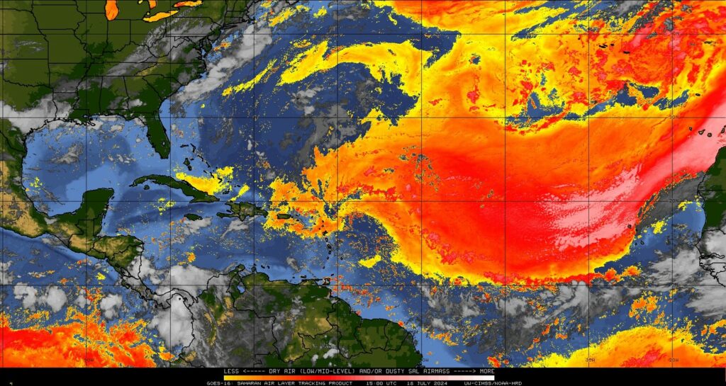
No tropical development is expected over the next 7 to 10 days as a continued dust-clogged Atlantic and sinking air in the background suppresses activity. There is a wave emerging off Africa today that a handful of ensemble members give a miniscule chance of development to in about 6 or 7 days, but that seems unlikely and not a concern.

How long is this sleep going to last? It’s not uncommon at all for late July to be dormant in the Atlantic, so don’t get too excited. We are still only 6.1 percent of the way through hurricane season using accumulated cyclone energy as a measure. It does appear that conditions will become gradually more conducive to activity again after August 5th, and that’s not just me looking at climatology either. The background state looks to be a good bit less hostile in early August, which could translate to some action before mid-month. I would anticipate a very active mid to late August period right now.
But trouble lurks beneath
After Beryl, one of the common questions was “will this lower water temperatures finally?” And the answer was, “Yes, sort of — along its track.” Even that was minimal, and any benefits we’ve enjoyed from Beryl’s cooler wake have since faded into oblivion. If you look at the Gulf of Mexico specifically, water temperatures have resumed warming, particularly in the central third of the Gulf, where they had not been too terribly warm in June and early July.
The Caribbean? Record warm again. The Atlantic Main Development Region? Approaching record warm levels again. Basically, everywhere you look that matters, water is near record warm levels in the Atlantic. So any hope we may have had that things could meaningfully change this summer appears to be fading. Expect near record warm water to be with us over the peak of hurricane season in the Atlantic.
What’s the deal with La Niña?
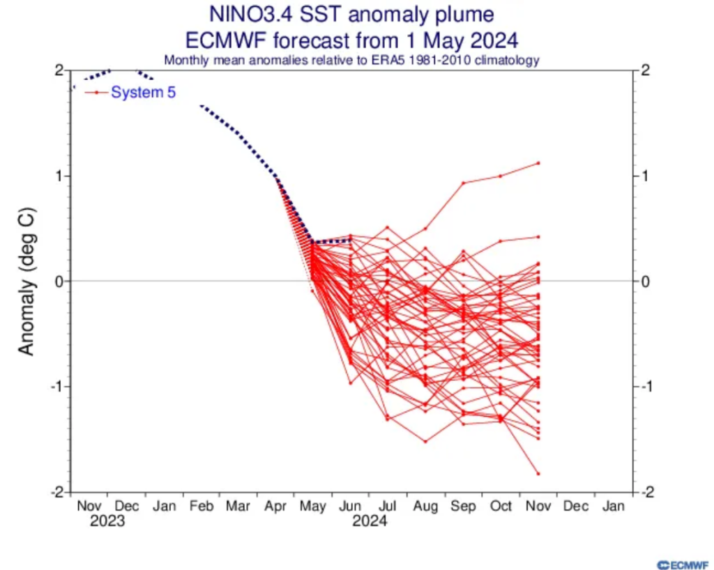
Coming into this hurricane season, one of the big factors for a busy season besides really warm water was La Niña. To this point, however, the La Niña event has mostly been mediocre, at least when you look at the key ENSO 3.4 region water temperatures, which we use to truly define El Niño or La Niña. Here’s the ECMWF forecast for ENSO from May and where we’ve verified.

To understand more about what’s happening now, I encourage you to read NOAA’s excellent ENSO blog from last week. In terms of hurricane season, we still expect La Niña to get going next month or in September, but perhaps the pace will be slower than expected earlier in hurricane season. I would argue that most of this “is it or isn’t it La Niña” banter is not particularly important for the rest of hurricane season. The eastern ENSO region is already well into La Niña thresholds, and with a slow drop in SSTs resuming to the west, expect ENSO to behave mostly like La Niña and support an active hurricane season.
The bottom line? All systems seem to be a-go for an active peak of hurricane season.
Source link


