Headlines
- Hurricane Milton is now a non-tropical storm as it moves out to sea.
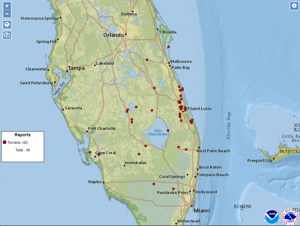
- A very historic tornado outbreak, flash flooding, and storm surge were all elements of Milton that were notable in Florida.
- In the deep Atlantic, Hurricane Leslie is headed out to sea.
- There are hints of additional development chances late next week in the western Caribbean, but it is way, way too soon to speculate on whether that happens for real or where it would go if it did.
Milton’s mess
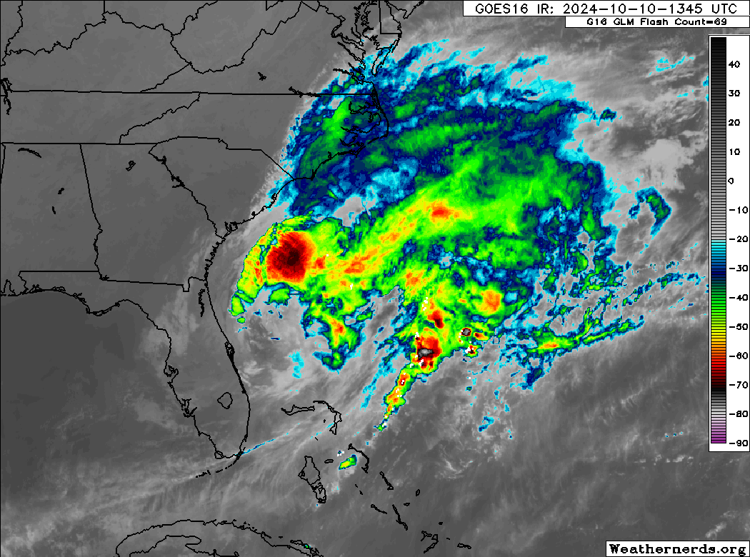
Hurricane Milton is moving farther away from Florida this afternoon. We say good riddance. There will be a number of things to discuss in the wake of Milton, from its incredible intensity ramp up to its precipitous weakening and how that may have played a role in surge, track, winds, flooding, and the daytime tornado outbreak in eastern Florida. We’ll place a bookmark here and come back to it at some point in the offseason I think.
The elements of Milton that were most noteworthy in my opinion:
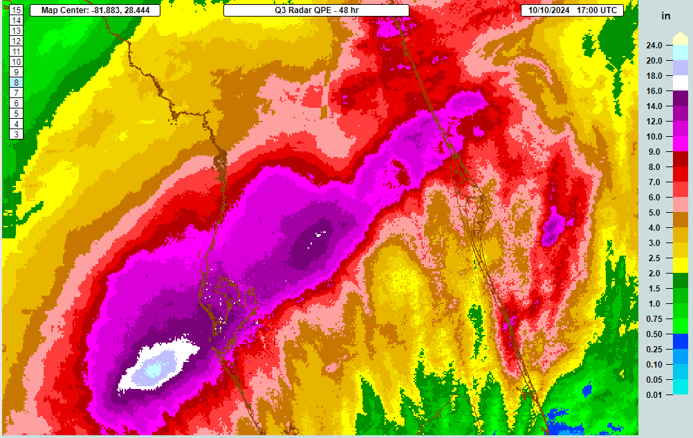
- The huge footprint of heavy, flooding rainfall. We had a wide area of rain totals that exceeded 10 inches with a 100 to 500 year return period between Tampa and Daytona Beach. The flash flooding is likely to have caused significant damage across the region.

- Then, obviously, the storm surge. How bad was it between Longboat Key, Sarasota, Siesta Key, and Venice? That’s only just now becoming clearer. It’s been tough to find hard station data but I have seen a report of 7 foot water levels near Venice, which would equate to at least 6 to 7 feet of surge. One would assume that water levels were somewhat higher to the north of there near Siesta Key and Sarasota, possibly up to 10 feet or so.
Between Milton and Helene, we’ve had a rough few weeks in the Southeast. We hope for the best for those impacted and for the recovery process to be as painless as possible.
What’s next?
In the deep Atlantic we have Hurricane Leslie that is on its last legs as it motors out to sea.
But there are hints on the models at least of a new potential disturbance in the Caribbean. This is still about a week or more out. But it seems that if something were to develop in the next 2 weeks, this is where it would happen.

While this will certainly get a lot of folks riled up, it’s important to note that with this being a week or more out, there is no guarantee anything will develop, nor is there any knowledge of where anything will go if it does develop at this point. All we can do right now is speculate that something could possibly develop in the western Caribbean in a week to 10 days. That’s a long time out, so don’t start stressing right now.
Source link