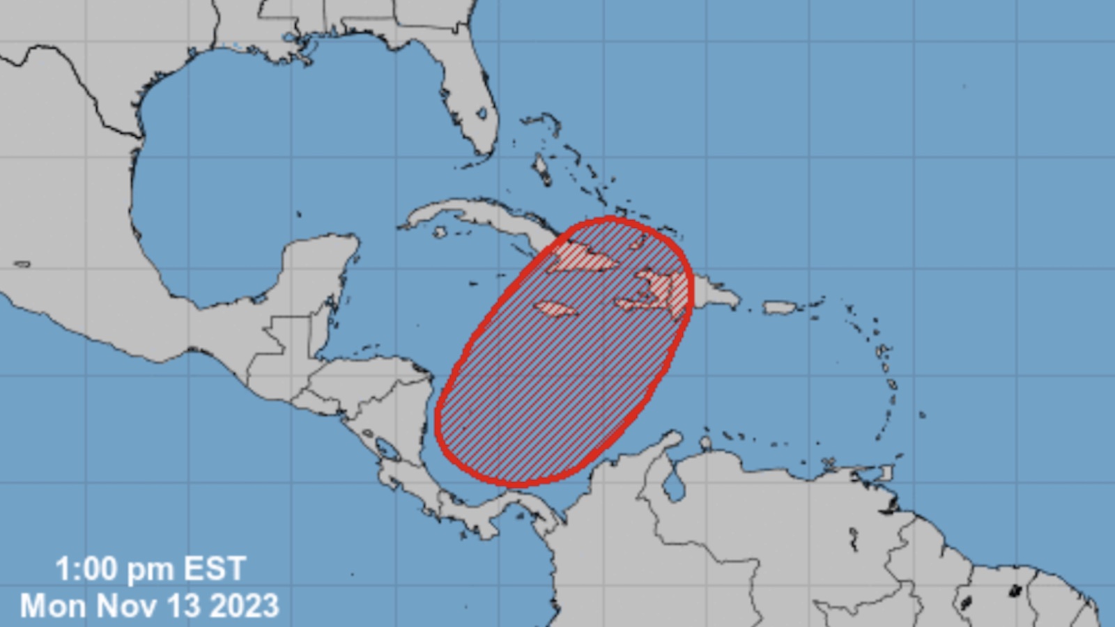
A disturbance in the Caribbean is likely to evolve into a tropical depression or tropical storm by late week, perhaps bringing dangerously heavy amounts of rain to Hispaniola and eastern Cuba as it heads northeast. In its Tropical Weather Outlook issued at 1 p.m. EST Monday, the National Hurricane Center gave this system a 70% chance of developing into at least a tropical depression in the 7-day period through Monday, November 20.

The new system is expected to emerge in the southwest Caribbean Sea, where low pressure often develops toward the end of hurricane season in October or November. As of Monday, there was little happening in this area other than scattered showers and thunderstorms (convection) associated with the Intertropical Convergence Zone. The National Hurricane Center had a near-zero chance of development through Wednesday. However, long-range forecast models are in increasing agreement that a surface low will take shape by late this week east of Nicaragua and then move northeastward through the Caribbean.
Both the GFS and European model runs from Sunday night show a tropical depression or tropical storm moving steadily northeast across the Greater Antilles over the weekend. The GFS has trended stronger than the European model. The heaviest rains would likely occur near and east of the center, possibly affecting eastern Cuba, Haiti, the Dominican Republic, and Jamaica. If strong southerly winds push into Hispaniola, then moisture will get squeezed out against the higher terrain and extreme rainfall amounts will be possible, as depicted by the GFS model run below. Haiti is heavily deforested and extremely vulnerable to flooding and mudslides from heavy rain.

The 2023 Atlantic season could run the naming table once again
The next name on this year’s Atlantic list is Vince. If the Caribbean system becomes Tropical Storm Vince, then the Atlantic will have just one name left on the 2023 list: Whitney. There’s one additional storm to take into account—a belatedly recognized subtropical storm from January—so in fact, there have already been 20 “named” storms in the Atlantic this year. The only years that were more prolific were 2020 (30 named storms), 2005 (28), and 2021 (21). In fact, Whitney is a replacement name for the retired Category 5 Wilma from 2005.
Hurricane season officially ends on November 30, but any straggler storms that develop in the Atlantic before the end of the year would be named using the 2023 list.
Welcome rains, but coastal flooding too, are on tap for Southeast Louisiana
A non-tropical low moving across the western Gulf will bring much-needed moisture to the central Gulf Coast early this week. As gale-force winds ramp up on the east side of this low, minor to moderate coastal flooding is possible across southeast Louisiana.
Multi-day rainfall totals of 2-6 inches are possible across Southeast Louisiana, southern Mississippi, southern Alabama, and the Florida Panhandle. These areas are desperate for rain after months of record and near-record heat and drought. The weekly installment of the U.S. Drought Monitor issued on November 2 showed that 73% of Louisiana was in the most dire category, exceptional drought (D4). It’s the state’s highest weekly D4 ranking since the monitor was established 23 years ago.
Accompanying the intense heat and drought have been wildfires—not only torching vegetation across the Louisiana bayou country but also drilling into the surface to set peat afire. Smoke from a 200-acre swamp fire in New Orleans East has mixed with sultry fog on several occasions to create “super fog”, leading to a horrific pile-up on Interstate 10 that killed seven motorists on October 23, and another on November 7 that killed another.
Website visitors can comment on “Eye on the Storm” posts (see comments policy below). Sign up to receive notices of new postings here.
Source link


