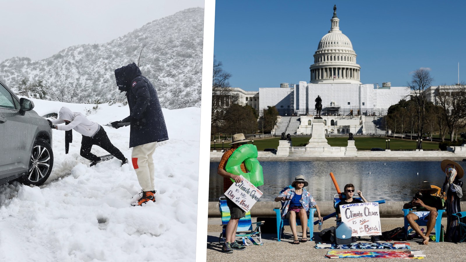
An astonishing smorgasbord of extreme weather gripped the U.S. this week, with blizzards and epic snows in the West and Northern Plains, a deadly ice storm in the Midwest, and summerlike heat in the East and South.
Fueling the contrast was a dramatic contortion of the polar jet stream across North America, with the polar jet barreling south along the West Coast and then ripping northeastward. Such an overall pattern has been in place for much of February, but it intensified dramatically this week.


The result has been amped-up temperature contrasts and high-impact winter weather, especially along and north of the intense jet stream crossing the nation.
One example: at 6 a.m. EST Thursday, Feb. 23, Denver shivered at -10 degrees Fahrenheit (-23 degrees Celsius), the coldest reading observed there so late in any winter since 1962. Meanwhile, Houston was experiencing a foggy, humid predawn at 71°F (22°C), on what turned out to be the city’s third day in a row with record-warm daily lows.
The most eyebrow-raising extreme of the week was the heat across the Southeast (see details below), which in some cases brought the warmest temperatures observed on any winter day in more than a century of record-keeping. Toward the northwest, this week’s cold wasn’t as historically noteworthy, but some of the winter weather, especially in California, qualified as a once-in-a-generation event.
In Canada, it was the geographic consistency of the cold that stood out. At one point Wednesday night, every station in Canada was at or below freezing, including coastal areas that often hover above freezing even in midwinter.
Rare blizzard warnings in the Southern California mountains
Notably intense snowfall has hit the Pacific Coast states this week, moving toward California as the offshore upper low pushes southward.
Snowfall extended to unusually low elevations across Northern California as the upper low raced past. Across Southern California, heavy sea-level rains and mammoth mountain snows were just kicking in on Friday.
Cold rains of two to five inches were predicted for lower elevations around Los Angeles from Friday into Saturday, with small hail and even brief tornadoes possible. Snowfall isn’t expected to reach as far toward sea level as it did on several occasions in the 19th and 20th centuries, though.
Higher up, the mountains of Los Angeles and Ventura counties were under blizzard warnings for the first time in more than 30 years. Snowfall rates of up to five inches an hour will bring massive accumulations at the highest elevations of two to five feet, with isolated totals as high as seven feet. Mudslides and avalanches will be serious threats.
With upper-level energy predicted to continue recharging the persistent trough near California through the end of February, mountain areas will continue to pile up some of their most bountiful snowpack in years – a major boost after 23 years of megadrought. Big years like 2022-23 will become increasingly important as climate change continues to pinch the West’s notoriously feast-or-famine snow regime: Warmer temperatures are hastening snowmelt and parching snowless landscapes more easily, raising the risk of wildfire.
As of Feb. 23, snowpack was near or above average for the date across nearly all of the western U.S., and the drought-hammered Colorado River basin was running 150-250% above average.
Heavy snow blankets the Upper Midwest
A prolonged, multiphase snowstorm hammered the Northern Plains and Upper Midwest. The worst was focused from eastern South Dakota into Upper Michigan, where the final phase of the storm was accompanied by blizzard conditions in some areas.
In the Minneapolis-St. Paul area, snow totals were a bit lower than expected, but 12 to 15 inches of snow covered the metro area, including 13.4 inches at the Minneapolis-St. Paul airport from Tuesday to Thursday, Feb. 21-23. This ranked as the city’s second-heaviest February snowstorm in 148 years of record-keeping, just behind 13.8 inches on Feb. 20-21, 2011.
A nasty ice storm hits Michigan hard
A narrow band of freezing rain brought widespread freezing rain of a quarter to half an inch to Southern Lower Michigan and surrounding regions on Wednesday and Thursday, with localized higher amounts. The ice brought down power lines and knocked out power to nearly one million customers; a downed power line killed one firefighter in Pawpaw, Michigan. On Friday afternoon, power was still out to over 700,000 customers in Michigan.
Record wintertime heat in the East and South
A record-strength ridge of high pressure over the Southeast brought summerlike heat with temperatures 30 degrees above average to multiple states on Thursday, with many cities in Tennessee, West Virginia, Florida, Georgia, Mississippi, Virginia, Alabama, and North Carolina setting all-time heat records for the month of February – or for an entire winter.
The record heat extended southward into the Caribbean, where Havana, Cuba, recorded its hottest February day on record on the 22nd, with 34.5 degrees Celsius (94°F).
On Thursday in southern Texas, the mercury shot up to 102 degrees Fahrenheit at Falcon Lake – the second-hottest February reading in U.S. history, according to extreme weather expert Maximiliano Herrera. Thursday temperatures reached as high as 92°F in Florida, 88°F in Georgia, 88°F in Mississippi, 87°F in North Carolina, 86°F in Alabama, 85°F in Virginia, 85°F in Tennessee, 81°F in Kentucky, and 79°F in Ohio. As impressive as these high temperatures were, the nighttime lows were even more extraordinary, bottoming out at summerlike levels (see Tweet below).
Extreme weather is increasing because of climate change-induced atmospheric circulation changes
This week’s extreme weather was caused by an unusually extreme configuration of the jet stream, which forms the boundary between cold, Arctic air to the north and warm, subtropical air to the south. The jet stream formed a U-shaped trough of low pressure over the Western U.S., which allowed cold surface air to spill southward into Oregon and California. Frigid upper-level air was careening far southward with the jet along the Pacific Coast on Friday.
At the same time, an inverted U-shaped ridge of high pressure set up over the Southeast, bringing clear skies and record heat. This ridge was of record strength, as measured by balloon sounding at Key West (see Tweet below).
Though the weather is naturally extreme, over-the-top patterns like we observed this week (called “global weirding” by climate scientists) have become more common in recent decades, and have been linked to human-caused climate change. In particular, the loss of Arctic sea ice is thought to be significantly affecting the global atmospheric circulation. The Arctic Ocean is mostly covered in sea ice, but the increase in global temperatures since 1979 has led to an approximately one-third drop in summer sea ice coverage — and likely a 50% drop over the past century – because of a vicious cycle called Arctic amplification. A key part of this vicious cycle is that melting of ice reveals dark seawater underneath, which absorbs more sunlight and causes more warming.
As of Thursday, Feb. 23, Arctic sea ice was roughly tied at third-lowest for the date across the 43-year period of satellite observations.
In a Thursday op-ed in The Hill, two of the best climate change communicators in the business, Susan Hassol of climatecommunication.org and climate scientist Dr. Michael Mann, explained:
“The Arctic is heating up nearly four times as fast as the rest of the globe. This reduces the temperature difference between the equator and pole, increasing disruptions of the polar vortex — a swirl of cold air in the stratosphere that circles the North Pole — and favoring a wavier winter jet stream, which is the high-altitude wind current that creates and steers weather systems from west to east. A wavier jet stream tends to swing in larger north-south meanders and travel east more slowly, bringing more frequent and persistent cold plunges over the United States. A warming ocean may also be leading to more intense Nor’easters and coastal winter storms that bring large snowfalls and bitter cold snaps.”
In closing, the authors argue:
“We dislike hearing the phrase ‘new normal’ attached to our increasingly wild weather. There is nothing normal about what’s happening, just as there is nothing ‘natural’ about the weather disasters we now experience. Another reason we reject the phrase ‘new normal’ is that it implies that we’ve reached a new steady state, when in fact things will continue to get worse until we eliminate heat-trapping pollution.”
Website visitors can comment on “Eye on the Storm” posts (see comments policy below). Sign up to receive notices of new postings here.
Source link