
Headlines
- Quiet for the next 5 days in the Atlantic.
- Continuing to watch a potential tropical wave later next week in the Western Atlantic.
Watching the next wave
Hello from 35,000 feet! Just scoping out the atmosphere on my way back to the Gulf Coast. Anyway, let’s take a look at what’s doing in the tropics heading into another summer weekend
The National Hurricane Center has a clean outlook map for the next 7 days across the Atlantic. There has been some noise coming from some models for this wave in the far eastern Atlantic today.
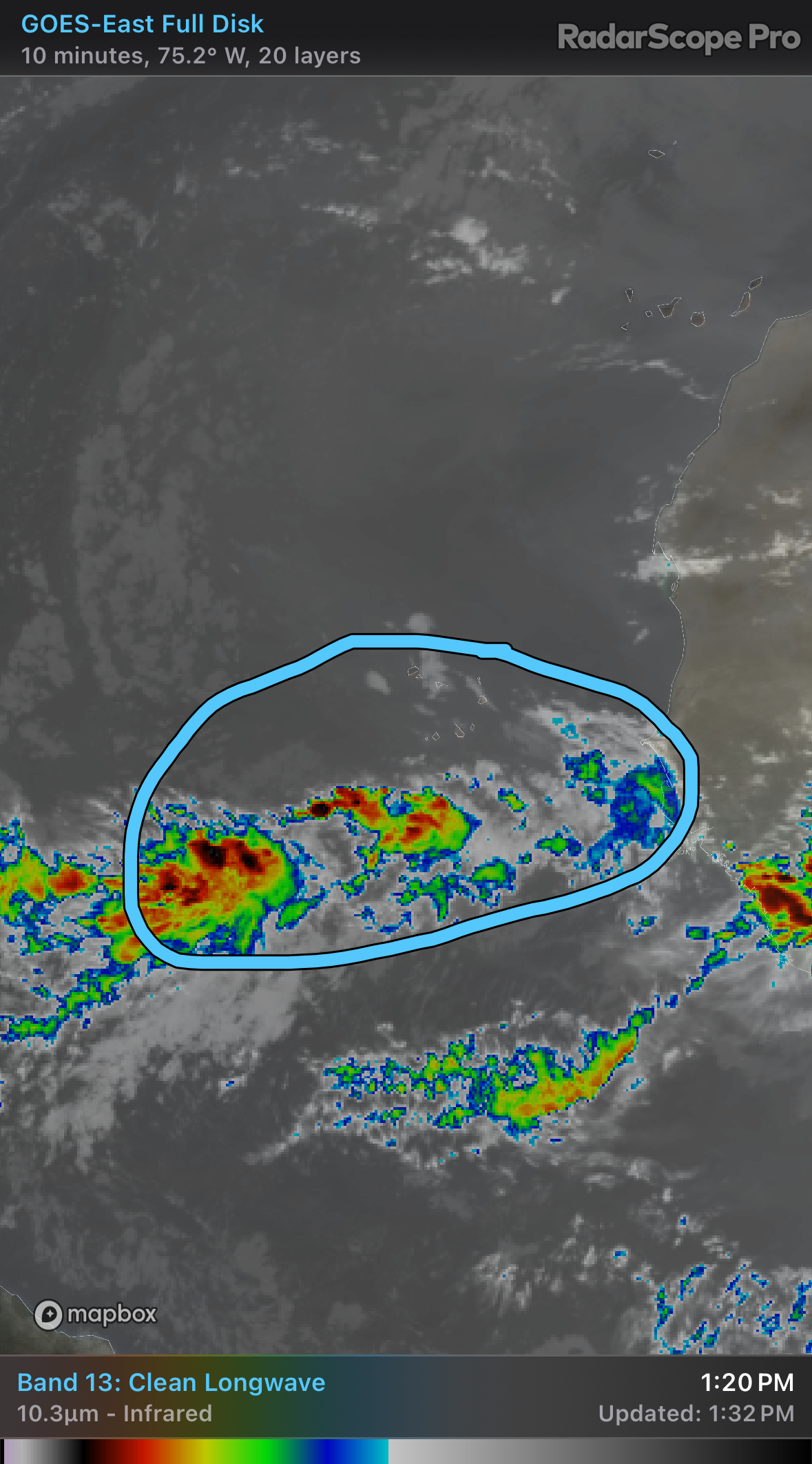
The wave is currently in an atmosphere that is dominated by dust. Or at least the road in front of it is. As the wave approaches the Caribbean or southwest Atlantic later next week, it will have some dry air to fend off. The forecast from last night’s European model shows this rather well. I’m using this to illustrate what the environment may be like when it gets to that general location, not where I think it will specifically be or what it will exactly look like. So take this with a grain of salt. Or Saharan dust.
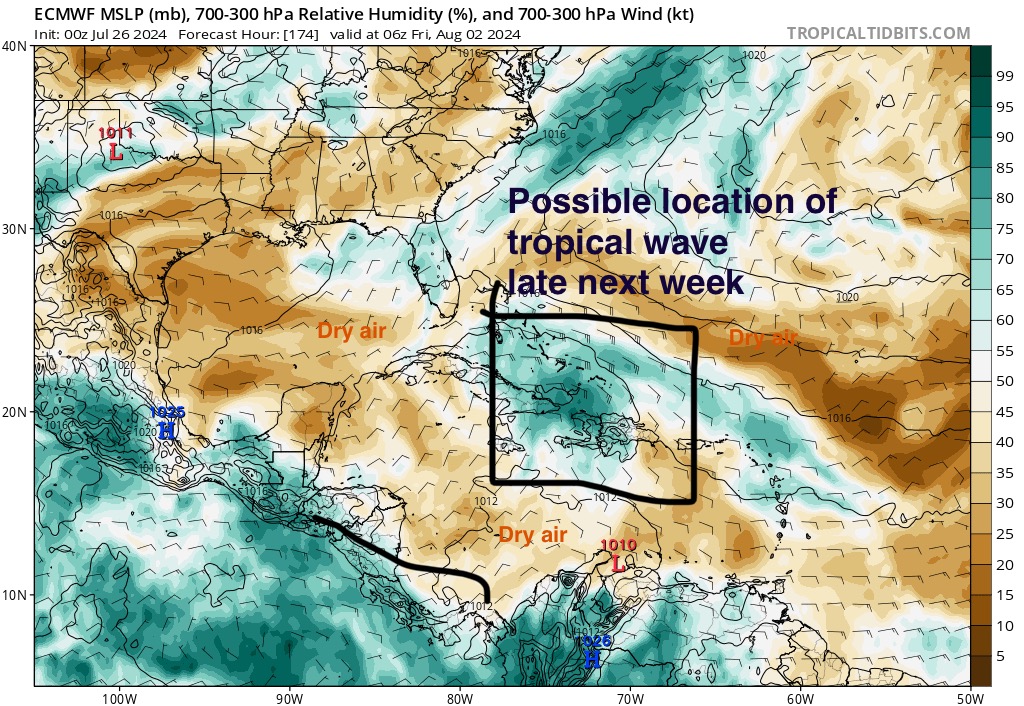
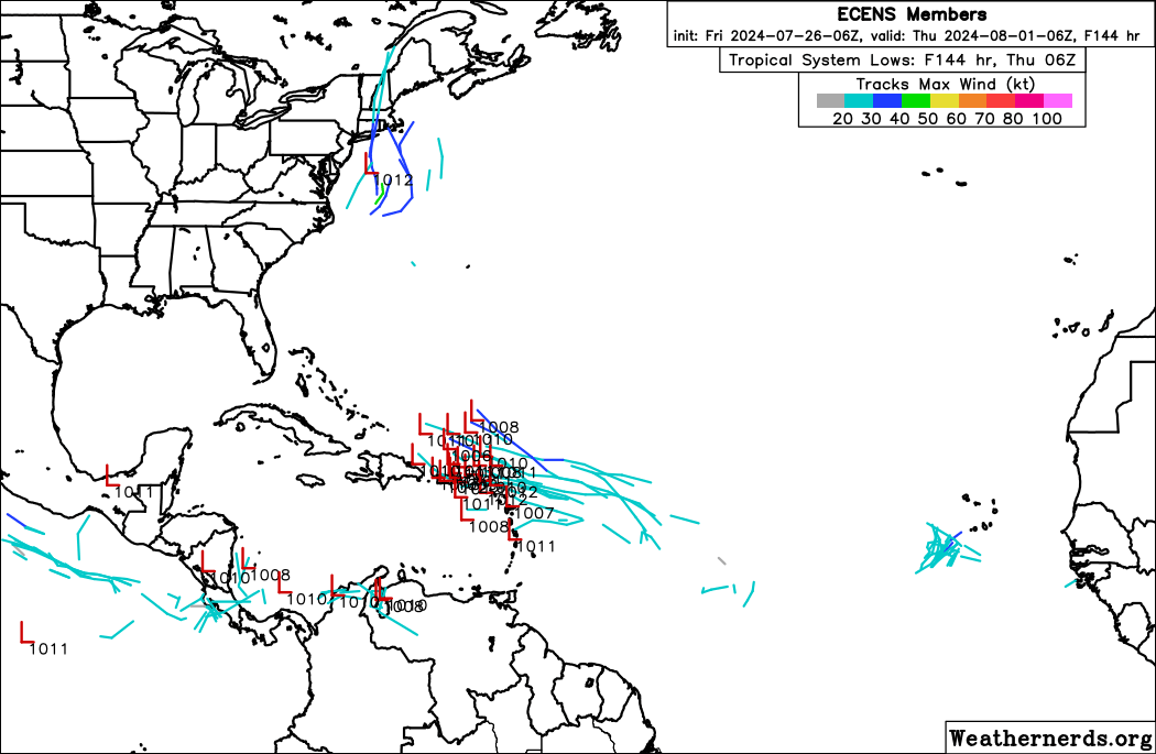
So yeah, this probably bears a bit of watching. But there is nothing to say that this will definitely develop into something yet. Ensemble support for this is growing somewhat, though again, no models really shoot this to the moon yet. Still, with a tropical wave in a marginally favorable environment in early August, I will at least continue to watch this.
Outside of that, we continue to watch for the August increase. There are no other specific concerns we see at this time. Let’s check back in on this tomorrow or Sunday.
Source link