In brief: Forecasts through the day today have tended to trend toward an even more impactful storm from Delmarva through southern New England tomorrow and Monday. Major snow, powerful winds, and major coastal flooding have all escalated a bit since this morning.
There have continued to be a few changes today to the forecast with respect to the East Coast blizzard that will begin bearing down in about 12 to 18 hours. As a radio DJ said in college ahead of the Presidents’ Day storm of 2003, “we’ve upped our totals, now up yours.”
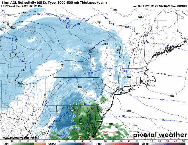
The expanse of snow seems to have grown a bit. It’s certainly expanded a bit more north and west. You can see this by looking at snow totals across New York, New Jersey, and Pennsylvania.
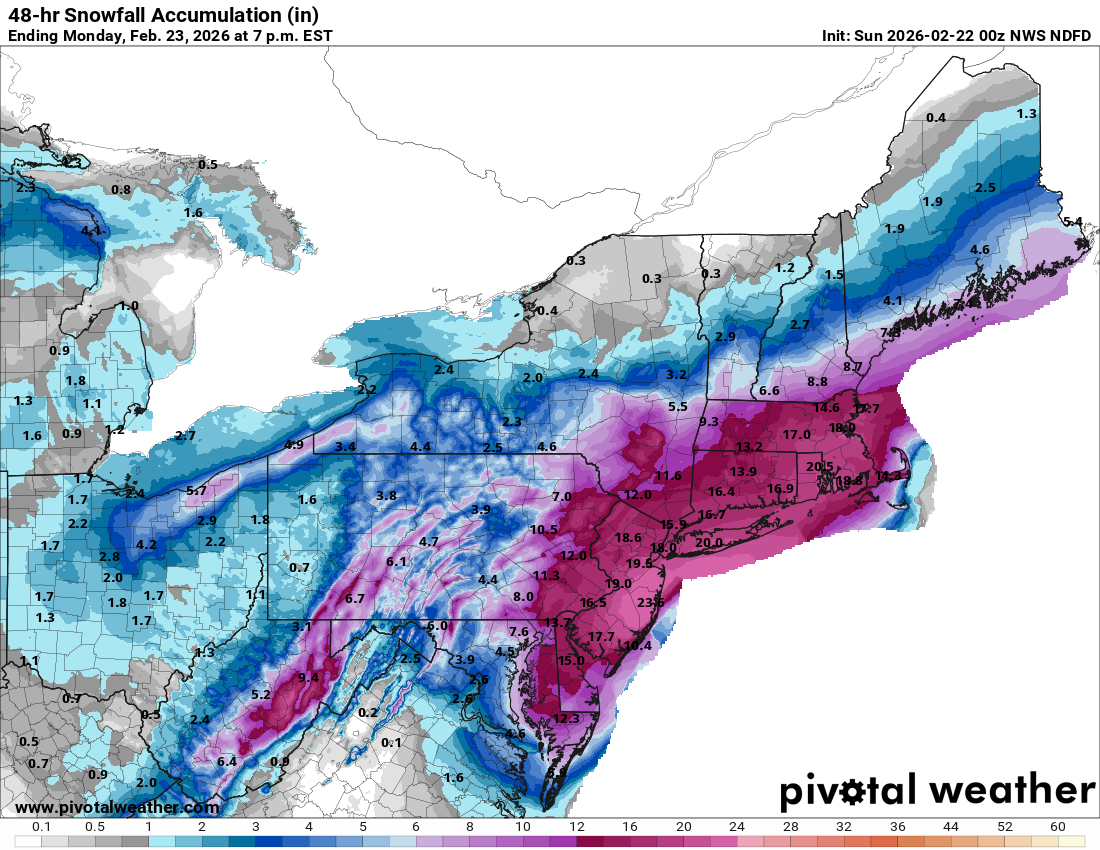
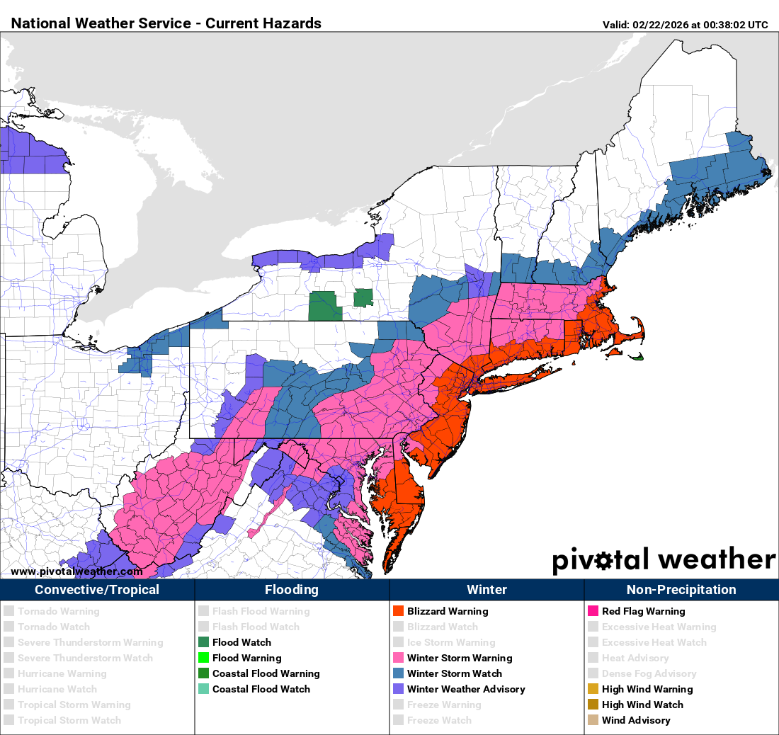
It now appears that the one-foot line will extend to the north of Boston out through Poughkeepsie and south into Allentown and possibly into much of Delaware now. Blizzard Warnings have also been expanded through the day today, now covering a huge area from Boston through the length of Delmarva.
Additionally, it seems that the wind forecasts have ratcheted up some since earlier today too. Here is one ensemble model, the HREF and its probability of wind gusts hitting 65 mph or higher through the event.
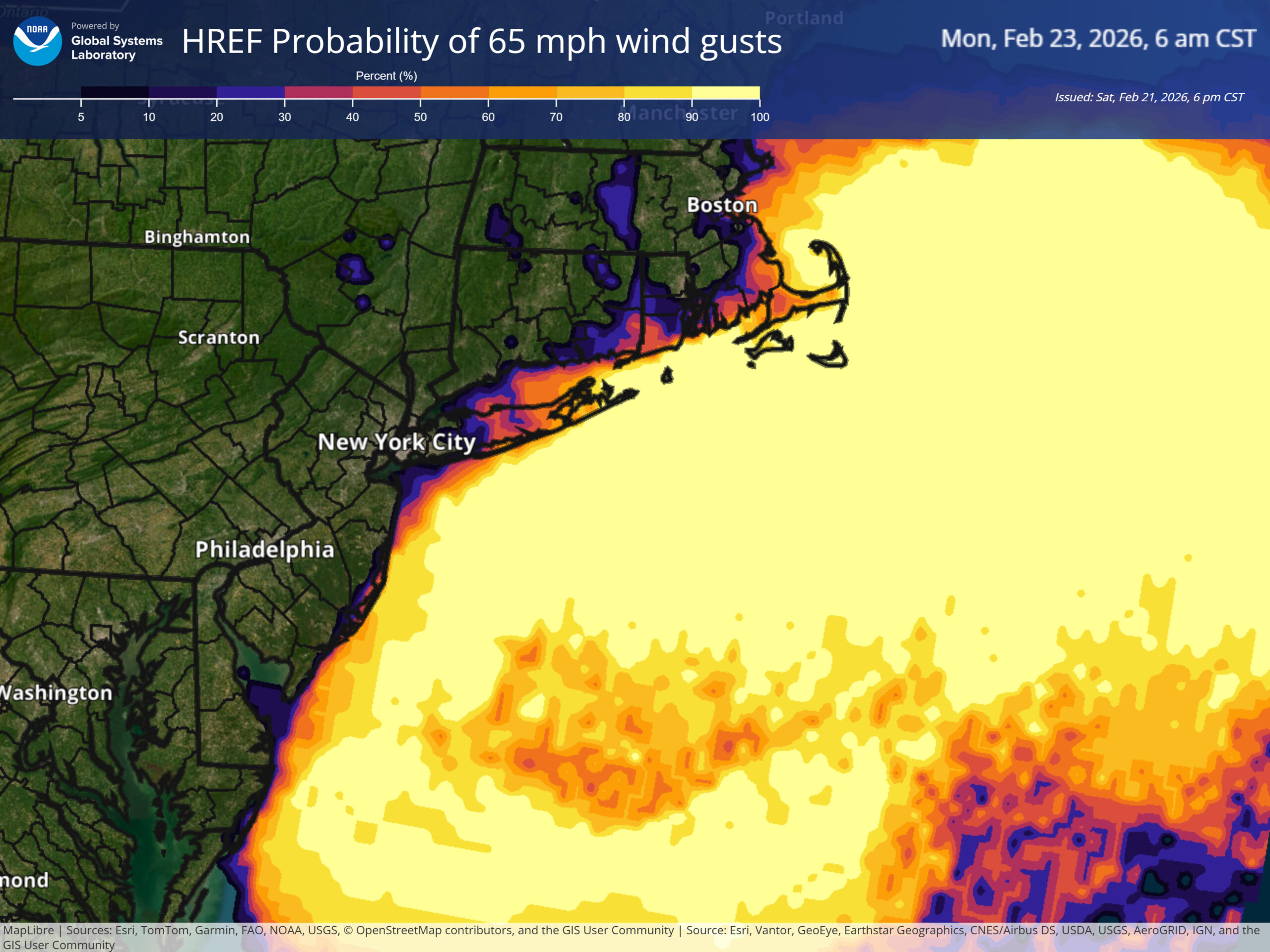
Those probabilities are quite high. These winds may locally cause some damage, particularly on the immediate coastline, with numerous power outages possible near the coast as well.
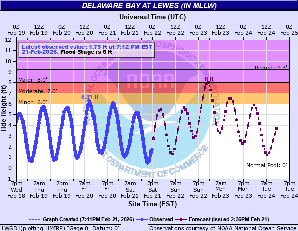
Another notch upward came via tidal flooding outlooks today. There is now likely to be some pockets of major coastal flooding from Delaware through Long Island. For example, the gauge at Lewes, DE is now expected to hit 8 feet with Sunday night’s high tide cycle. This would be the highest since the January 2016 blizzard.
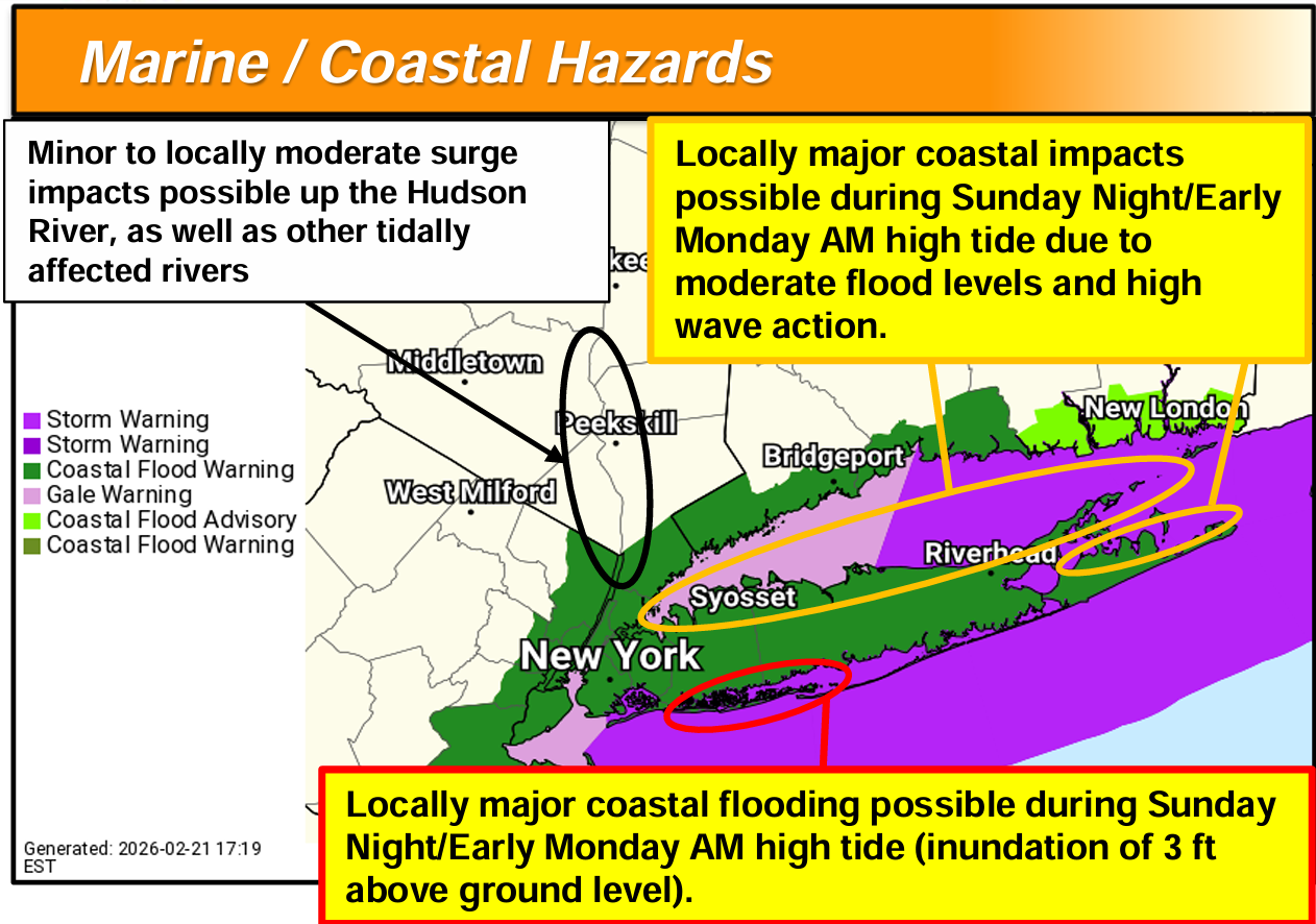
The NWS in New York City is highlighting the potential for significant coastal flooding for portions of southwest Long Island in particular.
By the way, a pro-user tip: Go to your local NWS forecast office and read the briefing packages they put up during events like this. These are primarily geared toward media and emergency manager partners, but they contain a metric ton of information for the local area, including some very useful details on forecast uncertainties. Some offices make this easy to find. Others do not. But with enough digging, you can find them.
One other note: This is likely to be fairly wet snow, which makes shoveling a little more stressful. Please exercise caution when clearing the sidewalks. Your risk of a heart attack increases substantially when dealing with this sort of snow. As we tell people here in Houston when it gets a little extra hotter than usual in summer: Don’t underestimate the impact these more extreme events can have on personal health risks.
I had seen some comparisons to the Blizzard of 1978 (the New England one, not the Midwest one) thrown around, which seems, kind of reasonable? No two storms are identical, and indeed this storm’s track will not be identical to that one, nor will the snow totals be identical. But just including that as an analog puts this storm in rarefied air.

We are probably looking at a memorable, if not historic storm for the coast from Delmarva through southern New England. This one appears to be one for the books.
Source link