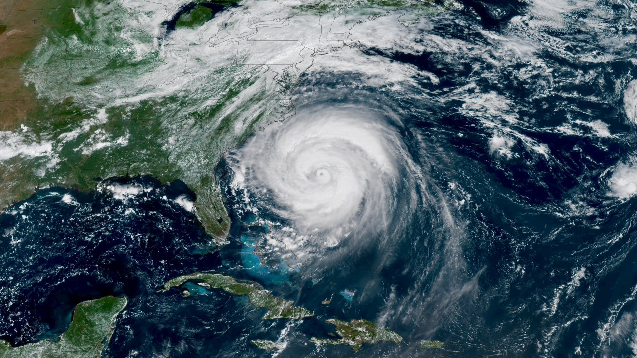
Inland flooding broadens a hurricane’s danger to the millions of people who don’t live along the coast. Hurricanes can weaken to their “death”, yet the trillions of gallons of rain they brought with them remain. Tropical storms that do not reach hurricane status can still be very dangerous, causing heavy rainfall that increases the risk of inland flooding and mudslides in steep terrain.
Here, we explore what inland flooding looks like and how you can be prepared.
The immediate rain
On average, tropical cyclones bring more than 6 inches of rain to thousands of square miles after hitting land. This can quickly cause flooded roadways, swollen rivers, and dangerous flash floods — or floods that form in a matter of minutes.
While water rescue teams are prepared for this, there are often too many rescues for them to do in such inclement weather. This leads to residents becoming trapped in homes until the weather improves, or until the water goes down. This can take days or even weeks.
How it becomes catastrophic
Inland flooding is exacerbated by three main factors: urbanization, topography, and concurrent weather systems.
Highly urbanized areas often have a difficult time draining off water thanks to concrete, which causes runoff rather than drainage. If draining systems are not properly located, cleaned, or designed, they can quickly back up and cause flooding in densely populated areas.
Topography is perhaps the biggest amplifier of heavy rains. Mountainous terrain funnels all water into nearby streams and rivers, causing them to swell quickly. This also loosens mountain soil, making landslides more likely to occur.
Finally, other weather systems can combine with a tropical cyclone or its remnants, adding to the total rainfall or simply ‘stalling’ the storm system. This causes it to train over the same areas, bringing heavy rain for days on end that quickly overwhelm all waterways and drainage systems.
Why strength is not necessarily an indicator of rainfall amounts
Tropical cyclones — regardless of their strength — have an ability to hold extremely high amounts of water. All tropical cyclones form over the water, where the atmosphere is primed for holding water until it can’t anymore. The cycle is never ending, and any tropical system that makes landfall pushes all of this moisture over land.
It is for this reason that the strength of a tropical depression, tropical storm, or hurricane at landfall is not the most important factor when it comes to rainfall potential.
‘PWAT’, or Precipitable Water, is a scientific measure of how much water a column of the atmosphere can hold and ultimately ‘rain out’. This value demonstrates just how much water vapor hurricanes can hold. The average global PWAT offsite link is 0.85 inches (generally dry), while hurricanes can have PWAT values upwards of 3 inches (extremely saturated).
Historic examples
The most recent example of deadly inland flooding came from Hurricane Helene in 2024. Before making landfall, Helene was preceded by a stalled cold front that brought 4-6 inches of rain across the Appalachian Mountains of North Carolina. Once Helene made landfall in Florida, it travelled northward into that very region, where it was ‘caught’ by the cut-off low associated with the prior system. This caused days of heavy rain on top of already-saturated soil, leading to a flooding catastrophe in the region. 107 fatalities occurred in the region alone.
In 2021, Hurricane Ida made a devastating Category 4 landfall in Louisiana. However, the worst of the flooding came in the Northeast. Up to ten inches of rain fell along the I-95 corridor, leading to historic flooding across the region. New York City saw dozens of apartment building basements flooded while residents struggled to escape. 43 people lost their lives across the Northeast even though it was only Ida’s remnants that moved through the area.
In 2017, Hurricane Harvey rewrote the record books. A Category 4 landfall was only the start of a nightmare for southeast Texas. Harvey ‘stalled’, or remained stationary, for over four days. Rain totals over 60 inches were recorded, flooding the Houston metro and all surrounding areas. The storm cost $160 billion, making it the 2nd costliest of all time only behind Hurricane Katrina in 2005.
Source link