|
|
| Mesoscale Discussion 2287 | |
| < Previous MD | |

|
|
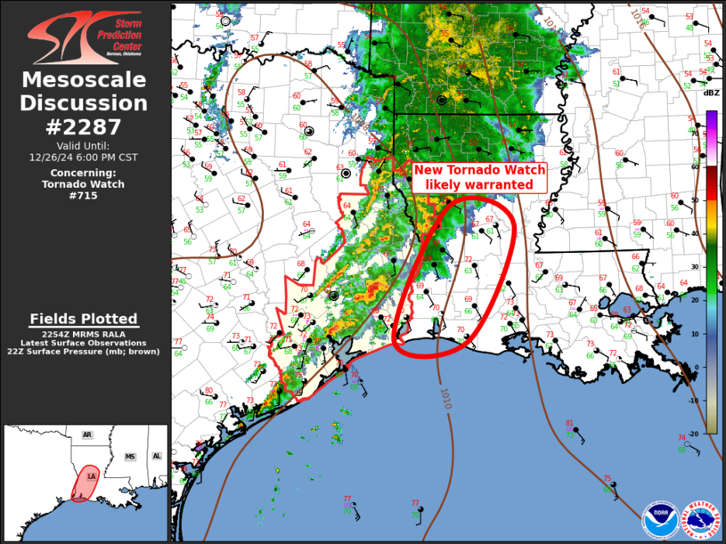
Mesoscale Discussion 2287 NWS Storm Prediction Center Norman OK 0457 PM CST Thu Dec 26 2024 Areas affected...Louisiana Concerning...Tornado Watch 715... Valid 262257Z - 270000Z The severe weather threat for Tornado Watch 715 continues. SUMMARY...Severe threat is expected to spread into central and southern Louisiana this evening. New tornado watch appears warranted. DISCUSSION...Strong, negative-tilt short-wave trough is ejecting across east TX early this evening. 500mb speed max is forecast to translate across northern LA which will encourage LLJ to shift north across the lower MS over the next 3-6hr. As this occurs, warm sector will recover a bit across LA, especially southwestern LA where surface dew points are rising through the mid 60s. This will contribute to near-surface based buoyancy, that appears adequate, for maintaining ongoing, upstream supercell activity. Latest radar data depicts several longer-lived supercells over southeast TX that will track northeast into a strongly sheared air mass, just east of ww715. This evolving risk likely warrants a new tornado watch immediately downstream. ..Darrow.. 12/26/2024 ...Please see www.spc.noaa.gov for graphic product... ATTN...WFO...JAN...LCH...SHV... LAT...LON 29739399 31679308 31409199 29729276 29739399 |
|
|
Top/All Mesoscale Discussions/Forecast Products/Home |
|
Source link


