|
|
| Mesoscale Discussion 2273 | |
| < Previous MD | |

|
|
   Mesoscale Discussion 2273
   NWS Storm Prediction Center Norman OK
   0948 AM CST Thu Dec 19 2024

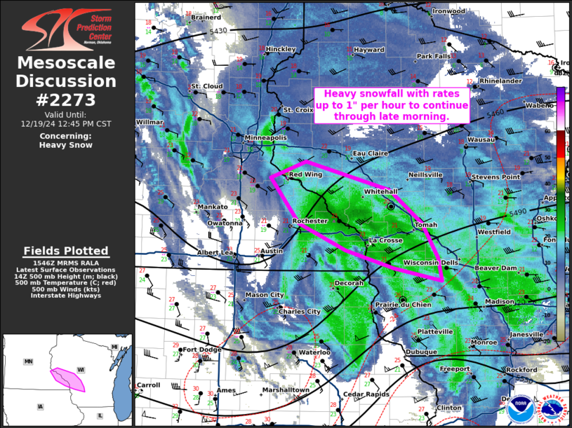
   Areas affected...far southeastern Minnesota into west-central
   Wisconsin

   Concerning...Heavy snow

   Valid 191548Z - 191845Z

   SUMMARY...Areas of heavy snow with rates around 1" per hour to
   continue through the late morning.

   DISCUSSION...Bands of moderate to heavy snow are ongoing across
   portions of southeastern MN into west-central WI. The heaviest snow
   appears to be focused near the MN/WI/IA border where upper-level
   divergence from a mid-level shortwave is leading to greater forcing
   amid deep moist convergence. HREF guidance indicates that rates will
   come down into the afternoon as upper-level support shifts
   southward, before the backside of the low shifts across the region
   later in the afternoon/evening when rates may increase again.

   ..Thornton.. 12/19/2024

   ...Please see www.spc.noaa.gov for graphic product...

   ATTN...WFO...MKX...ARX...MPX...

   LAT...LON   44769223 44589279 44049233 43749159 43529082 43379004
               43649010 44049035 44439087 44769223
|
|
|
Top/All Mesoscale Discussions/Forecast Products/Home |
|


