|
|
| Mesoscale Discussion 2259 | |
| < Previous MD | |

|
|
   Mesoscale Discussion 2259
   NWS Storm Prediction Center Norman OK
   0215 AM CST Wed Dec 11 2024

   Areas affected...Southern Maine

   Concerning...Freezing rain

   Valid 110815Z - 111215Z

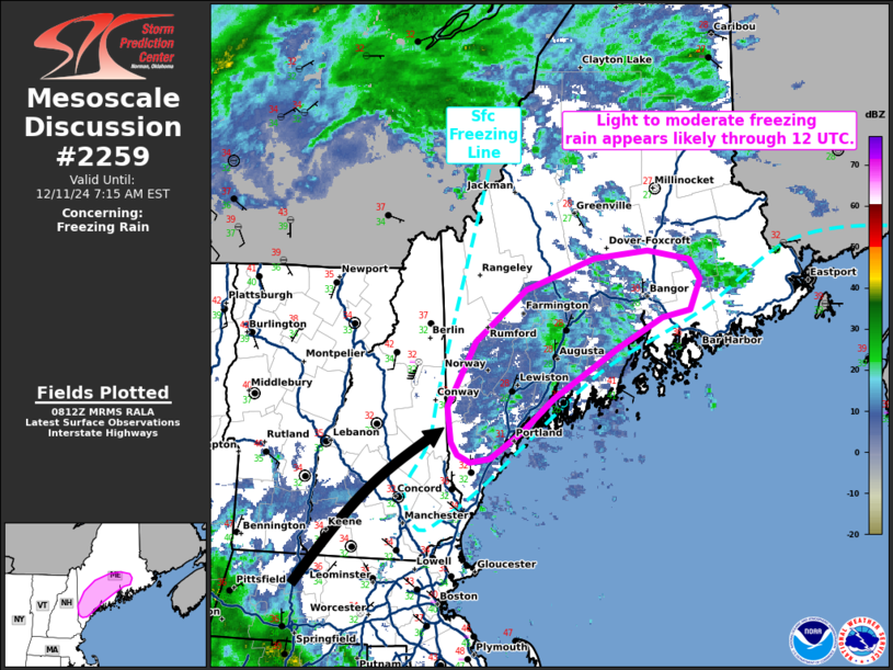
   SUMMARY...Light to moderate freezing rain appears likely through 12
   UTC across parts of southern Maine.

   DISCUSSION...Recent surface observations from southern ME have
   reported a wintry mix of light freezing rain and snow over the past
   hour as light precipitation migrates over the region. The 00 UTC GYX
   sounding sampled sub-freezing surface temperatures in the upper 20s
   with a 2 C warm nose at around 850 mb. This warm nose is expected to
   intensify through 12 UTC, amid strengthening low to mid-level warm
   air advection, within the warm conveyor belt of an intensifying
   cyclone. This should promote a change over from a wintry mix to
   predominantly liquid hydrometeors over the next couple of hours.

   Latest surface analyses/observations show the surface warm front
   remains well displaced to the south, so the shallow sub-freezing
   layer should remain in place through sunrise. Light precipitation
   should continue as isentropic ascent increases, but precipitation
   rates will increase closer to 10-12 UTC as a broader plume of
   stratiform rain (associated with deeper large-scale ascent and
   closer to the surface warm front) migrates from New England
   northeast into southern ME. It remains unclear how surface
   temperatures will respond as this precipitation approaches, given
   the coincident arrival of the surface warm front. However, latest
   high-res guidance suggests the sub-freezing layer will persist long
   enough to realize moderate freezing rain rates between 10-12 UTC,
   especially within deeper valleys.

   ..Moore.. 12/11/2024

   ...Please see www.spc.noaa.gov for graphic product...

   ATTN...WFO...CAR...GYX...

   LAT...LON   43927097 44437066 44847012 45106936 45156876 45096831
               44936819 44696829 44626860 44386910 43996980 43727015
               43517051 43487072 43547087 43647093 43927097
|
|
|
Top/All Mesoscale Discussions/Forecast Products/Home |
|


