|
|
| Mesoscale Discussion 2255 | |
| < Previous MD | |

|
|
   Mesoscale Discussion 2255
   NWS Storm Prediction Center Norman OK
   0534 AM CST Tue Dec 10 2024

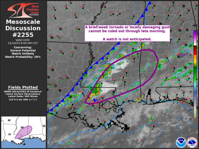
   Areas affected...parts of eastern Louisiana into southern
   Mississippi and southwest Alabama

   Concerning...Severe potential...Watch unlikely

   Valid 101134Z - 101400Z

   Probability of Watch Issuance...20 percent

   SUMMARY...A brief/weak tornado or locally damaging gust may occur
   during the next several hours. Coverage of severe is not expected to
   warrant a watch.

   DISCUSSION...A slow-moving cold front currently extends from
   southwest LA into central and northeast MS, with generally weak
   surface winds. However, storms have increased in coverage near and
   just ahead of the boundary within the moistening air mass.

   Surface analysis shows dewpoints in the upper 60s F to near 70 F,
   along with 1-1.5 mb 2-hr pressure falls into southwest MS. Winds
   around 850 mb are around 30 kt out of the southwest, with 0-1 km SRH
   across the warm sector generally from 100 to 150 m2/s2. MUCAPE per
   objective analysis is generally in the 500-1000 J/kg range.

   In aggregate, the marginal instability, shear, and ascent may remain
   sufficient for a low risk of a brief tornado or locally damaging
   gusts over the next few hours as storms develop east/northeast
   across MS and into western AL. Instability may not be strong enough
   to support very long-lived supercells, but a QLCS-type tornado may
   occur in association with the stronger outflows.

   ..Jewell.. 12/10/2024

   ...Please see www.spc.noaa.gov for graphic product...

   ATTN...WFO...BMX...MOB...JAN...LIX...

   LAT...LON   30309133 31769032 32218966 32708834 32628768 32248746
               31898755 31128830 30319065 30239105 30309133
|
|
|
Top/All Mesoscale Discussions/Forecast Products/Home |
|


