|
|
| Mesoscale Discussion 2248 | |
| < Previous MD | |

|
|
   Mesoscale Discussion 2248
   NWS Storm Prediction Center Norman OK
   0340 PM CST Wed Dec 04 2024

   Areas affected...East-central Wisconsin into parts of
   central/southern Lower Michigan

   Concerning...Snow Squall

   Valid 042140Z - 050045Z

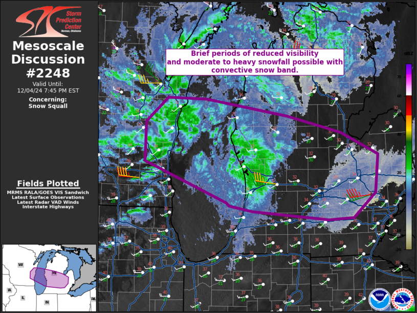
   SUMMARY...Reduced visibility, moderate to heavy snow, and strong
   wind gusts are possible with a shallow convective line of snow along
   the quickly advancing cold front.

   DISCUSSION...A line of semi-organized, shallow convective snow has
   continued across eastern Wisconsin. Recent surface observations from
   Fond du Lac/Oshkosh and vicinity show moderate to heavy snowfall and
   visibility reduced to around 1/4 mile in some locations. Wind gusts
   of 40+ kts remain possible as well per surface observation and
   regional VAD wind profiles. Given the strong frontal forcing, the
   expectation is for this line to continue across Lake Michigan and
   eventually impact portions of central/southern Lower Michigan. Some
   southward expansion of the line is possible, but this should be
   limited by much warmer temperatures in northeast Illinois into
   northern Indiana.

   ..Wendt.. 12/04/2024

   ...Please see www.spc.noaa.gov for graphic product...

   ATTN...WFO...DTX...APX...GRR...GRB...MKX...

   LAT...LON   43878842 44268793 44248708 43978529 43708411 43358328
               42738336 42328383 42308438 42448605 42538657 42588662
               43238842 43878842
|
|
|
Top/All Mesoscale Discussions/Forecast Products/Home |
|


