|
|
| Mesoscale Discussion 2245 | |
| < Previous MD | |

|
|
   Mesoscale Discussion 2245
   NWS Storm Prediction Center Norman OK
   0608 PM CST Thu Nov 28 2024

   Areas affected...Inland portions of Maine

   Concerning...Heavy snow

   Valid 290008Z - 290515Z

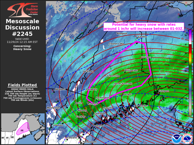
   SUMMARY...The potential for banded heavy snow with rates around 1
   inch per hour will increase across inland portions of Maine between
   01-03Z and persist through at least 06Z.

   DISCUSSION...Surface observations and mosaic radar data indicate
   light to moderate snow falling across inland portions of Maine,
   where surface temperatures are hovering around 32-33 deg F. This
   broad area of snow is being driven by a plume of moderate low-level
   warm advection to the north of a gradually deepening surface low
   tracking north-northeastward off the southern New England coast.

   Over the next few hours, a negatively tilted midlevel impulse --
   evident in water-vapor imagery -- will continue northeastward across
   southern Maine. This will favor strengthening deep-layer ascent to
   the north of the deepening surface low, where the ascending branch
   of a strengthening frontogenetic circulation should intercept the
   base of a deep/saturated dendritic growth zone. Despite somewhat
   marginal low-level temperatures, this should yield several hours of
   banded heavy snow with rates around 1 inch per hour (locally
   higher). The onset of the heavy snow is generally expected in the
   01-03Z timeframe, and should persist through at least 06Z while
   spreading northeastward.

   ..Weinman.. 11/29/2024

   ...Please see www.spc.noaa.gov for graphic product...

   ATTN...WFO...CAR...GYX...

   LAT...LON   45497004 45097043 44707058 44477017 44916894 45166782
               45566733 46666763 46756807 46316891 45497004
|
|
|
Top/All Mesoscale Discussions/Forecast Products/Home |
|
Source link


