|
|
| Mesoscale Discussion 2235 | |
| < Previous MD | |

|
|
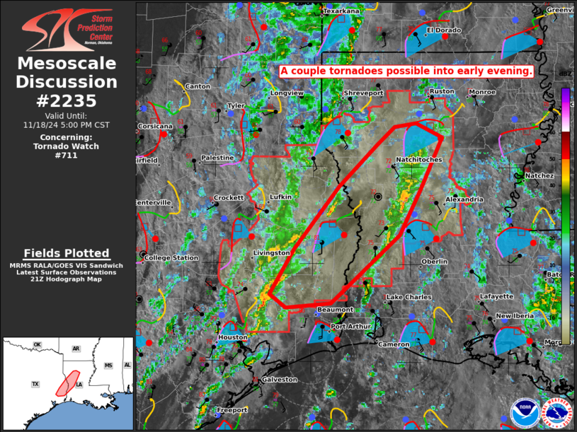
Mesoscale Discussion 2235 NWS Storm Prediction Center Norman OK 0329 PM CST Mon Nov 18 2024 Areas affected...southeast TX and western LA Concerning...Tornado Watch 711... Valid 182129Z - 182300Z The severe weather threat for Tornado Watch 711 continues. SUMMARY...A couple tornadoes are possible through early evening with semi-discrete warm-sector storms ahead of an eastward-moving cold front. DISCUSSION...Deep convection intensified during the past hour with multiple supercells ahead of a cold front marching east in Deep East to southeast TX. The most favorable thermodynamic/kinematic environmental overlap through 01Z appears to be centered on the Sabine Valley. Here, surface winds remain southerly amid increasing low-level flow from south to north. Surface temperatures within this corridor are approaching the low 80s from the west, with dew points holding in the low to mid 70s. Ongoing semi-discrete storms across southeast TX will have the opportunity to maintain sustained supercell structures. Low-topped convection over western LA might intensify as well, but seemingly the more probable severe threat should emanate from the southeast TX storms before these cells get undercut by the impinging cold front. ..Grams.. 11/18/2024 ...Please see www.spc.noaa.gov for graphic product... ATTN...WFO...LCH...SHV...HGX... LAT...LON 30319470 30819439 31529379 31989331 32179307 32229279 32069245 31489274 30979301 30209390 30169449 30319470 |
|
|
Top/All Mesoscale Discussions/Forecast Products/Home |
|


