|
|
| Mesoscale Discussion 2231 | |
| < Previous MD | |

|
|
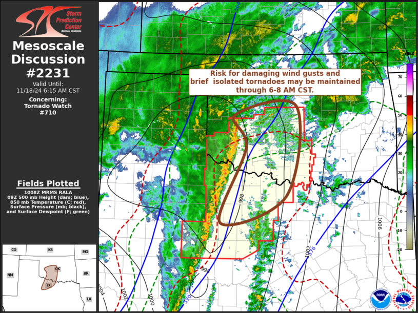
Mesoscale Discussion 2231 NWS Storm Prediction Center Norman OK 0409 AM CST Mon Nov 18 2024 Areas affected...parts of northwestern Texas and southwest into central Oklahoma Concerning...Tornado Watch 710... Valid 181009Z - 181215Z The severe weather threat for Tornado Watch 710 continues. SUMMARY...A narrow squall line may continue to pose a risk for localized damaging wind gusts and isolated brief tornadoes while approaching the I-35 corridor, including the Oklahoma City metro, through 6-8 AM CST. DISCUSSION...A narrow, strongly forced squall line, with embedded meso-gamma scale cyclonic circulations continues propagating north-northeastward into/across the Red River Valley vicinity. Downstream of mid-level troughing taking on a more negative tilt into and through the Texas South Plains, models indicate that this may be maintained at least into the 12-14Z time frame. Although boundary-layer instability remains limited across southwest Oklahoma into the I-35 corridor of central Oklahoma, stronger surface pressure falls in advance of the deepening surface cyclone may allow for sufficient boundary-layer warming and moistening to maintain a risk for damaging wind gusts and additional brief tornadoes. ..Kerr.. 11/18/2024 ...Please see www.spc.noaa.gov for graphic product... ATTN...WFO...FWD...OUN...SJT... LAT...LON 35549918 35769737 33589767 32939957 34769884 35549918 |
|
|
Top/All Mesoscale Discussions/Forecast Products/Home |
|


