|
|
| Mesoscale Discussion 2223 | |
| < Previous MD | |

|
|
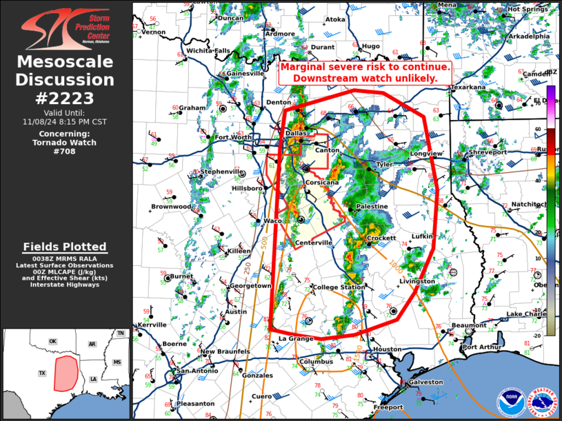
Mesoscale Discussion 2223 NWS Storm Prediction Center Norman OK 0640 PM CST Fri Nov 08 2024 Areas affected...northern/eastern Texas Concerning...Tornado Watch 708... Valid 090040Z - 090215Z The severe weather threat for Tornado Watch 708 continues. SUMMARY...Marginal risk for wind/hail continues. A downstream watch is not anticipated at this time. DISCUSSION...A line of thunderstorms is ongoing across a front crossing through northeastern Texas, with a few cells ahead of the line. Trends have continued to favor weakening thunderstorm activity, with occasional weakly organized cells ahead of the line. Overall, the severe risk has been mitigated by displacement of better forcing aloft and shear to the north across far northern Texas/southern Oklahoma away from surface-based instability. A few instances of hail and damaging wind may be possible with cells ahead of the line through the next couple of hours. Overall, the risk remains isolated and a downstream watch is unlikely to be needed at this time. ..Thornton/Gleason.. 11/09/2024 ...Please see www.spc.noaa.gov for graphic product... ATTN...WFO...LCH...SHV...HGX...FWD...EWX... LAT...LON 32629686 33179679 33459563 33419514 33089448 32059427 31229435 30619466 30239495 30029562 29969617 30039661 30109699 32629686 |
|
|
Top/All Mesoscale Discussions/Forecast Products/Home |
|


