|
|
| Mesoscale Discussion 2219 | |
| < Previous MD | |

|
|
   Mesoscale Discussion 2219
   NWS Storm Prediction Center Norman OK
   0623 AM CST Fri Nov 08 2024

   Areas affected...southeast Colorado...far northeast New Mexico...and
   the western OK Panhandle.

   Concerning...Heavy snow

   Valid 081223Z - 081630Z

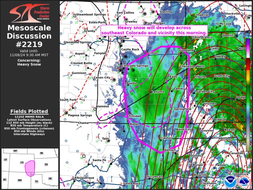
   SUMMARY...Heavy snow will develop across southeast Colorado and
   vicinity this morning.

   DISCUSSION...An upper-level low across New Mexico has started to
   become negatively tilted this morning. As this has occurred, a broad
   region of ascent has overspread the southern Plains, evidenced by
   widespread lightning activity. In addition, strong frontogenesis
   across the Texas Panhandle has resulted in a more focused region of
   ascent. The heavier precipitation associated with this enhanced area
   of UVV will migrate northwestward into the cold airmass across
   southeast Colorado over the next few hours. In addition, a easterly
   low-level jet, currently around 35 knots (per DDC VWP) and expected
   to strengthen to around 45 knots, will result in strengthening
   isentropic ascent. The combination of these factors will result in a
   favorable region across southeast Colorado and vicinity with
   snowfall rates of 1 to 2 inches per hour, likely starting between
   13Z and 14Z.

   ..Bentley.. 11/08/2024

   ...Please see www.spc.noaa.gov for graphic product...

   ATTN...WFO...DDC...GLD...AMA...PUB...BOU...ABQ...

   LAT...LON   36440403 37140450 38360471 38920453 39550311 39530235
               39220194 38040196 36830208 36290236 36020315 36440403
|
|
|
Top/All Mesoscale Discussions/Forecast Products/Home |
|


