Headlines
- Tropical Storm Rafael is likely to become a hurricane soon.
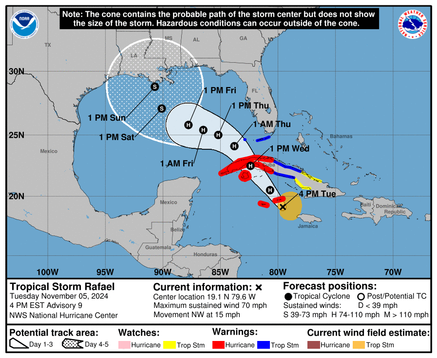
- It is moving through the Cayman Islands and will approach Cuba tomorrow with hurricane conditions there.
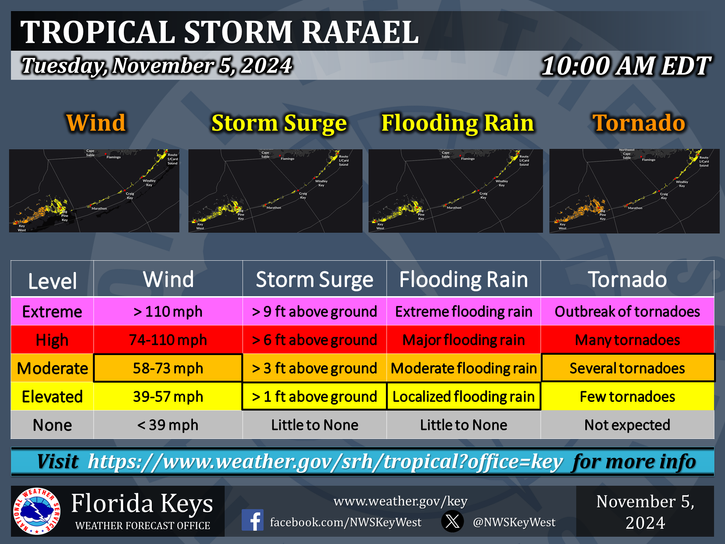
- The Florida Keys will experience tropical storm conditions tomorrow and tomorrow night as Rafael passes comfortably west.
- Heavy rain will spread into portions of Southeast Georgia and South Carolina leading to localized flooding.
- Rafael is expected to weaken significantly as it approaches the U.S. Gulf Coast and no significant impacts are currently expected.
Rafael to impact Cuba and the Caymans, then the U.S., sort of
Tropical Storm Rafael is on the cusp of hurricane intensity this evening as it bears down on the Cayman Islands. A look at the storm on satellite shows a lopsided but otherwise tidy storm that is clearly on the upswing.

I would anticipate that Rafael becomes a hurricane tonight as it tracks toward Cuba. While further strengthening is likely, the good news today is that models are in decent agreement on there being a functional ceiling for Rafael, probably up around category 2 intensity. That certainly is not meant to minimize the potential impacts to the Caymans and Cuba, but it would be nice to have a storm not do a worst-case scenario thing again. Either way, hurricane conditions are likely tonight for the Cayman Islands, while conditions will deteriorate in Cuba. Heavy rain will continue a bit longer in Jamaica as well before Rafael maneuvers into the Gulf tomorrow night.
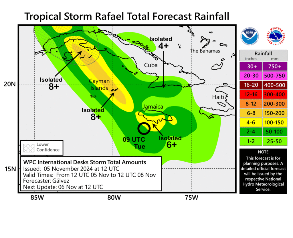
Rain totals could exceed 8 inches in spots, particularly the higher terrain of western Cuba. This should produce flash flooding and the potential for mudslides.
Rafael should peak in intensity either before it feels some impacts from Cuban terrain or not long after it moves back into the Gulf of Mexico. From that point on, the combination of dry air and wind shear should begin to enact a weakening trend on Rafael.
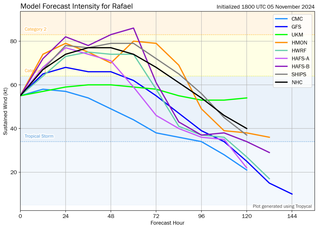
You can see how most tropical and operational model guidance supports this weakening trend outcome. From this point of view, I don’t believe that this will deliver any serious impacts to the United States Gulf Coast, but it still is worth watching. The track is less confident, with a wide possibility of options but a weak majority favoring a general path toward Louisiana.
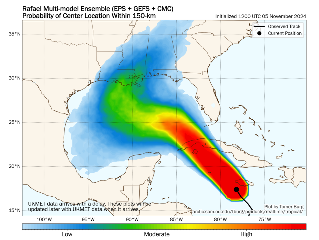
Whatever happens here should not matter much, and in fact it’s even possible that a weaker Rafael meanders in the Gulf until just getting absorbed into a cold front next week. The official NHC forecast has Rafael as a weak tropical storm once near Louisiana.
The moisture out in front of Rafael is another story though. The Florida Keys will see tropical storm conditions likely on the heavier weighted east side of the storm as it passes Cuba. A few tornadoes are possible there as well.
Moisture will link up with a trough on the East Coast as well, spreading heavy rain up into Georgia and South Carolina, again south of areas severely impacted by Helene earlier this season.
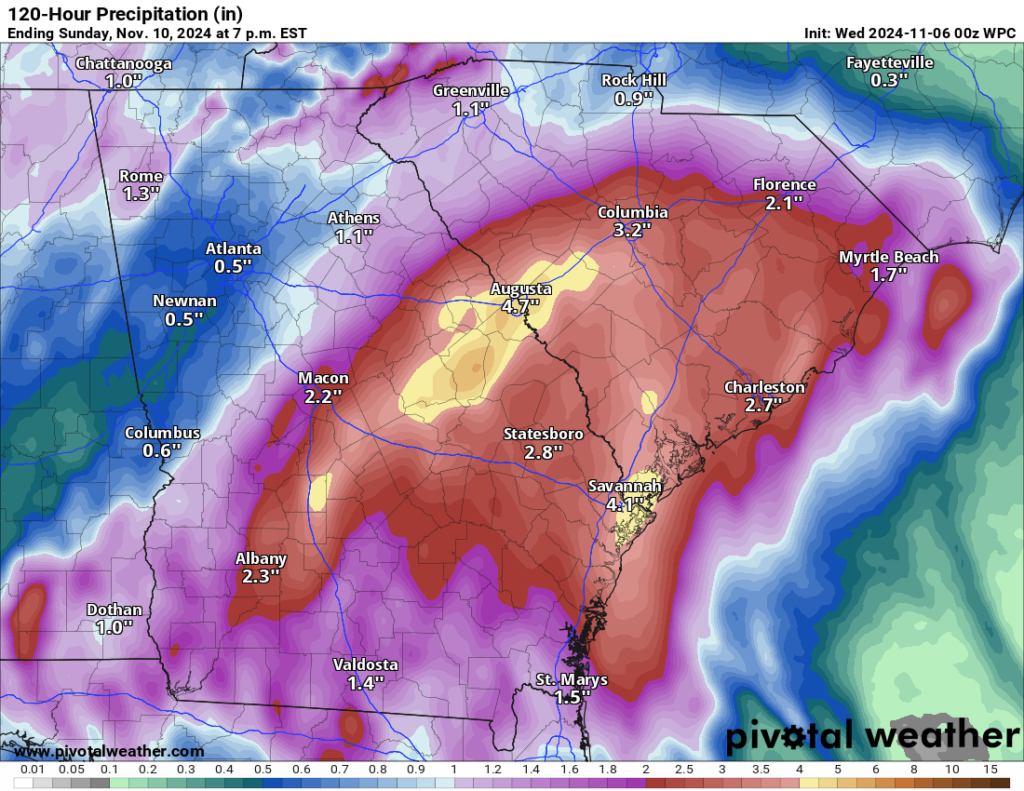
Rain totals will be on the order of 3 to 6 inches between Macon, Savannah, Charleston, and Columbia. This won’t cause catastrophic flooding, but it may lead to localized flash flooding in spots. Conditions should improve on Thursday.
Beyond Rafael, there is a slow increase in odds that something may form north of the islands this weekend or next week. For now, I wouldn’t worry a ton about this, but we’ll look at it closer in a day or two if development odds keep increasing.
Source link


