|
|
| Mesoscale Discussion 2207 | |
| < Previous MD | |

|
|
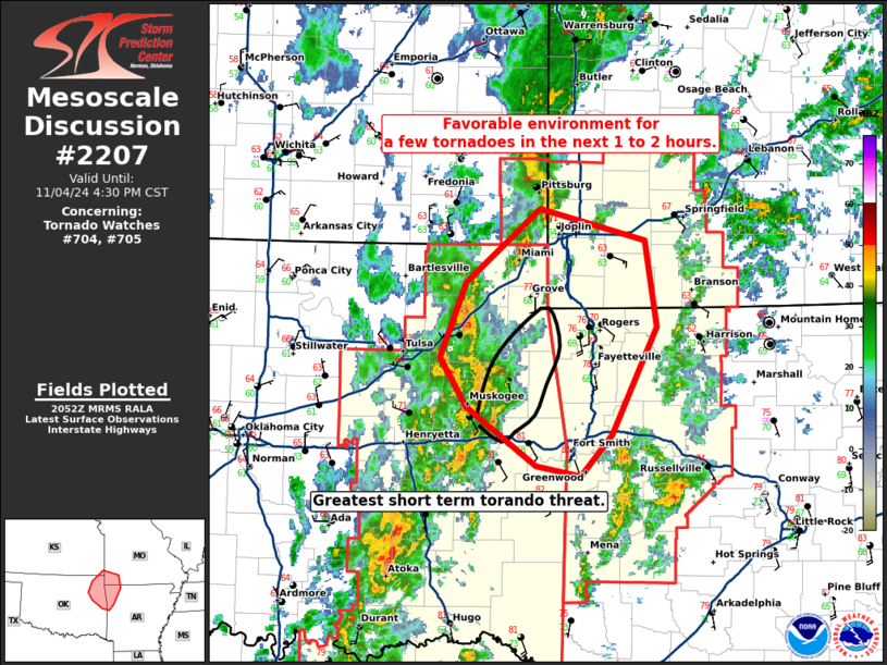
Mesoscale Discussion 2207 NWS Storm Prediction Center Norman OK 0254 PM CST Mon Nov 04 2024 Areas affected...Northeast Oklahoma...northwest Arkansas...and southwest Missouri Concerning...Tornado Watch 704...705... Valid 042054Z - 042230Z The severe weather threat for Tornado Watch 704, 705 continues. SUMMARY...A favorable environment for a few tornadoes exists across northeast Oklahoma, northwest Arkansas, and southwest Missouri over the next 1 to 2 hours. DISCUSSION...A cluster of supercells is moving through northeast Oklahoma. Surface winds have backed somewhat ahead of these supercells as a surface low continues northeast along the frontal boundary just south of Tulsa. Temperatures have warmed into the upper 70s with dewpoints in the upper 60 ahead of these storms. Shear has started to increase over the last hour on the KSRX VWP with 0-1km SRH around 225 m2/s2 and 0-500m SRH around 150 m2/s2 as of 2035Z. This increase in shear, combined with a pocket of moderate instability has provided an environment favorable for a few tornadoes over the next 1 to 2 hours. The greatest threat will be with any supercells which can avoid interference which in the short term favors the storm entering southern Cherokee County in Oklahoma. ..Bentley/Hart.. 11/04/2024 ...Please see www.spc.noaa.gov for graphic product... ATTN...WFO...SGF...TSA... LAT...LON 35259472 35729539 36119566 36699540 37289469 37029366 36349355 35509400 35179430 35259472 |
|
|
Top/All Mesoscale Discussions/Forecast Products/Home |
|


