|
|
| Mesoscale Discussion 2194 | |
| < Previous MD | |

|
|
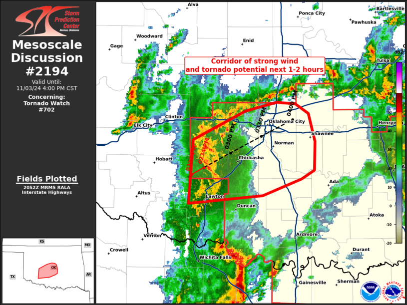
Mesoscale Discussion 2194 NWS Storm Prediction Center Norman OK 0255 PM CST Sun Nov 03 2024 Areas affected...portions of central Oklahoma Concerning...Tornado Watch 702... Valid 032055Z - 032200Z The severe weather threat for Tornado Watch 702 continues. SUMMARY...A maturing line of storms may pose a heightened threat for severe winds and a few tornadoes over the next 1-2 hours as it approaches I-35. DISCUSSION...As of 2050 UTC, KFDR and KTLX radar imagery showed a maturing thunderstorm cluster has become better organized over the last 30 minutes as it has moved across southwestern OK. Emerging from an initial group of several independent supercells, the storm mode has trended towards a bowing/line segment over time. This trend will likely continue as it tracks along and near the stalled frontal zone over central OK. Radar velocity measurements have shown periodic strong outflow surges with embedded mesovorticies. Large low-level streamwise vorticity and strong 0-3 km line-normal shear evident on the TLX VAD hodograph will continue to favor a balanced QLCS mode as convection approaches the I-35 corridor in the next 60-90 minutes. Given the strong shear, linear mode, and potential for mature mesovorticies, damaging winds (some 70+ mph) a few embedded tornadoes are likely in central OK in the next 1-2 hours. ..Lyons.. 11/03/2024 ...Please see www.spc.noaa.gov for graphic product... ATTN...WFO...OUN... LAT...LON 35719715 35609697 35279687 34959689 34849707 34669760 34579864 35309857 35639784 35729740 35719715 |
|
|
Top/All Mesoscale Discussions/Forecast Products/Home |
|


