|
|
| Mesoscale Discussion 2179 | |
| < Previous MD | |

|
|
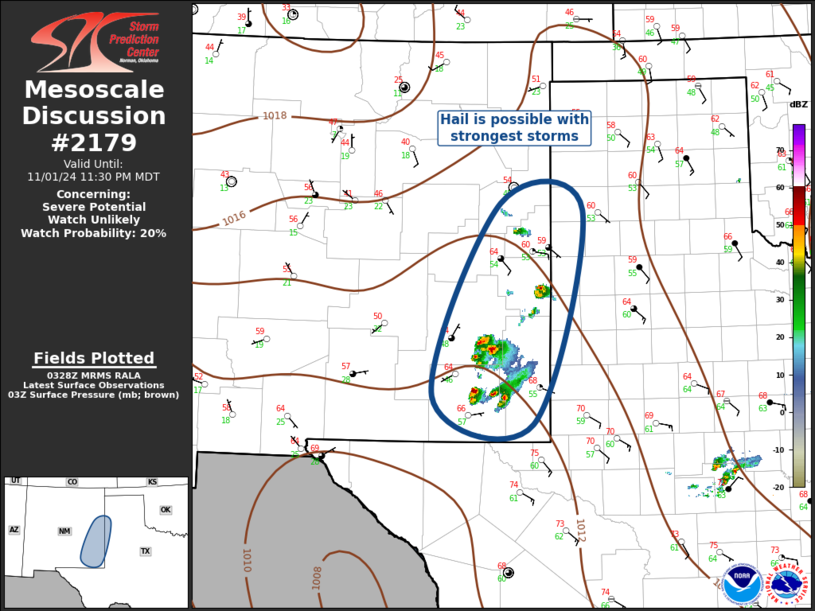
Mesoscale Discussion 2179 NWS Storm Prediction Center Norman OK 1030 PM CDT Fri Nov 01 2024 Areas affected...Southern High Plains Concerning...Severe potential...Watch unlikely Valid 020330Z - 020530Z Probability of Watch Issuance...20 percent SUMMARY...Hail may accompany the strongest storms across the southern High Plains tonight. DISCUSSION...Low-latitude short-wave trough is evident in water-vapor imagery over eastern AZ, extending into northern Mexico. This feature is ejecting northeast toward the southern Rockies and LLJ appears to be responding to this short wave. 1km wind field is increasing across western TX into the TX South Plains. This is forcing higher PW air mass into southeast NM where boundary-layer upslope flow is contributing to recent uptick in convection, especially over Eddy County NM. Several discrete updrafts have evolved across southeast NM, and more recently as far north as CVS. With time, additional storms should develop along this corridor as low-level warm advection will be focused into this portion of the southern Plains. At this time it appears hail is the primary concern and isolated severe hail is possible. However, hail coverage/size is not currently expected to warrant a severe thunderstorm watch. Will continue to monitor this region. ..Darrow/Hart.. 11/02/2024 ...Please see www.spc.noaa.gov for graphic product... ATTN...WFO...LUB...AMA...MAF...ABQ... LAT...LON 32560480 34970380 34880255 32210330 32560480 |
|
|
Top/All Mesoscale Discussions/Forecast Products/Home |
|
Source link


