|
|
| Mesoscale Discussion 2113 | |
| < Previous MD | |

|
|
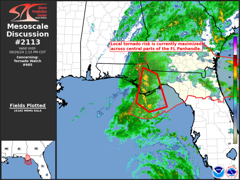
Mesoscale Discussion 2113 NWS Storm Prediction Center Norman OK 1120 AM CDT Thu Sep 26 2024 Areas affected...central portions of the Florida Panhandle Concerning...Tornado Watch 685... Valid 261620Z - 261815Z The severe weather threat for Tornado Watch 685 continues. SUMMARY...Local risk for brief tornadoes will continue -- with greatest short-term potential over central portions of the Florida Panhandle. DISCUSSION...Latest surface analysis reveals a nearly stationary north-south trough -- acting as a pseudo warm front and, as such, source of enhanced low-level vorticity -- extending from the Franklin/Gulf County vicinity on the Florida Coast, northward across far western Georgia and into the southern Appalachians. This boundary reflects the discontinuity between the moist/tropical airmass to the east, and the continental airmass to the west. Several/continued brief low-level spin-ups have been observed over the past couple of hours within this zone, and expect this local enhancement of tornado potential to continue over the next couple of hours, given increasingly favorably low-level flow and the nearly stationary character of this north-south boundary. ..Goss.. 09/26/2024 ...Please see www.spc.noaa.gov for graphic product... ATTN...WFO...TAE... LAT...LON 29938539 30858521 30558448 29118399 28878488 29298555 29938539 |
|
|
Top/All Mesoscale Discussions/Forecast Products/Home |
|


