|
|
| Mesoscale Discussion 2103 | |
| < Previous MD | |

|
|
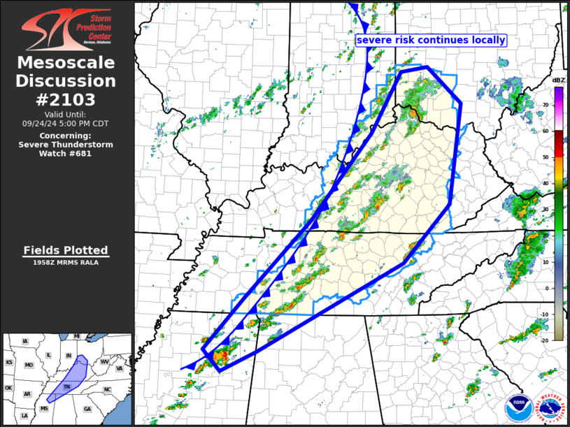
Mesoscale Discussion 2103 NWS Storm Prediction Center Norman OK 0301 PM CDT Tue Sep 24 2024 Areas affected...from southeastern Indiana/southwestern Ohio south-southwest to northeastern Mississippi and northwestern Alabama Concerning...Severe Thunderstorm Watch 681... Valid 242001Z - 242200Z The severe weather threat for Severe Thunderstorm Watch 681 continues. SUMMARY...Isolated risk for strong/damaging gusts and marginal hail continues in/near WW 681. DISCUSSION...Latest radar loop shows scattered thunderstorms ongoing near and ahead of a slowly advancing surface cold front that stretches from Indiana to the Tennessee Valley. Isolated stronger/occasionally severe storms continue across this area, where a favorable combination of moderate instability and moderate speed shear exists. Risk should continue in a relatively steady-state manner over the next few hours, shifting gradually eastward with time. ..Goss.. 09/24/2024 ...Please see www.spc.noaa.gov for graphic product... ATTN...WFO...RLX...MRX...JKL...ILN...LMK...OHX...BMX...HUN... PAH...MEG... LAT...LON 39788467 39868400 39138317 37158351 36018466 34258815 33848902 34268943 35308848 36848692 38588542 39788467 |
|
|
Top/All Mesoscale Discussions/Forecast Products/Home |
|


