|
|
| Mesoscale Discussion 2052 | |
| < Previous MD | |

|
|
   Mesoscale Discussion 2052
   NWS Storm Prediction Center Norman OK
   1228 PM CDT Wed Sep 11 2024

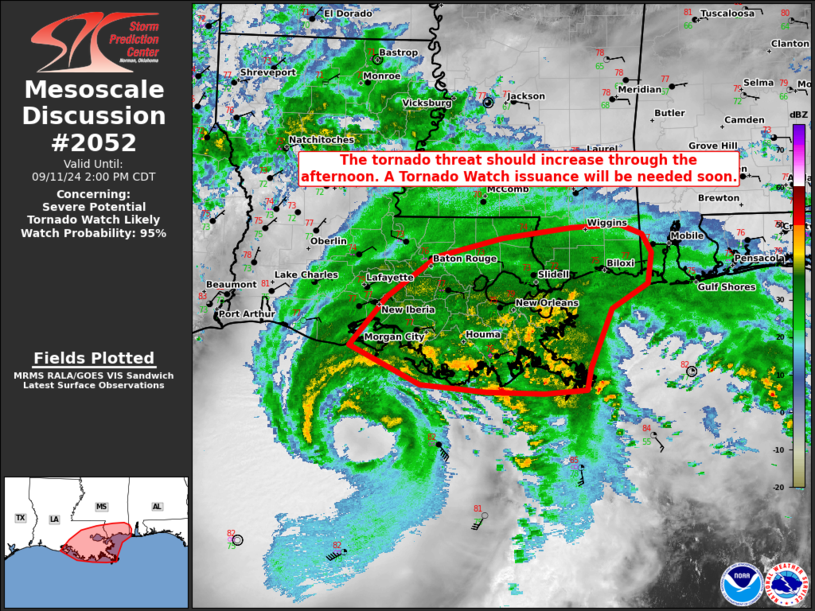
   Areas affected...portions of southern and eastern Louisiana into
   southern Mississippi

   Concerning...Severe potential...Tornado Watch likely

   Valid 111728Z - 111900Z

   Probability of Watch Issuance...95 percent

   SUMMARY...The threat for at least a few tornadoes is increasing
   across portions of southern LA into far southern MS. A Tornado Watch
   issuance will be needed soon.

   DISCUSSION...MRMS mosaic radar imagery has shown a gradual increase
   in the intensity of convective cells embedded within the broader
   rainbands associated with Hurricane Francine, which are attempting
   to move ashore. Surface temperatures/dewpoints in southeastern LA
   are in the upper 70s/mid 70s F, which are contributing to 500+ J/kg
   MLCAPE. At the same time, low-level shear continues to increase
   along the Gulf Coast, with the HDC VAD profiler showing increasingly
   curved hodographs, with nearly 200 m2/s2 0-3 km SRH noted. Low-level
   shear should continue to increase through the afternoon, with a
   subsequent increase in tornado potential likely as well. Given the
   increasing severe risk, a Tornado Watch issuance will be needed
   soon.

   ..Squitieri/Guyer.. 09/11/2024

   ...Please see www.spc.noaa.gov for graphic product...

   ATTN...WFO...MOB...LIX...LCH...

   LAT...LON   29539220 30089172 30559106 30769022 30888930 30908867
               30808839 30598827 30238832 29968878 29288907 29048912
               29008966 29019042 29099128 29539220
|
|
|
Top/All Mesoscale Discussions/Forecast Products/Home |
|


